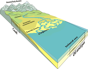
Millions of years ago, the region around Calgary was covered by an inland sea teeming with marine life. The land to the west featured rivers draining from the ancestral Rocky Mountains and swamps covered by dense vegetation.
The land to the west featured rivers draining from the ancestral Rocky Mountains and swamps covered by dense vegetation.
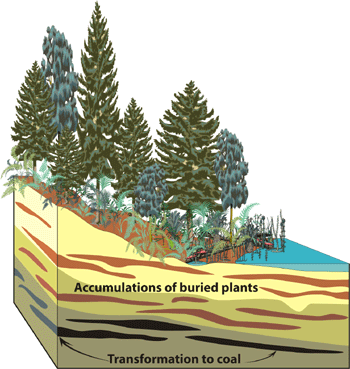
Burial of Land Plants Creates Coal
Dead land plants were buried by mud and sand as environments shifted. Through heat and pressure resulting from burial over millions of years, the sediments gradually transformed into sedimentary rock. The plant matter, concentrated at levels that were formerly swamps, became the coal seams of the Canmore and Bankhead areas. They were deformed to mineable thicknesses by faulting and folding.
Accumulations of buried plants are transformed to coal.
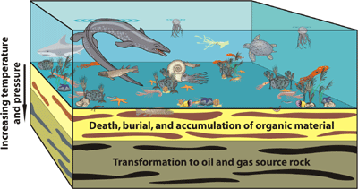
Burial of Marine Life Produces Oil and Gas
When the marine plants and animals died, their remains settled on the seafloor where they were buried by layers of sediment and fossilized. As the soft organic tissue was buried, heat and pressure transformed it into oil and gas: lower heat preserves oil whereas gas can survive to higher temperatures.
Organic material is transformed to oil and gas.
Migration and Entrapment
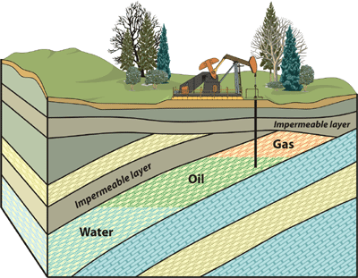
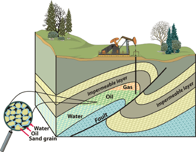
The rocks in which oil and gas form are called 'source rocks'. Due to the pressure of overlying rock layers, oil and gas seldom remain in the source rock. Instead, they migrate with water through the layers of rock until they either escape at the surface or are trapped by an impermeable barrier. There are two main types of traps: stratigraphic and structural.
Stratigraphic Trap
These occur when overlying impermeable layers act as a seal above the permeable strata below. The porous reservoir fills up with fluids. This is the kind of trap found commonly in the plains around Calgary. Gas and lighter fluids rise to the top.
Oil, gas and water are trapped by an impermeable layer.
Structural Trap
In this case, folding and faulting place porous and permeable rock full of fluids next to impermeable rock. This kind of trap is found throughout the Foothills to the west of Calgary.
A magnified view of sandstone showing sand grains surrounded by films of water with oil in the remaining pore space.
Petroleum Today
Abundant oil and gas reserves make Alberta Canada's energy storehouse. The province produces about 85% of Canada's daily oil requirements and the Jumping Pound gas field, discovered in 1944 just west of Cochrane, supplies over half the natural gas needs of Calgary.
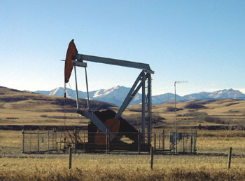
Pump jack (Photo: B. Groulx)
Mining
Coal was mined at Canmore from the late 1800s until 1979, and sold to the Canadian Pacific Railway to fuel coal-powered locomotives. The building of new subdivisions in Canmore must take into account subsidence hazards over the abandoned mines. Today, coal provides more than 80% of Alberta's electrical energy.
The Number 1 mine in Canmore produced coal from 1886 to 1916 (Photograph courtesy Canmore Museum and Geosciences Centre)
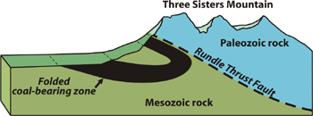
Folded coal-bearing zone at Three Sisters Mountain