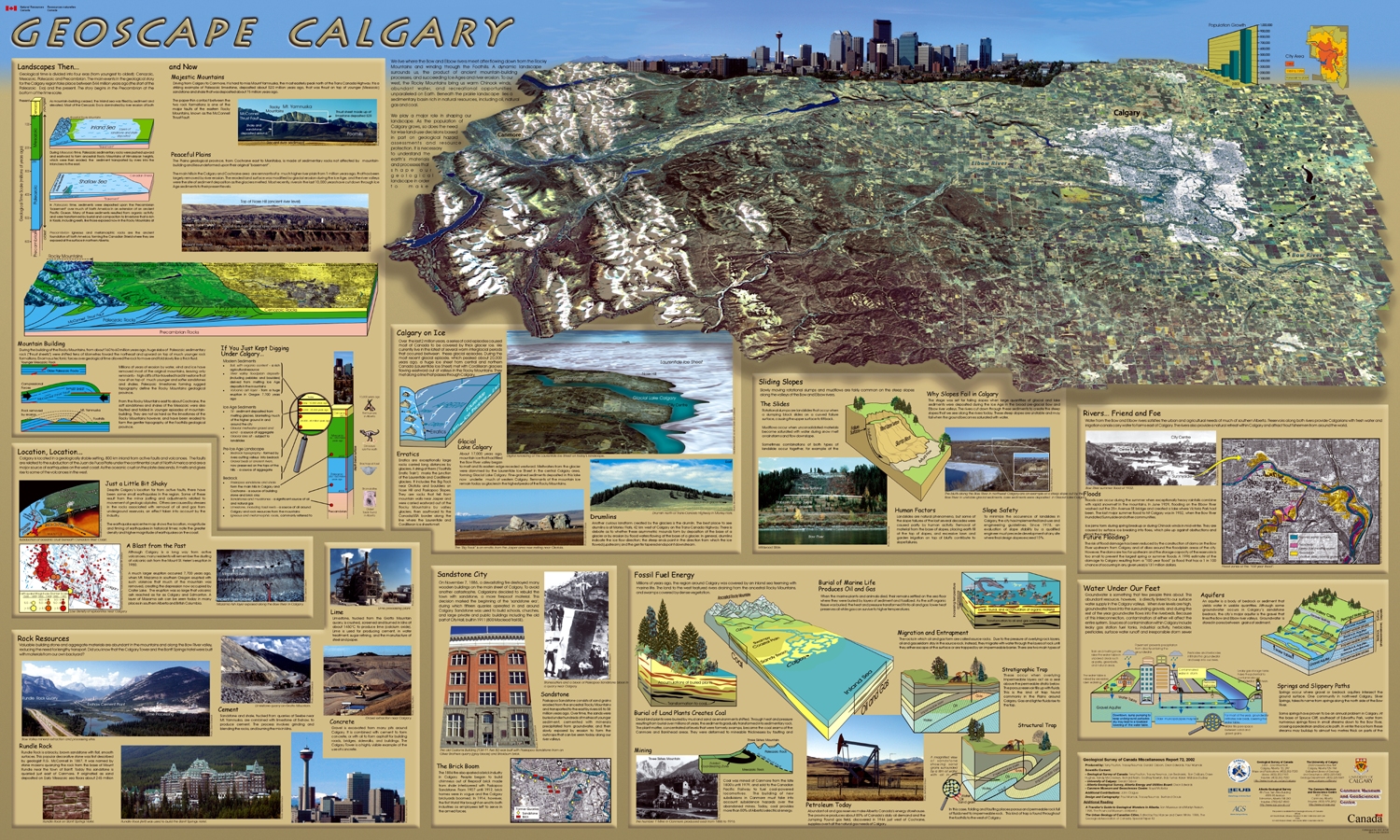
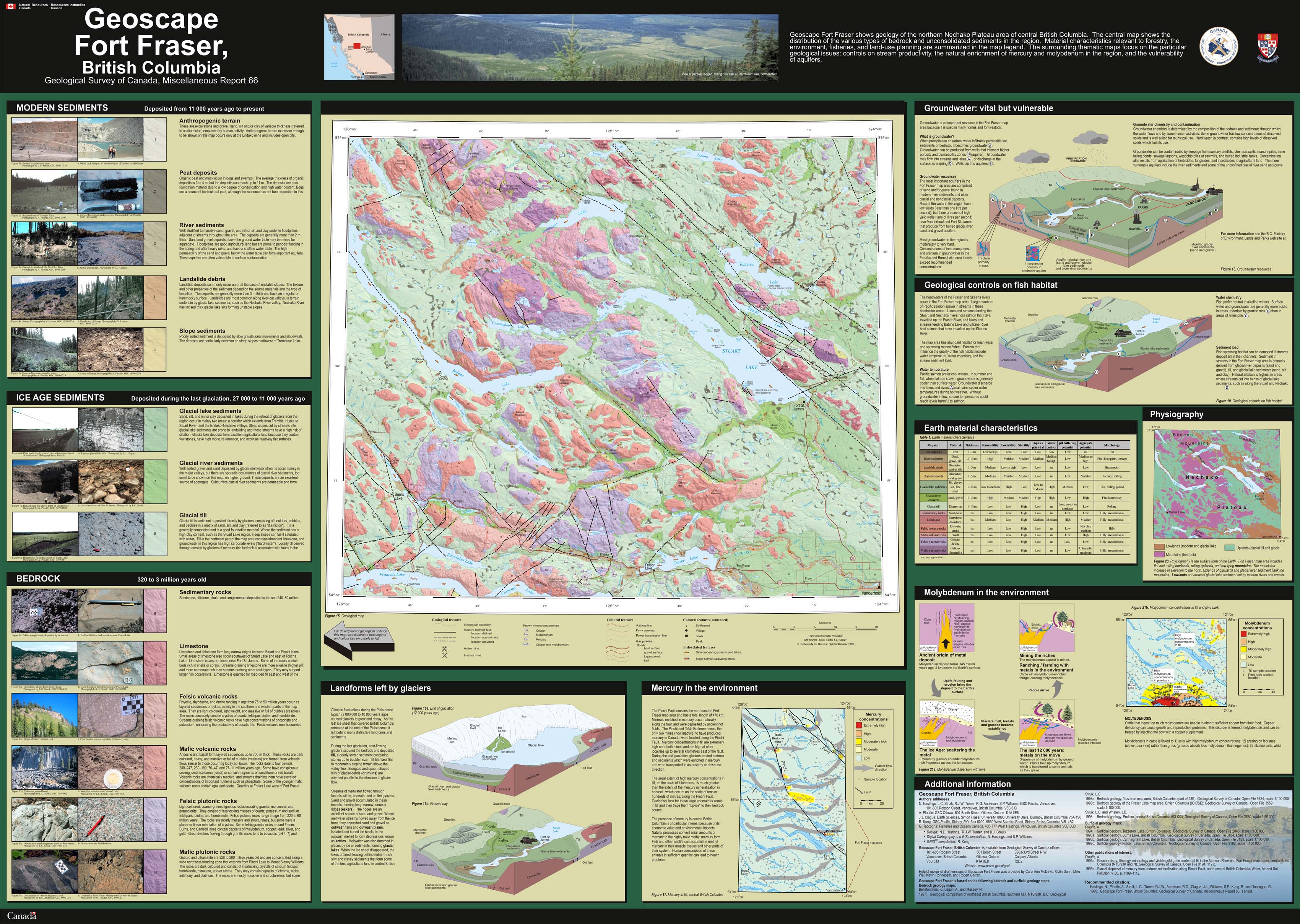
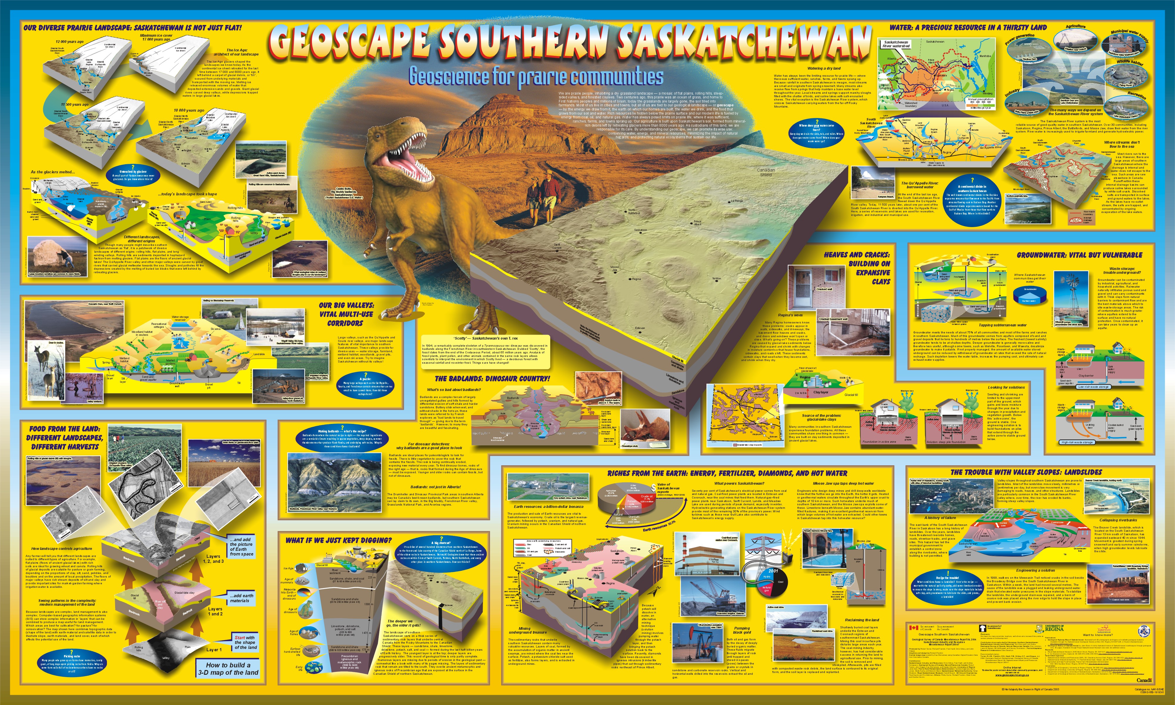
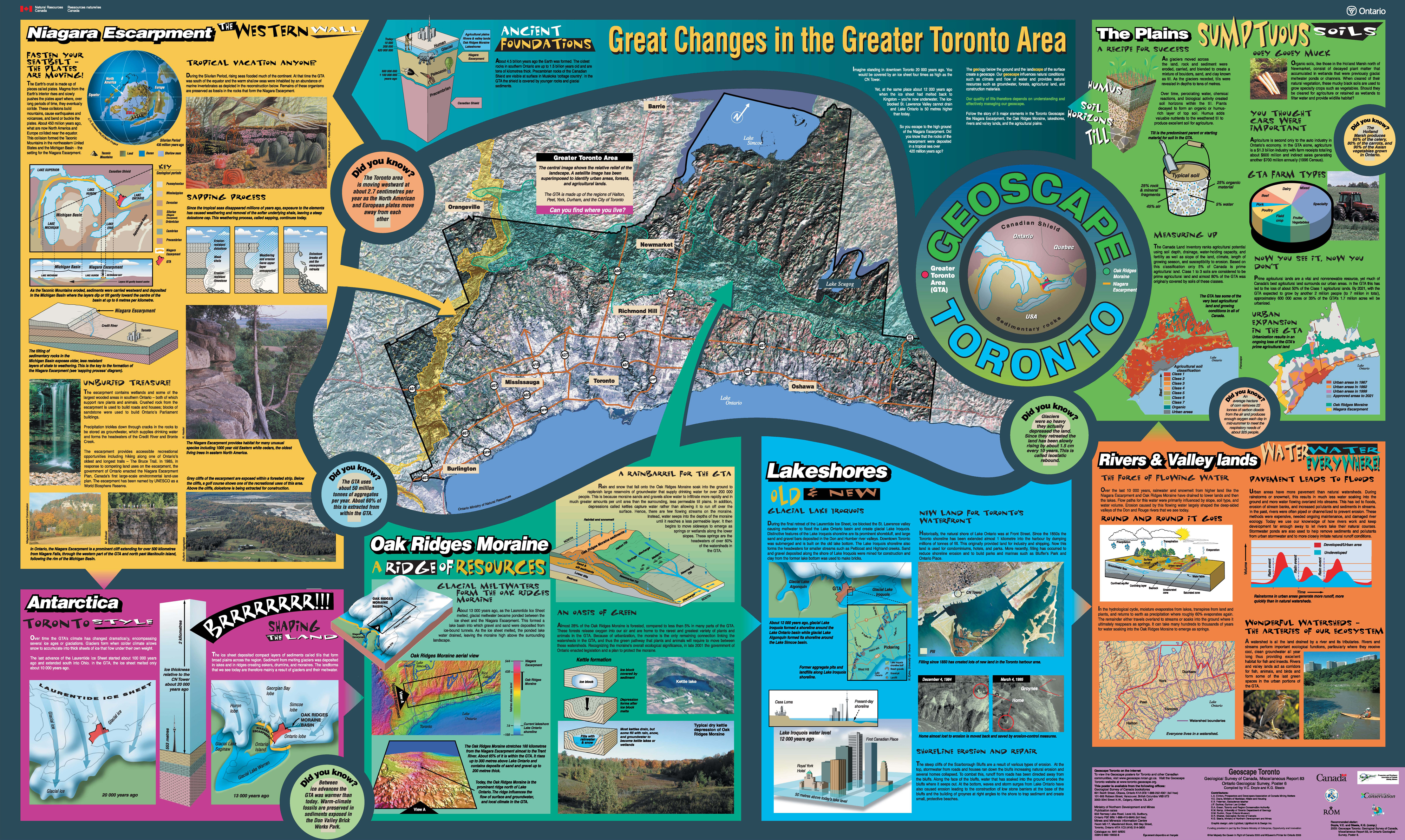
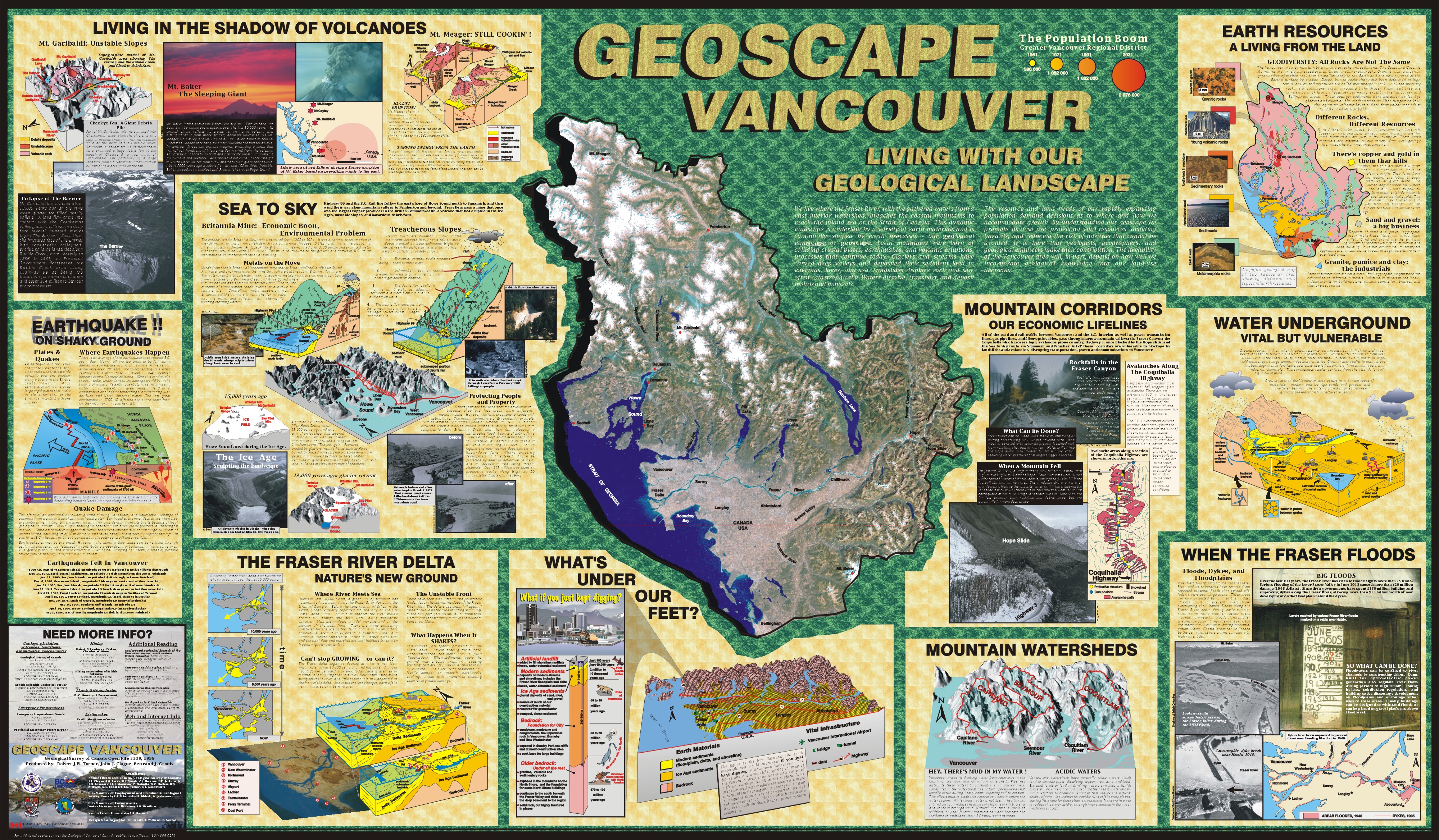
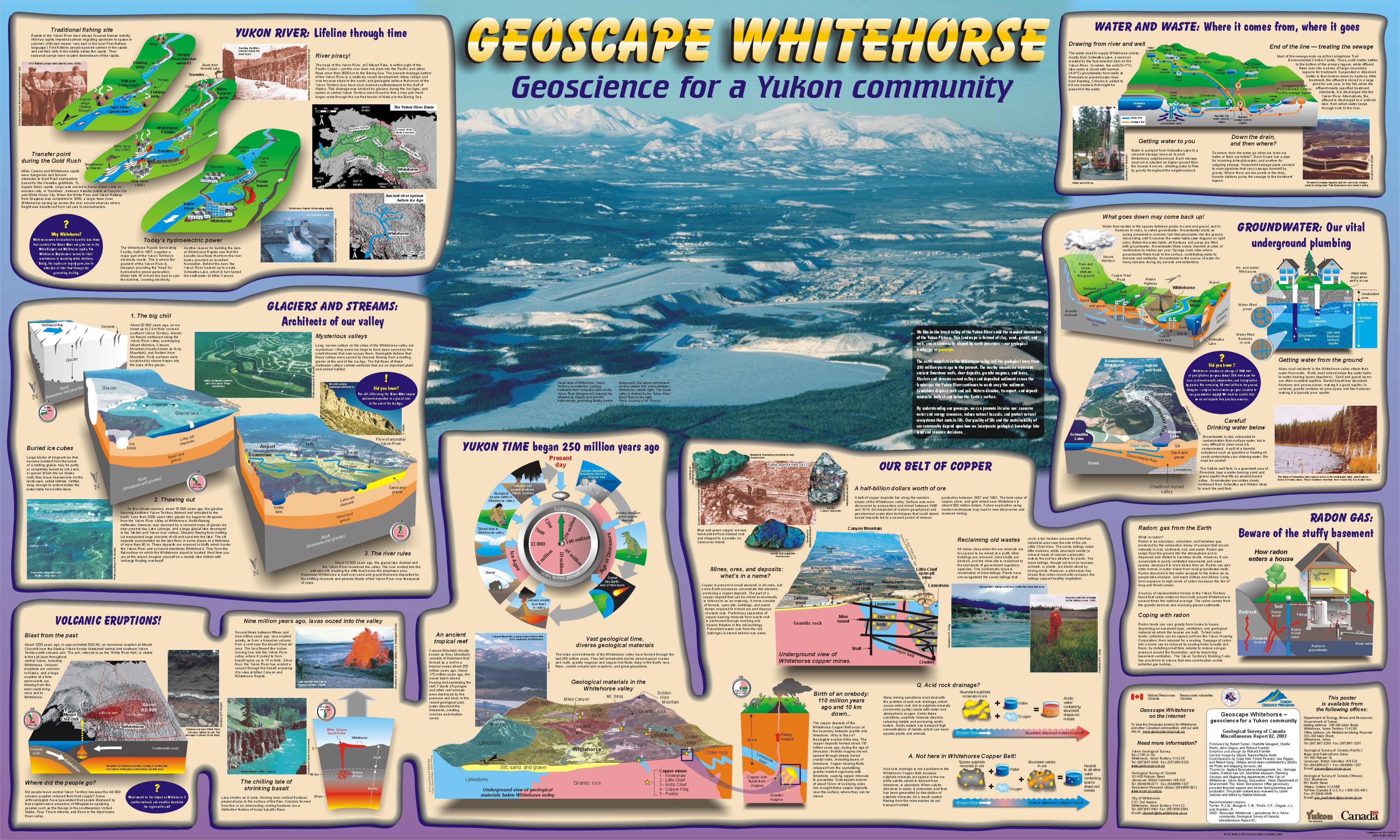
Geoscape Poster
|

Posters as PDF files
Many of these files are very large. Right click on the links to save them to your computer for viewing and printing. 
Posters as large JPG files
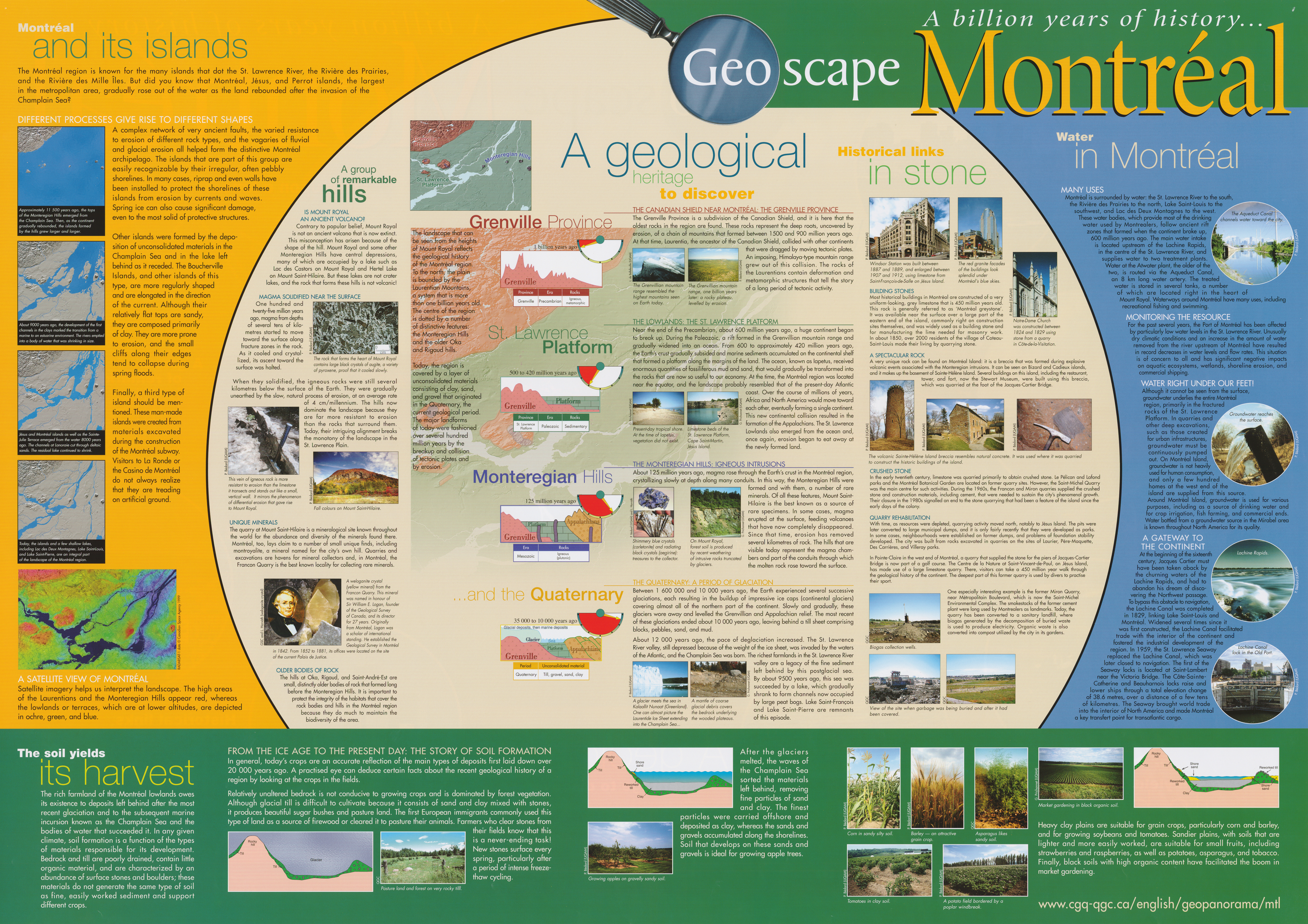
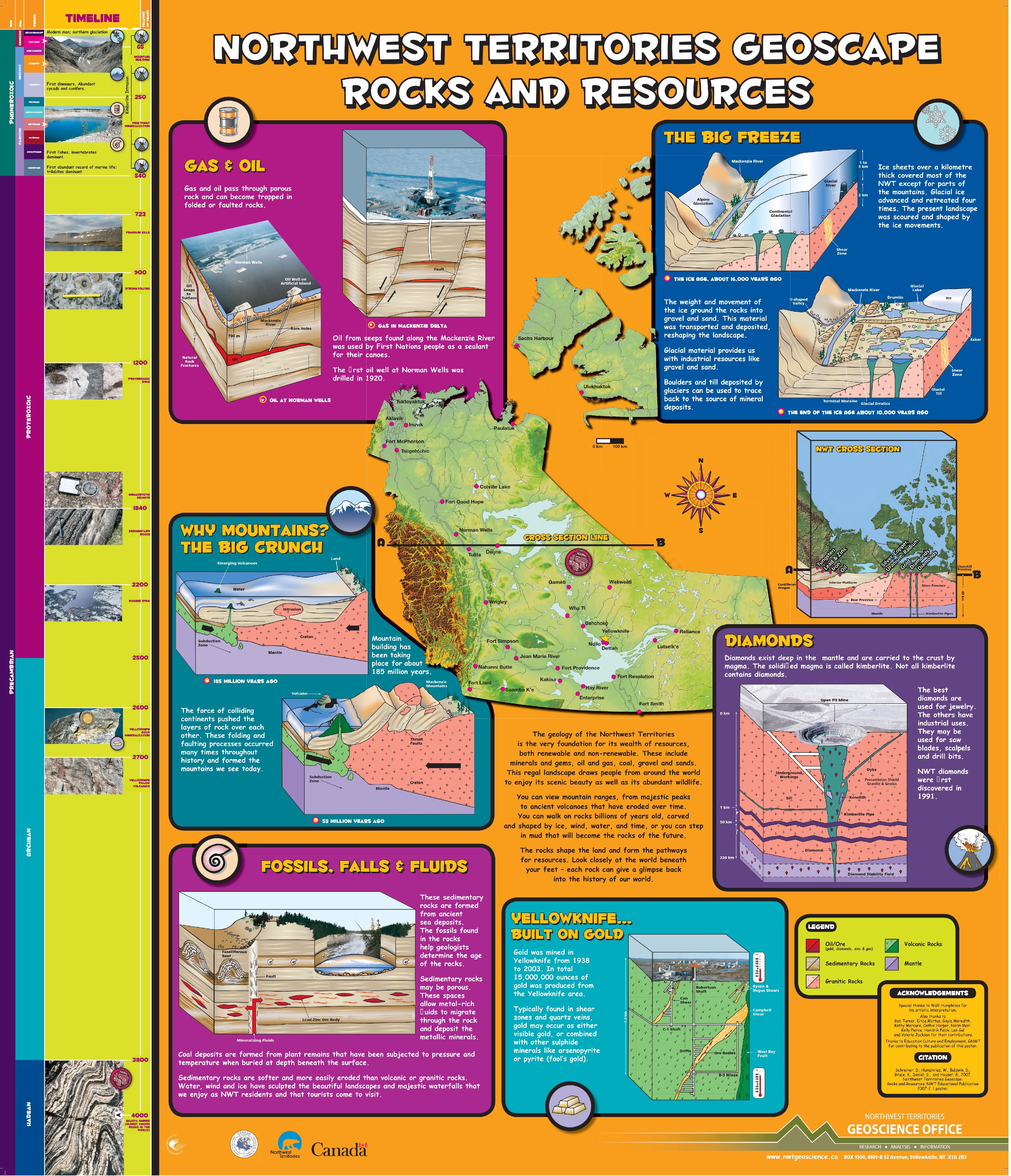
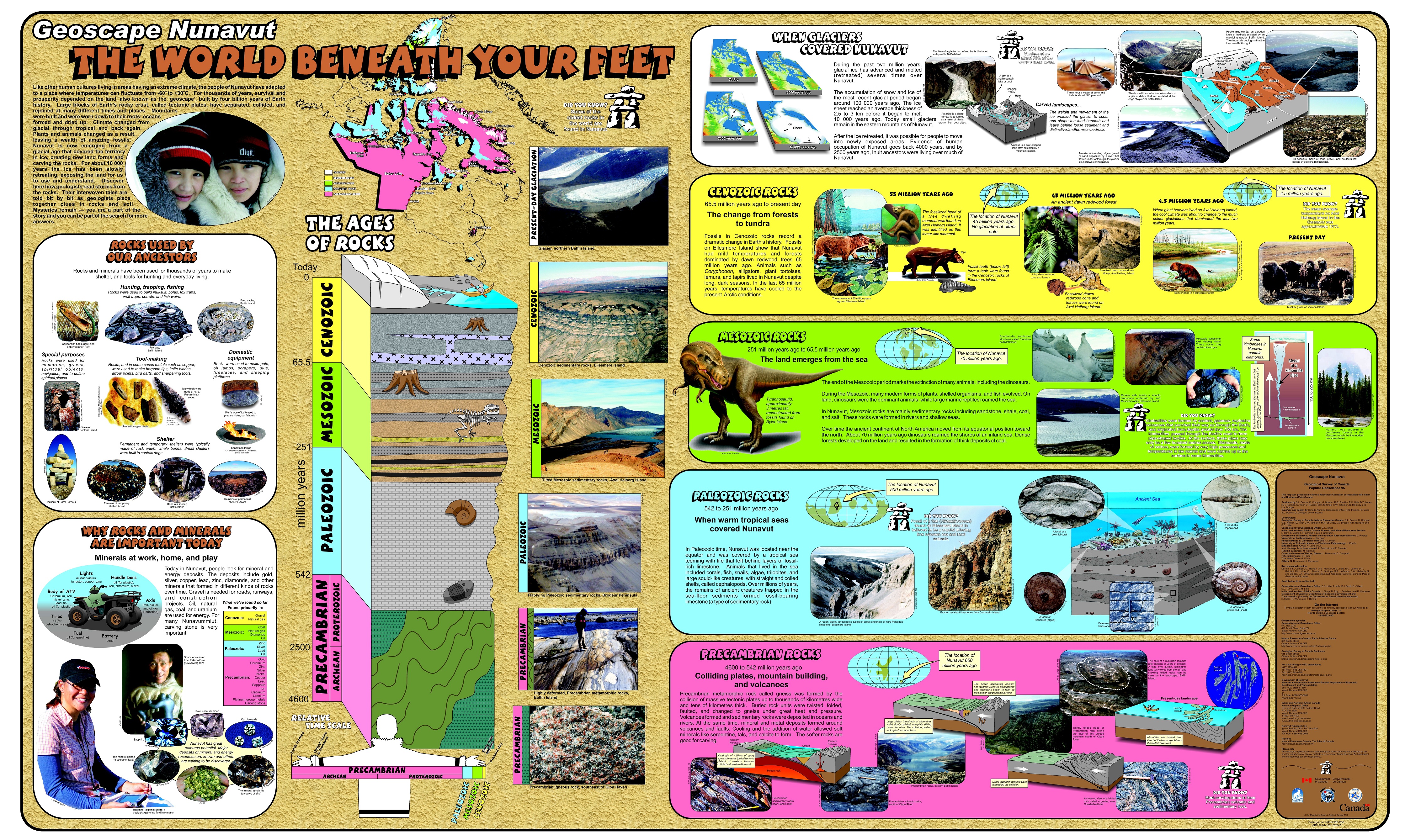
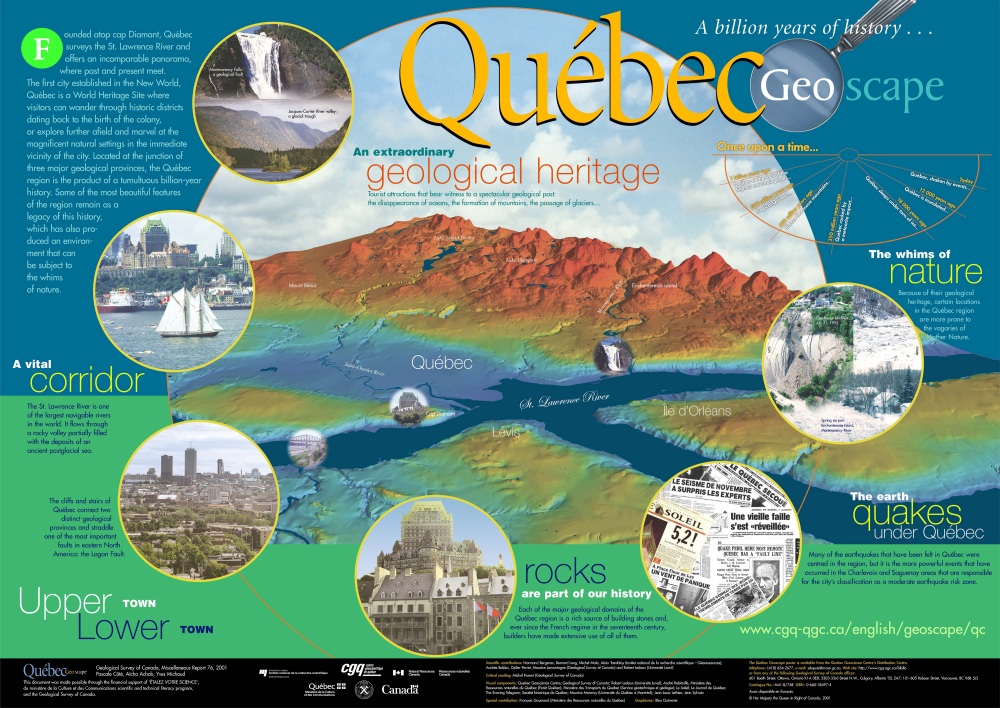
Click on thumbnails for larger images. |
|
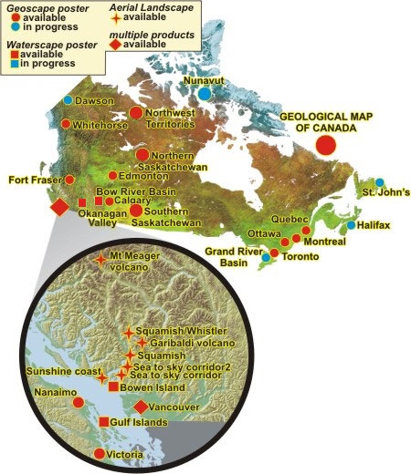
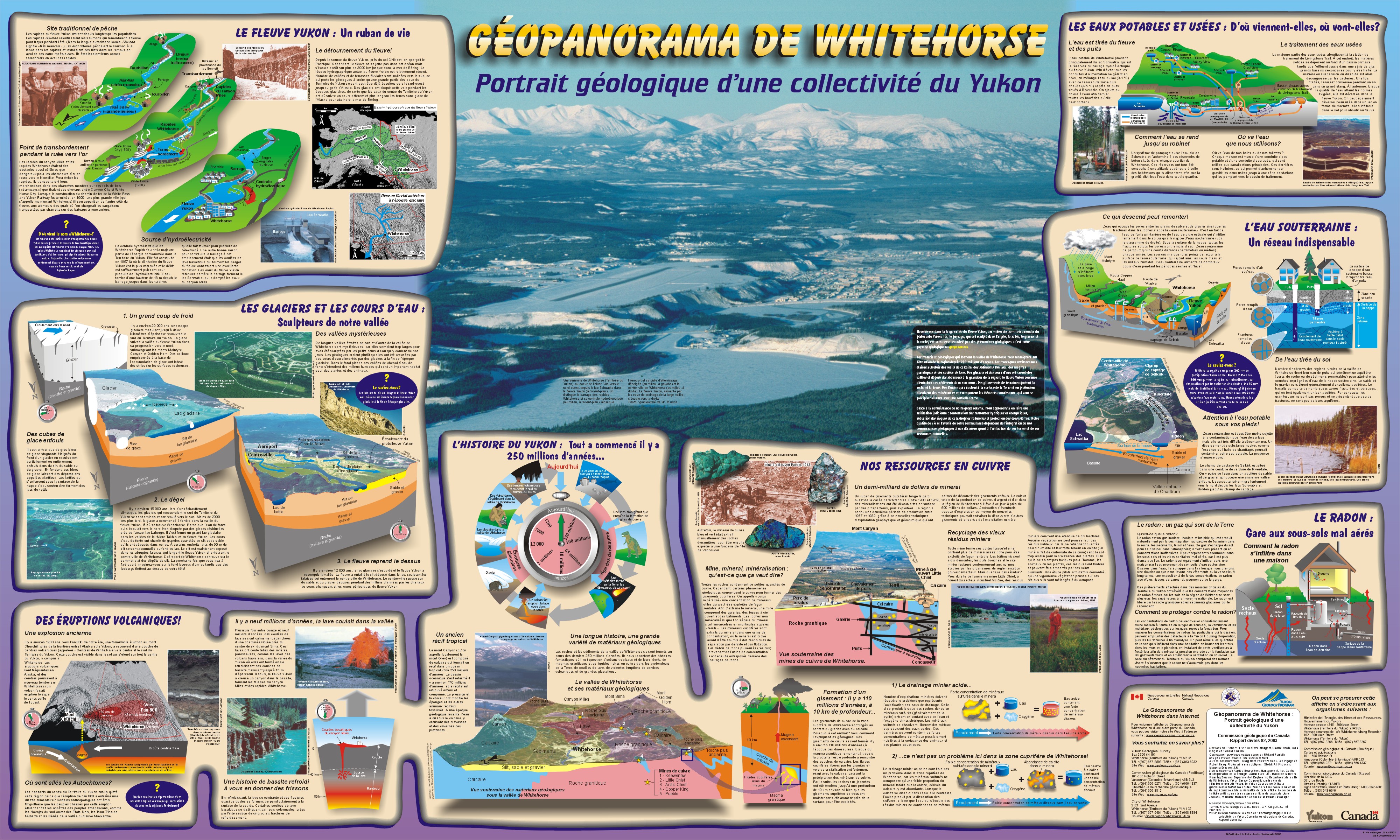
ENGLISH


|


|


|
|
FRANÇAIS
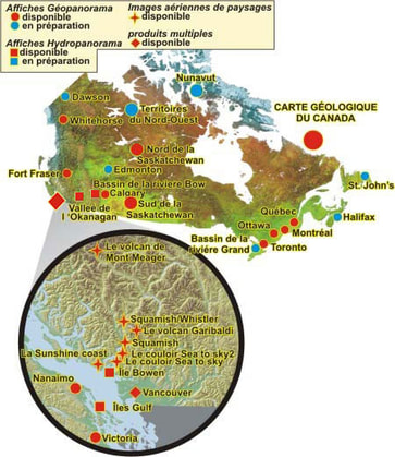
Géocartes: (liens Geoscan ) Geotours:

|


|

|
Links to the Government of Canada Web Archive for Geoscape:
Archived Content Notice: These publications are provided for reference, research or record-keeping purposes. It is not subject to the Government of Canada Web Standards and has not been altered or updated since it was archived.
Please note the adoption of the Open Government Licence - Canada supersedes any previous licences.
Please note the adoption of the Open Government Licence - Canada supersedes any previous licences.
Ressources naturelles Canada - Secteur des sciences de la Terre
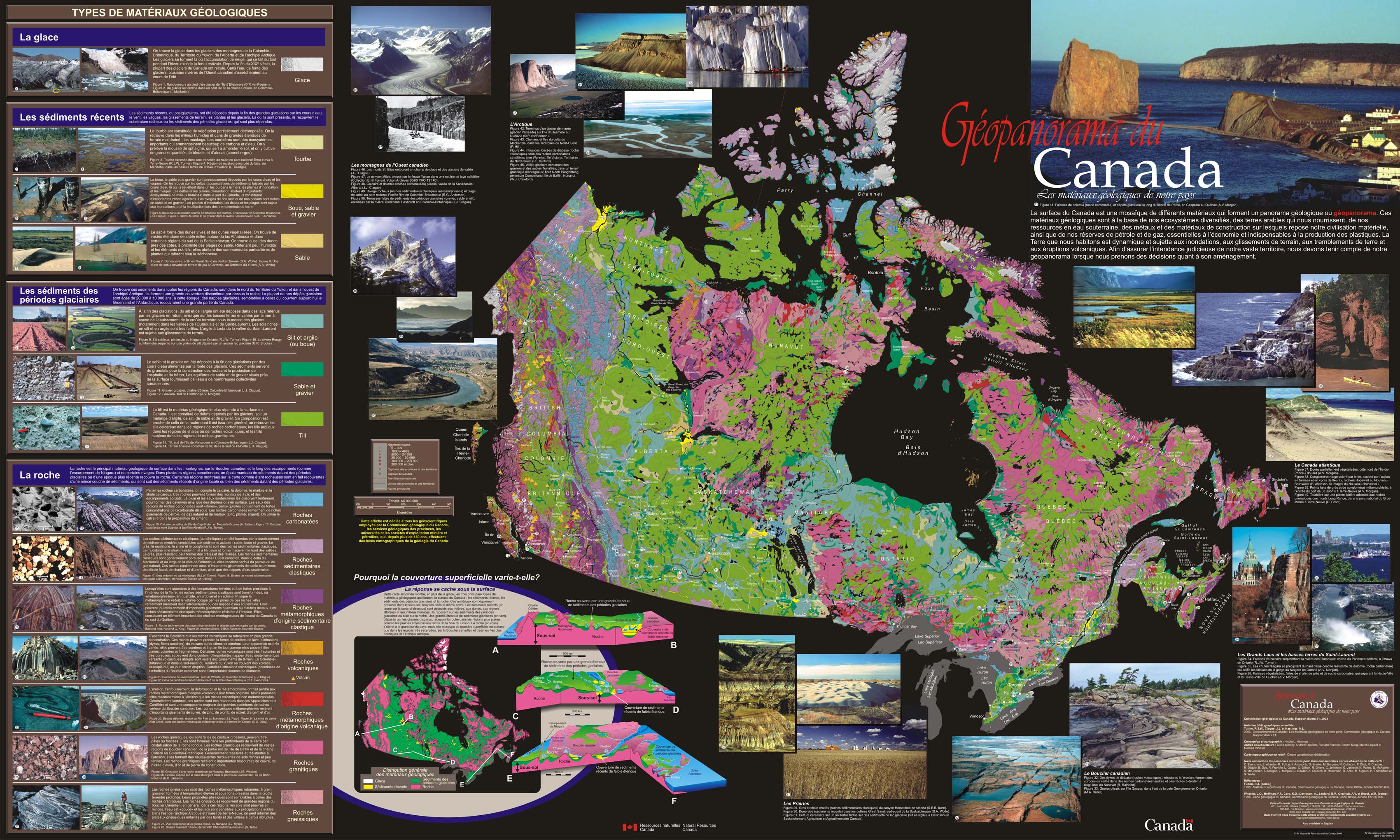
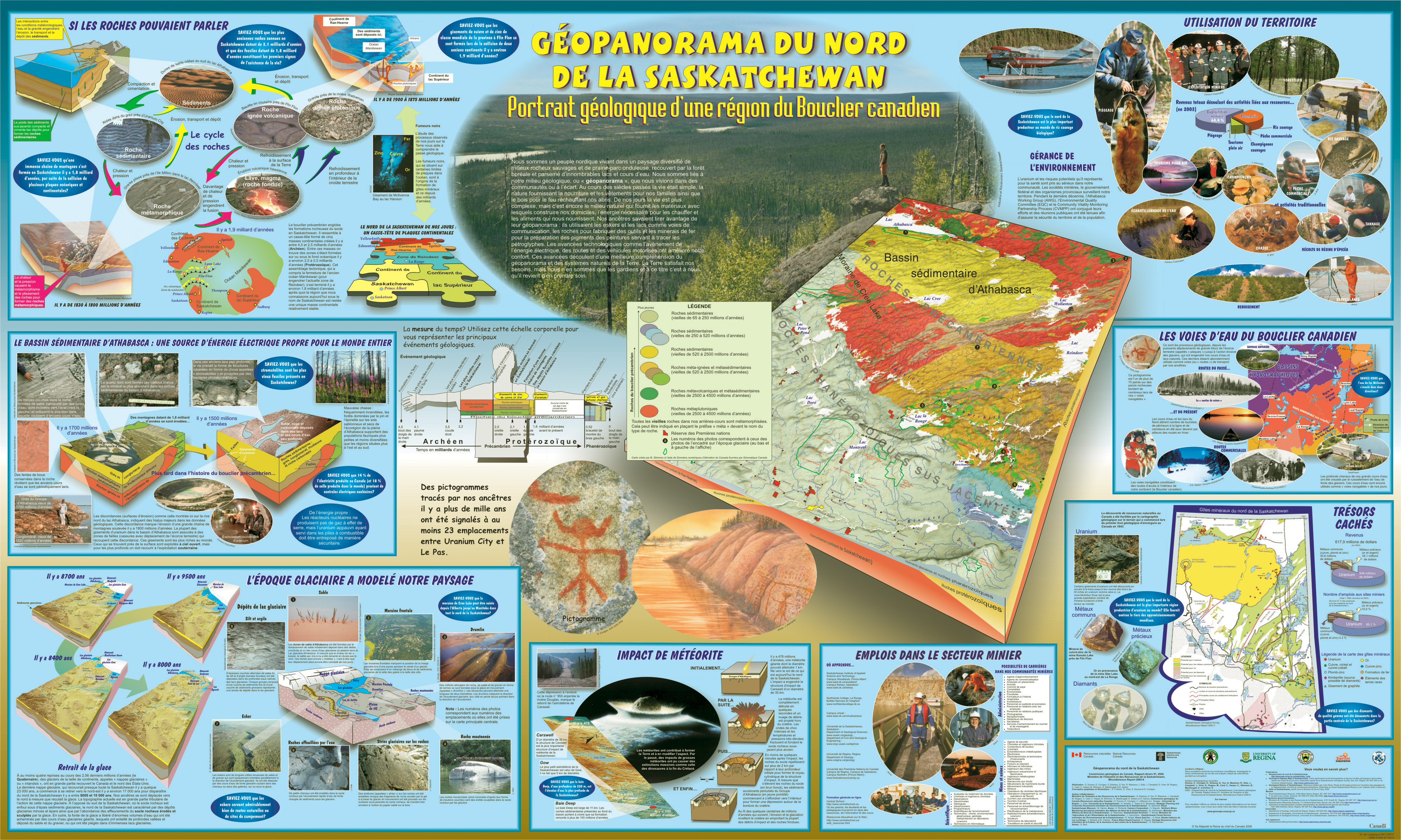
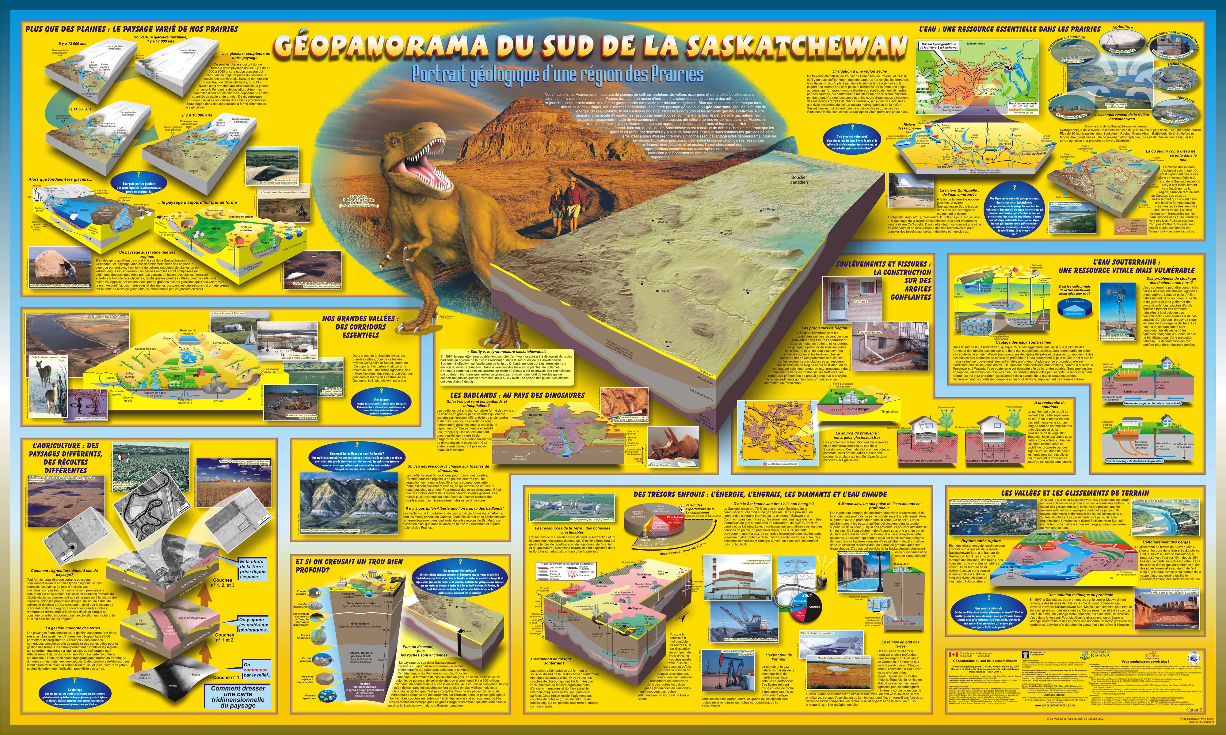
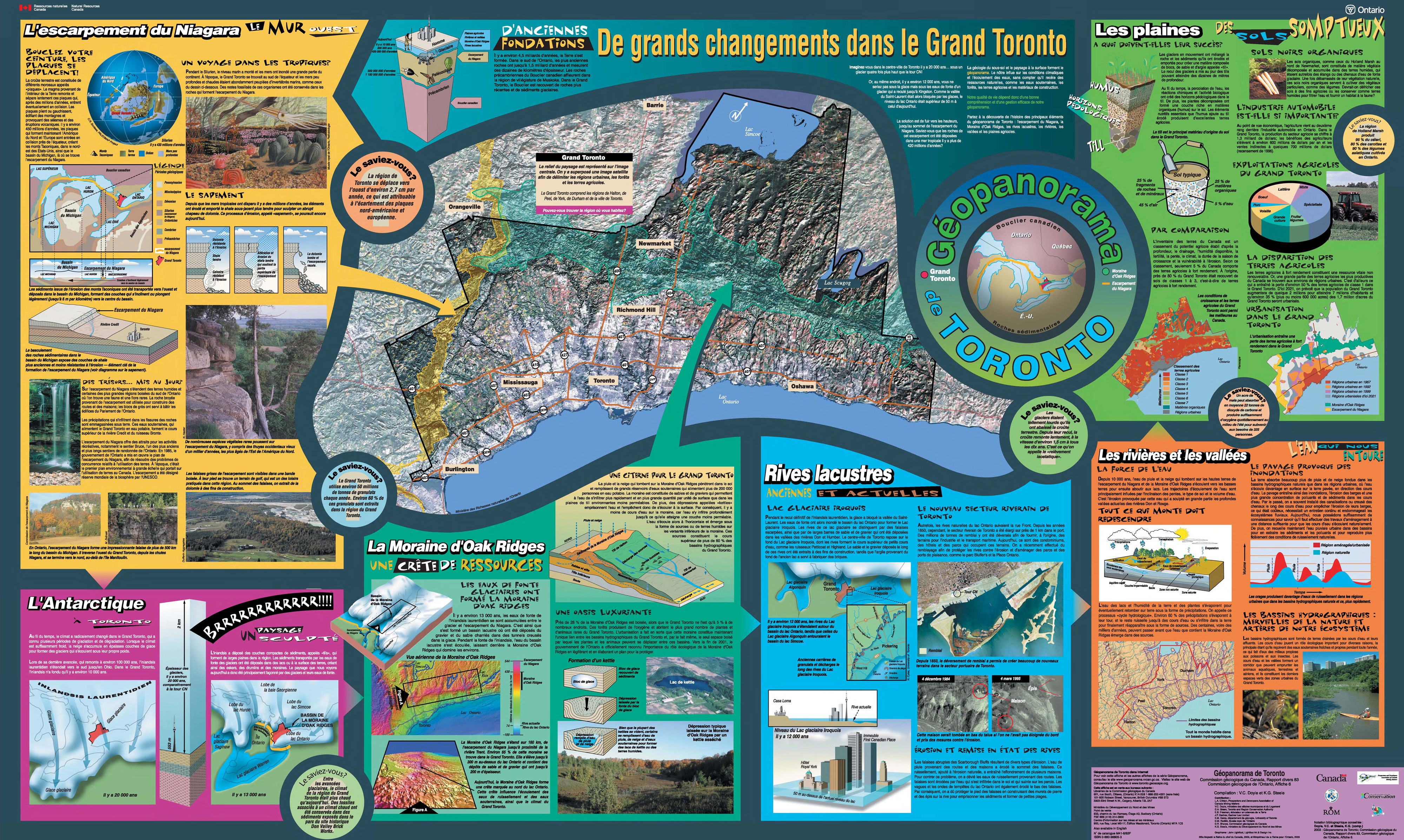
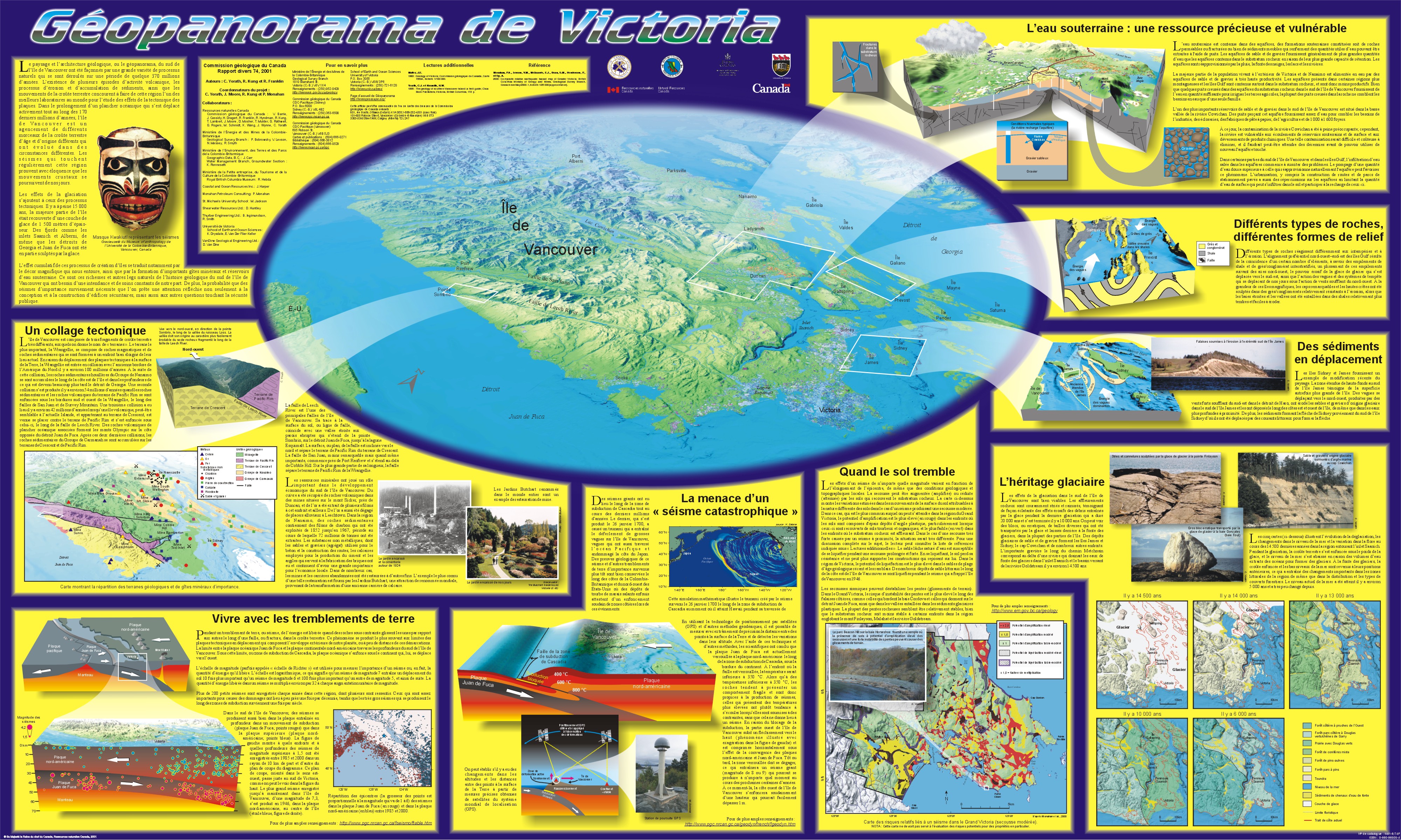
Géopanorama du Canada
Contenu archivé: Ces publications sont fournie à des fins de référence, de recherche ou de tenue de documents. Elle n'est pas assujettie aux normes Web du gouvernement du Canada et elle n'a pas été modifiée ou mise à jour depuis son archivage.
Veuillez noter que la Licence du gouvernement ouvert - Canada remplace toutes les licences antérieures.
Veuillez noter que la Licence du gouvernement ouvert - Canada remplace toutes les licences antérieures.