|


|
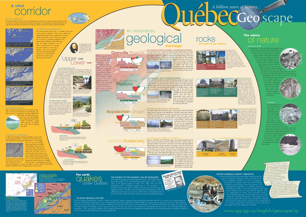
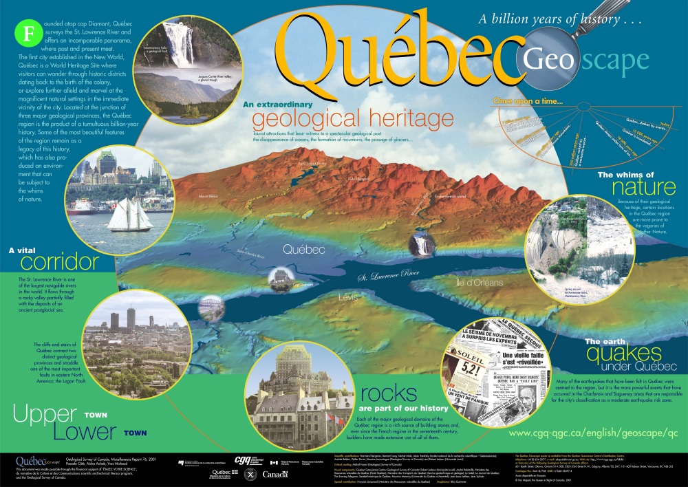
Each of the major geological domains of the Quebec region is a rich source of building stones and, ever since the French regime in the seventeenth century, builders have made extensive use of all of them.
Read more - Rocks Are Part of Our History … |
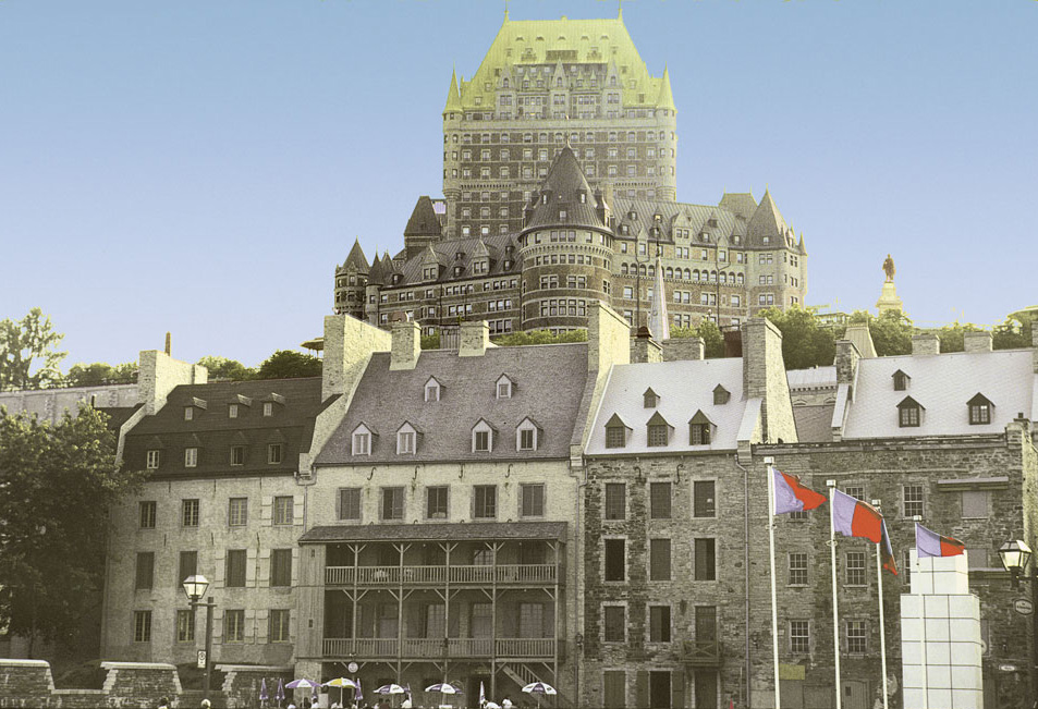
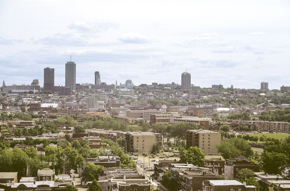
Old Town Quebec
|
The Earth Quakes Under Quebec
|
Many of the earthquakes that have been felt in Quebec were centered in the region, but it is the more powerful events that have occurred in the Charlevoix and Saguenay areas that are responsible for the city's classification as a moderate earthquake risk zone.
Read more - Earth Quakes under Quebec … |

Quakes in the news
|
|
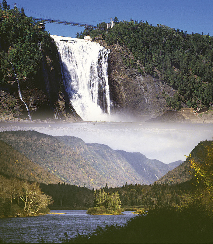
The Whims of Nature
Because of their geological heritage, certain locations in the Quebec region are more prone to the vagaries of Mother Nature. Read more - Whims of Nature … |
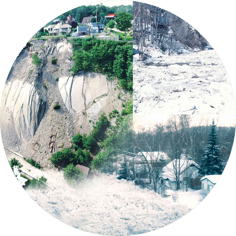
Cap-Rouge landslide and a spring ice jam on the Montmorency River
|
Want To Know More?
- Urban and Environmental Geology of the St. Lawrence Valley
The aim of the Urban and Environmental Geology of the St. Lawrence Valley project is to provide geoscience knowledge required for sound regional planning, environmental protection and sustainable development of the St. Lawrence Lowlands. The study area includes the St. Lawrence Valley and valleys of tributary rivers from Lake Ontario (Kingston) to the Gaspe peninsula.
- Biodiversity portrait of the Saint-Lawrence
- Saint-Lawrence observatory
- Saint-Lawrence Plan - Overview of Community Action Development
- The St. Lawrence Centre
- Geomorphic Effects and Impacts from July 1996 severe flooding in the Saguenay area, Quebec
- Redpath Museum
- Thetford Mines Mineralogical and Mineral Museum
- Musée de géologie René-Bureau
- Société des sciences naturelles de Havre-Saint-Pierre
- Building and ornamental stones in Old Québec: A walking tour
- Esker; Where Do You Come From?
- Fortifications of Québec National Historic Site (Parks Canada)
- Organisation of world heritage cities
- The Quebec City Area Through the Eyes of a Geologist