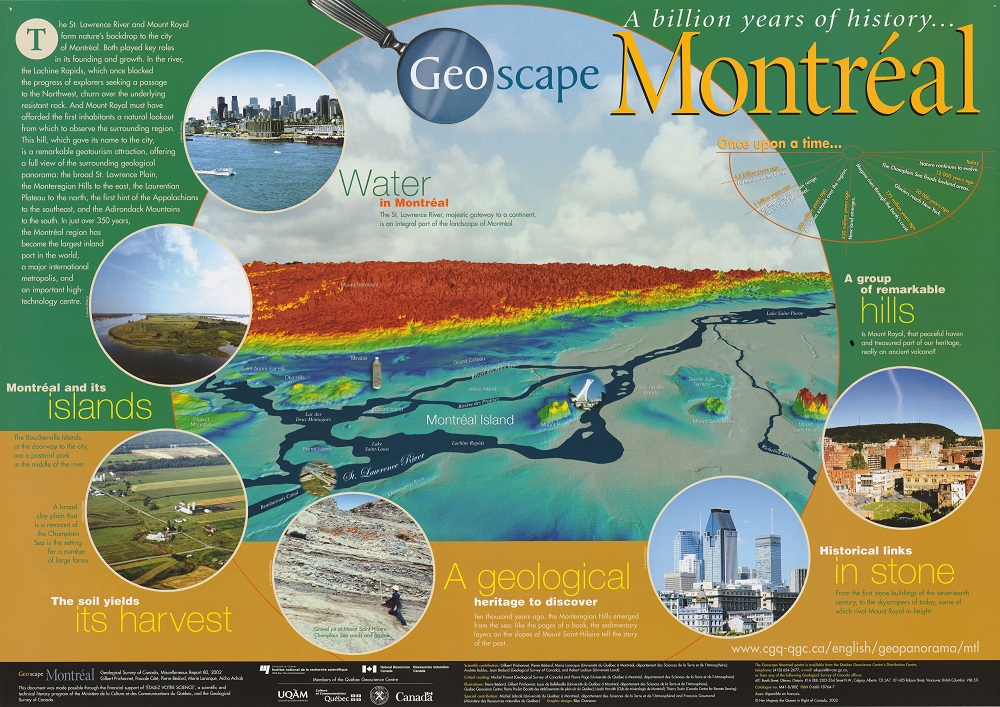
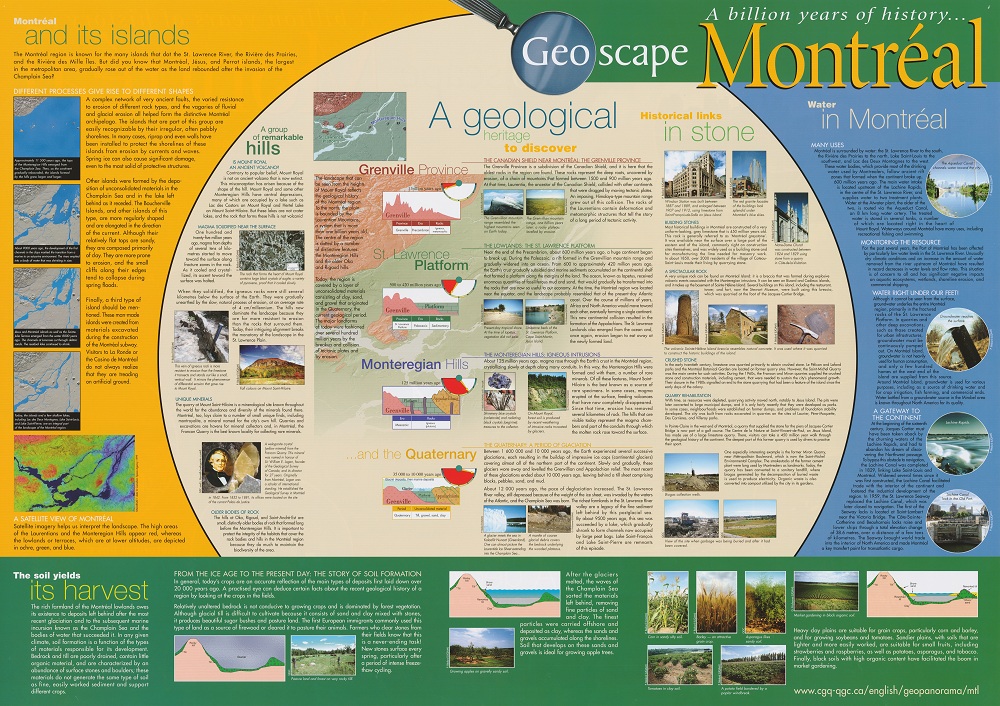
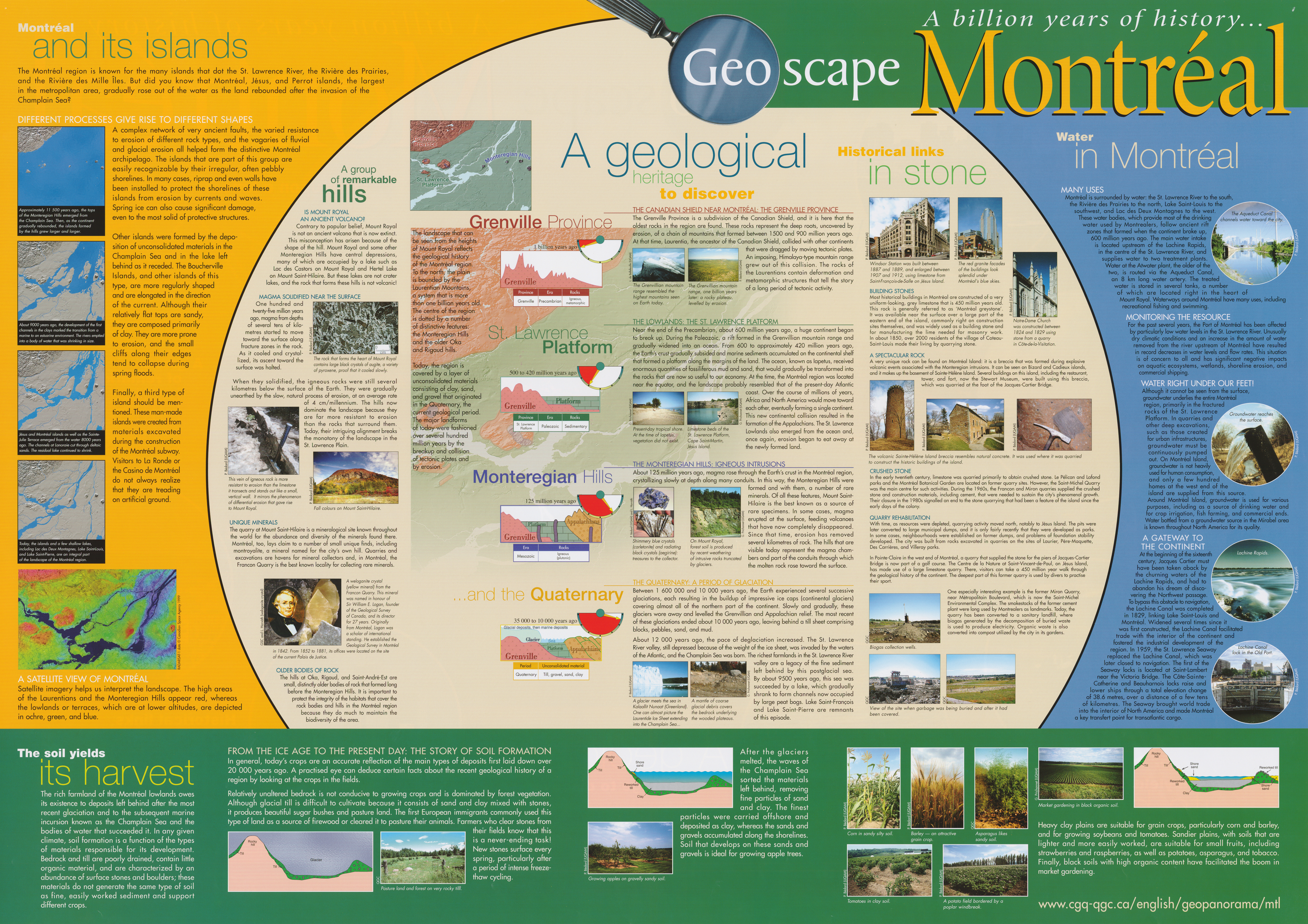
This hill, which gave its name to the city, is a remarkable geotourism attraction, offering a full view of the surrounding geological panorama: the broad St. Lawrence Plain, the Monteregian Hills to the east, the Laurentian Plateau to the north, the first hint of the Appalachians to the southeast, and the Adirondack Mountains to the south. In just over 350 years,the Montreal region has become the largest inland port in the world, a major international metropolis, and an important high-technology centre.
A Geological Heritage to Discover
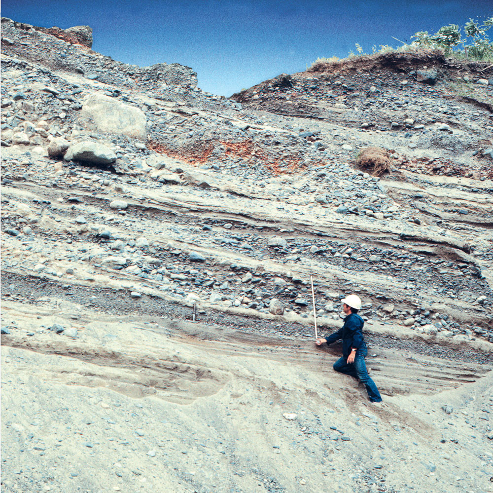
Ten thousand years ago, the Monteregian Hills emerged from the sea: like the pages of a book, the sedimentary layers on the slopes of Mount Saint-Hilaire tell the story of the past. Geological Heritage - Read more … 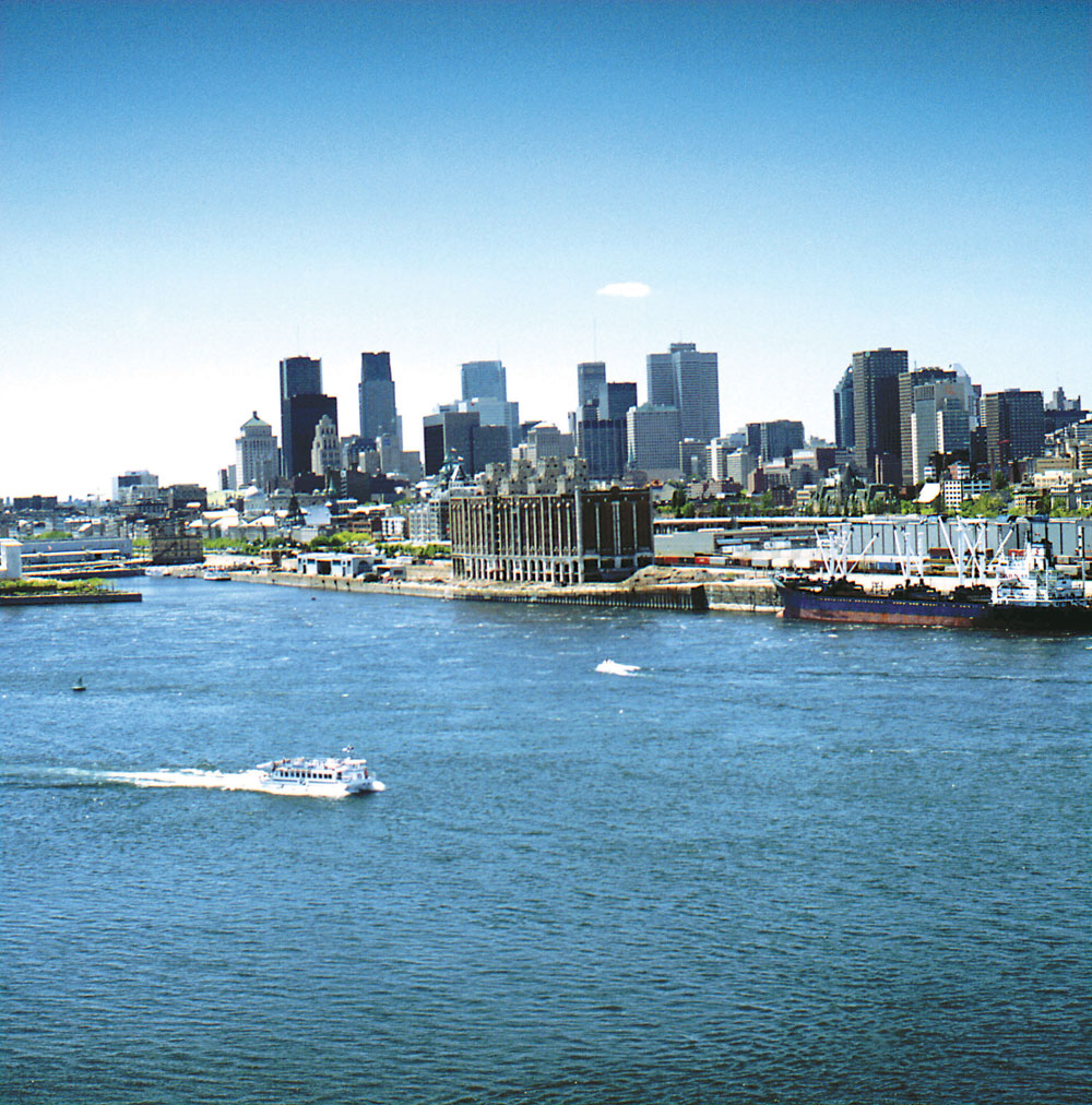
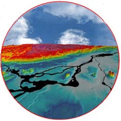
Water in Montreal
The St. Lawrence River, majestic gateway to a continent, is an integral part of the landscape of Montreal. Water in Montreal - Read more … 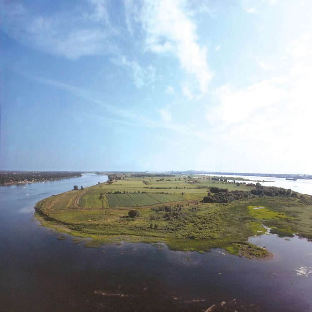
Montreal and its Islands
The Boucherville Islands, at the doorway to the city, are a pastoral park in the middle of the river. Montreal and its Islands - Read more … 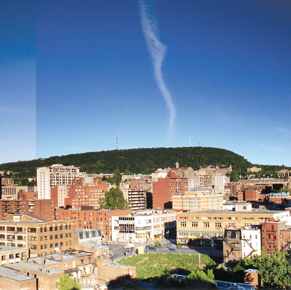
The Soil Yields its Harvest
A broad clay plain that is a remnant of the Champlain Sea is the setting for a number of large farms. Soil Yields its Harvest - Read more … 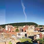
A Group of Remarkable Hills
Is Mount Royal, that peaceful haven and treasured part of our heritage, really an ancient volcano? Group of Remarkable Hill - Read more … 
Historical Links in Stone
From the first stone buildings of the seventeenth century, to the skyscrapers of today, some of which rival Mount Royal in height. Historical Links in Stone - Read more … Want to know more?
|