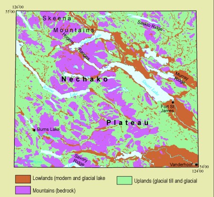
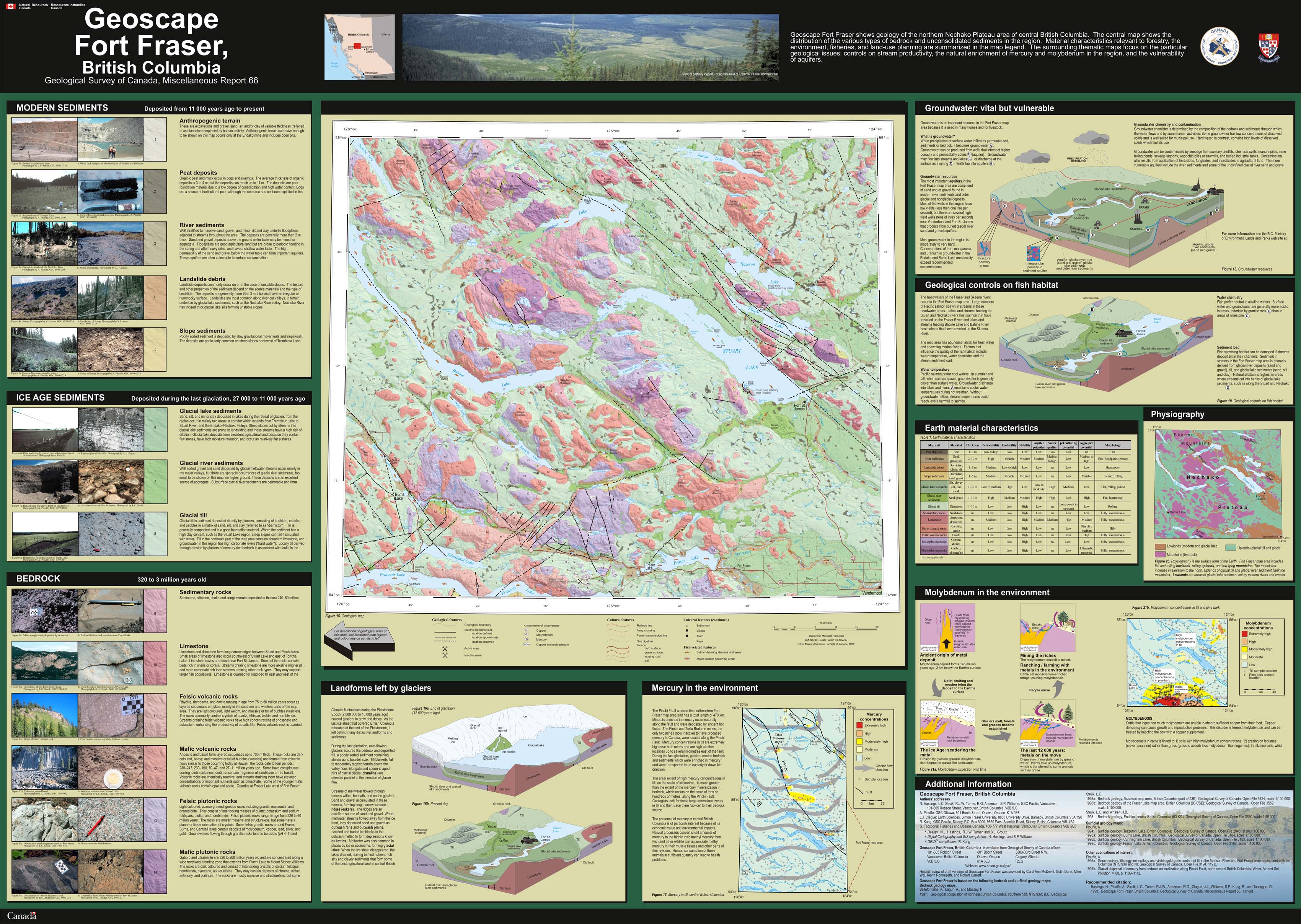
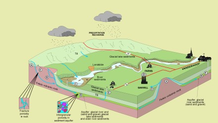
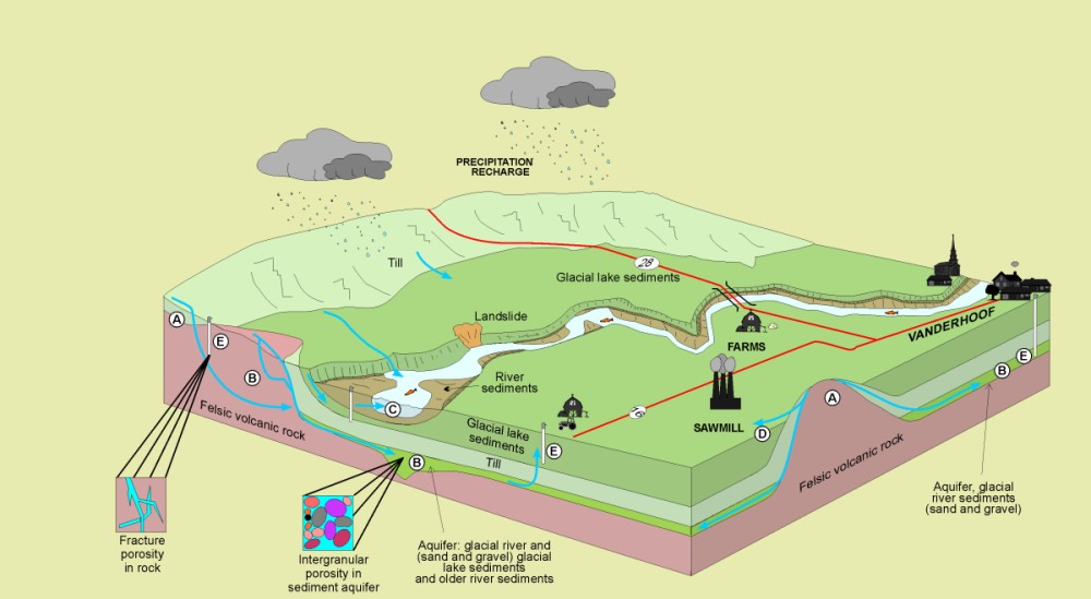
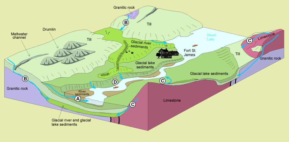
Physiography is the surface form of the Earth. The Fort Fraser map area above includes flat and rolling lowlands, rolling uplands, and low-lying mountains. The mountains increase elevation to the north. Uplands of glacial till and glacial river sediment flank the mountains. Lowlands are areas of glacial lake sediment cut by modern rivers and creeks.
Want to know more?
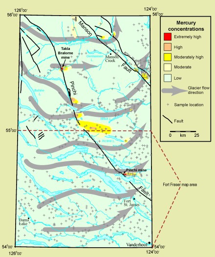
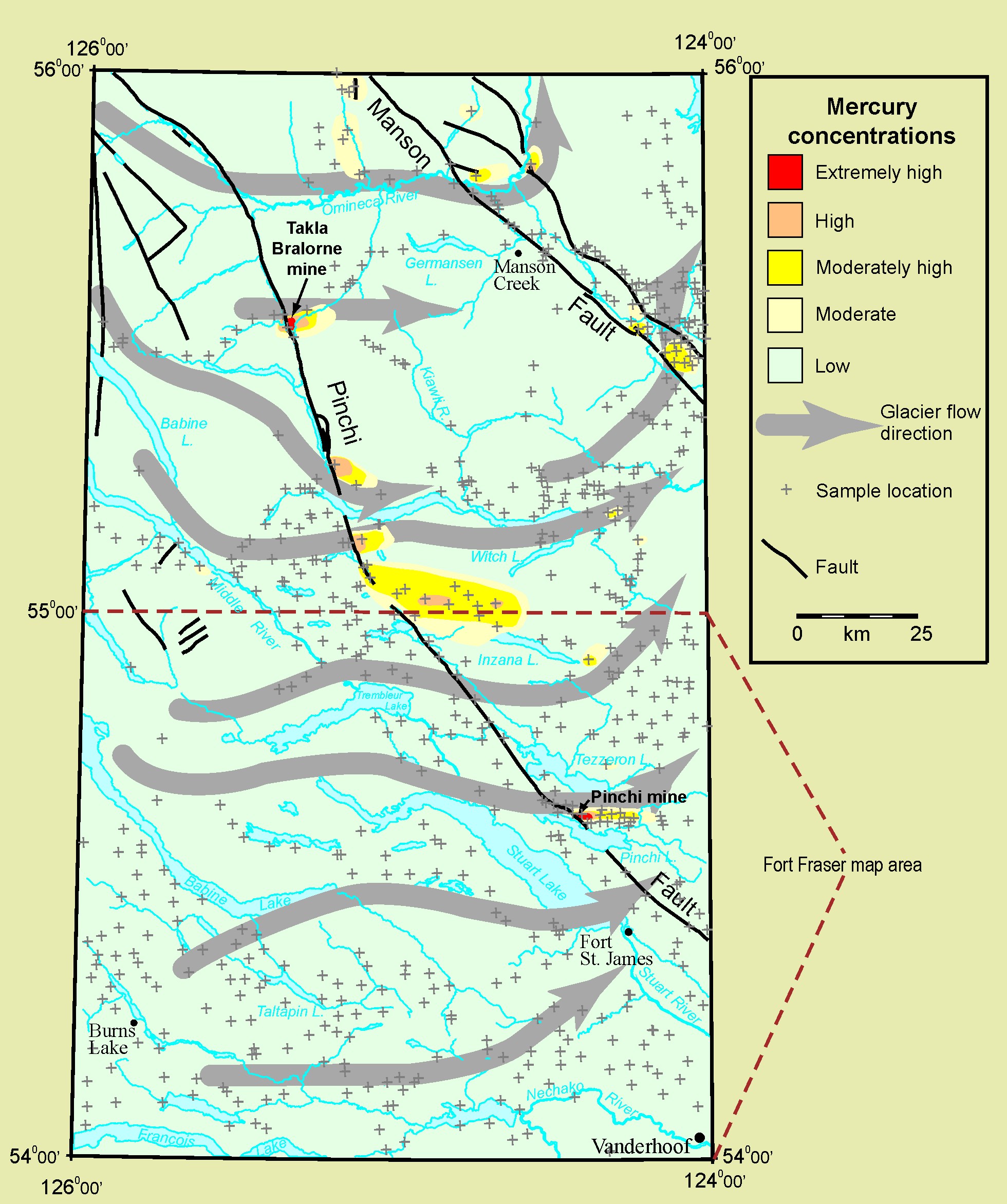
Other publications of interest: Plouffe, A. 1995a: Geochemistry, lithology, mineralogy and visible gold grain content of till in the Manson River and Fort Fraser map areas, central British Columbia (NTS 93K and N); Geological Survey of Canada, Open File 3194, 119 p. 1995b: Glacial dispersal of mercury from bedrock mineralization along Pinchi Fault, north central British Columbia; Water, Air and Soil Pollution, v. 80, p. 1109-1112. 
|
