CGEN Archive

Geoscape - Ottawa-Gatineau

CGEN's Home Page
  • Home
  • CGEN Minutes
  • EarthLinks
  • EdGEO
    • Bringing Earth Science to Life
    • Putting the Earth into Science
  • FBY
    • FBY-Chapter Previews
    • FBY-Sample Lesson
    • QMA-Apercus des chapitres
  • Geoscape
    • Geoscape Canada >
      • Calgary
      • Fort Fraser
      • Montreal
      • Nanaimo
      • Northwest Territories
      • Ottawa-Gatineau
      • Québec
      • Saskatchewan-North
      • Saskatchewan-South
      • Toronto
      • Vancouver
      • Victoria
      • Whitehorse
    • Géopanorama du Canada
    • Geoscape Posters
    • Geotours
    • Waterscapes >
      • Bowen Island
      • Bow River Basin
      • Gulf Islands
      • Okanagan Basin
  • Geovistas
  • Key Publications
    • Wat On Earth
  • OGGP
  • Contact Us
Geoscape - Ottawa-Gatineau
  • Home
  • Deep Time
  • Changing Landscape
  • Different Rocks
  • Wealth From the Land
  • Ottawa River
  • Groundwater
  • Flooding
  • Landslides
  • Earthquakes
  • Indoor Radon
  • Land Use
  • Teacher Resources
  • Credits & Citation
  • Poster Downloads

Geoscape - Ottawa-Gatineau

Geoscape Ottawa-Gatineau Poster
Download Poster [PDF, 54.3 Mb]

Picture
larger image
[JPEG, 1.3 Mb, 3400 X 2040]

Living With Our Geological Landscape - Ottawa

Picture
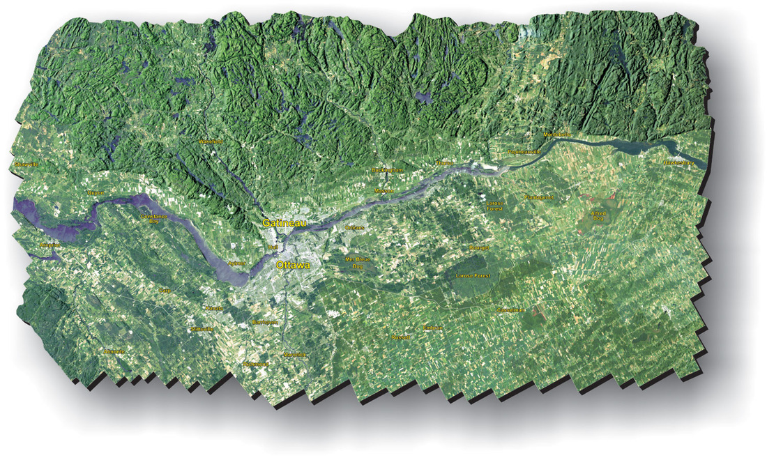
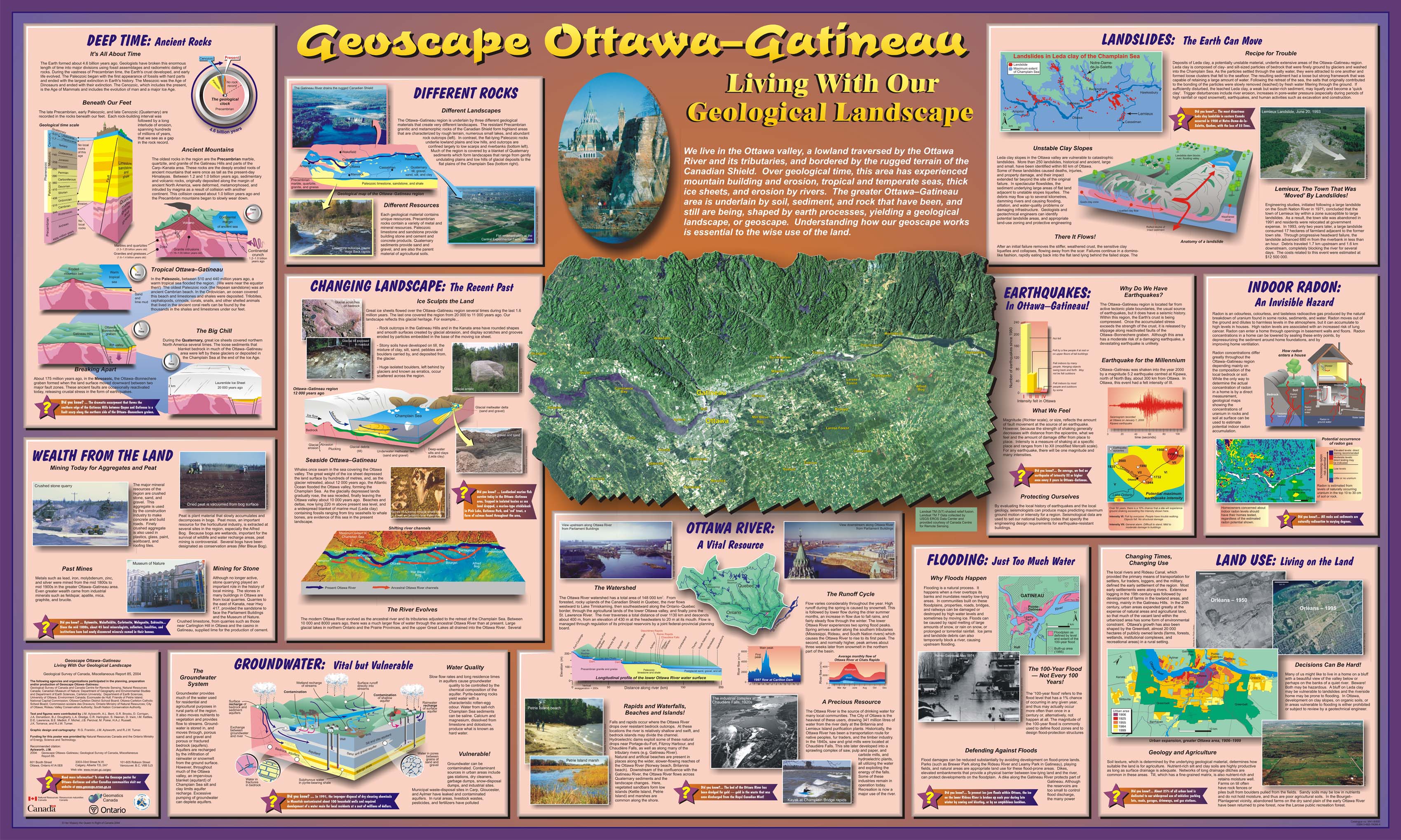
We live in the Ottawa valley, a lowland traversed by the Ottawa River and its tributaries, and bordered by the rugged terrain of the Canadian Shield. Over geological time, this area has experienced mountain building and erosion, tropical and temperate seas, thick ice sheets, and erosion by rivers. The greater Ottawa-Gatineau area is underlain by soil, sediment, and rock that have been, and still are being, shaped by earth processes, yielding a geological landscape, or geoscape. Understanding how our geoscape works is essential to the wise use of the land.

Picture

Want to know more?
  • Ottawa-Gatineau: Urban Geology of Canada's National Capital Area
    Urban Geology of Canada's National Capital Area was a pilot project aiming at developing approaches, methodologies and standards that can be applied to other major urban centres of the country, while providing the geoscience knowledge required for sound regional planning and environmental protection of the National Capital Area.
Géopanorama du Canada
Geoscapes:
  • Canada
  • Calgary
  • Fort Fraser
  • Montreal
  • Nanaimo
  • Northwest Territories
  • Ottawa-Gatineau
  • Québec
  • Saskatchewan - North
  • Saskatchewan - South
  • Toronto
  • Vancouver
  • Victoria
  • Whitehorse
Copyright CGEN 2014-2021
​ Quick Links to Earth Sciences Canada sites
​Earthlinks | WHERE Challenge | Careers in Earth Science |  Four Billion Years and Counting | IYPE | CFES | CGEN | IUGS | GeoVistas | OGGP