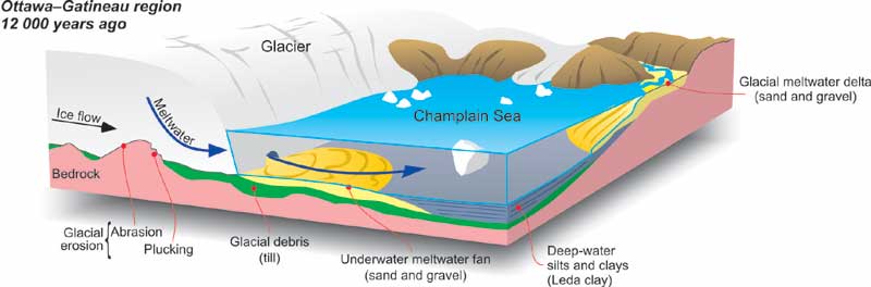
Great ice sheets flowed over the Ottawa-Gatineau region several times during the last 1.6 million years. The last one covered the region from 20 000 to 11 000 years ago. Our landscape reflects this glacial heritage. For example...
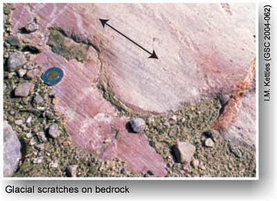
Rock outcrops in the Gatineau Hills and in the Kanata area have rounded shapes and smooth surfaces created by glacial abrasion, and display scratches and grooves eroded by particles embedded in the base of the moving ice sheet.
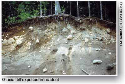
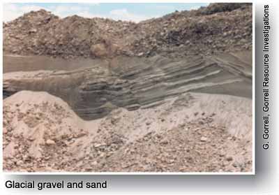
Stony soils have developed on till, the mixture of clay, silt, sand, pebbles and boulders carried by, and deposited from, the glacier.
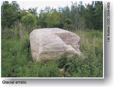
Huge isolated boulders, left behind by glaciers and known as erratics, occur scattered across the region.
Seaside Ottawa-Gatineau
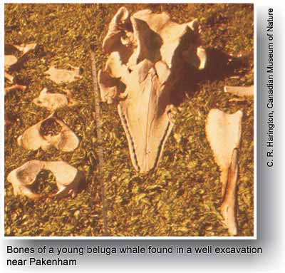
Whales once swam in the sea covering the Ottawa valley. The great weight of the ice sheet depressed the land surface by hundreds of metres, and, as the glacier retreated, about 12 000 years ago, the Atlantic Ocean flooded the Ottawa valley, forming the Champlain Sea. As the glacially depressed lands gradually rose, the sea receded, finally leaving the Ottawa valley about 10 000 years ago. Beaches and deltas, now lying 220 m above present sea level, and a widespread blanket of marine mud (Leda clay) containing fossils ranging from tiny seashells to whale bones, are evidence of this sea in the present landscape.
Did you know? ... Landlocked marine fish survive today in the Ottawa-Gatineau area. Trapped in isolated basins as sea level dropped, a marine-type stickleback in Pink Lake, Gatineau Park, and 'red' trout, a form of salmon found throughout the area, adapted to freshwater conditions.
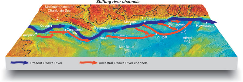
The River Evolves
The modern Ottawa River evolved as the ancestral river and its tributaries adjusted to the retreat of the Champlain Sea. Between 10 000 and 8000 years ago, there was a much larger flow of water through the ancestral Ottawa River than at present. Large glacial lakes in northern Ontario and the Prairie Provinces, and the upper Great Lakes all drained into the Ottawa River. Several times during this period the Ottawa River shifted into new channels. By about 8000 years ago, modern drainage had become established. Peatlands, such as the Mer Bleue and Alfred bogs, have filled abandoned early Ottawa River channels.