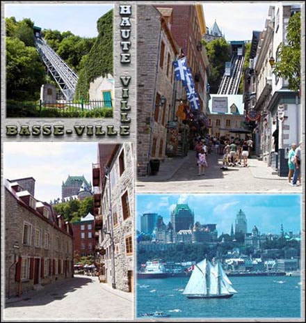
When you climb from the Lower Town to the Upper Town of Québec, you move from the St. Lawrence Platform into the Appalachian Orogen.
The boundary between these two geological provinces, or the northern edge of the Appalachians, is the Logan Fault, which can be followed along such streets as Arago, côte de la Pente-Douce, and boulevard du Versant-Nord Boulevard. It is the main structure in a series of thrust faults that stretches from Lake Champlain in southern Quebec to the Gaspésie, and passes through Cap-Rouge, Sainte-Foy, Québec, and île d'Orléans.
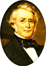
Sir William Logan founded the Geological Survey of Canada in 1842 and was its director for 27 years. He was the first person to study the fault that now bears his name. (Courtesy of GSC)
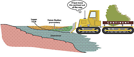
The Logan Fault represents a fracture in the Earth's crust. The fracture plane is shallowly inclined. Slabs of rock were transported along the fault in thrust sheets that were pushed toward the northwest as part of continental collision leading to the formation of the Appalachians. Also referred to as "Logan's Line", this fault has been inactive for hundreds of millions of years.
Every day, thousands travel along boulevard du Versant-Nord and its bike path, which follow the Logan Fault.
The Appalachians in Québec
The rocks of the Québec promontory are part of the Appalachian Orogen. This chain of mountains extends from Newfoundland to Alabama and was built up over a period of 250 million years. Along the côte Salaberry, the côte d'Abraham and boulevard Henri IV, and up the stairs of the Lower Town of Québec, you rise through the thrust sheets, moving from one geological environment to another.
Steep Slopes …
When Mountains form, collision-generated tectonic forces push against rock materials already in place. Imagine a bulldozer at work.
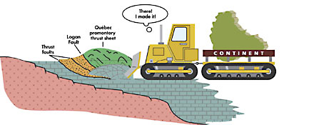
… A Set of Sheets
As all this thrusting takes place, materials break, fold and stack up. The result is an accumulation known as a thrust sheet or nappe.
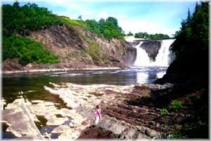
The deformation structures typical of the Appalachian thrust sheets are clearly in evidence at chute de la Chaudière.
The development of the Appalachian bedrock is responsible for the unique character of the local geography.