Aerial LandscapesAerial landscape images are created by combining satellite images (LANDSAT) and computer generated topography. Click on thumbnails to view larger images.
|
|
Geoscape - Vancouver And...
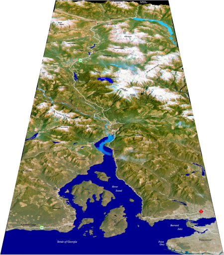
Sea to Sky Corridor 1View looks north along the Sea to Sky corridor and Highway 99 with the Sunshine Coast, Howe Sound, and Vancouver (foreground), Squamish and Whistler (middle ground) and Pemberton and Lillooet River Valley (background). Highway 99 follows a major valley that is flooded by the sea in the south (Howe sound) and cuts across the western Coast Mountains.
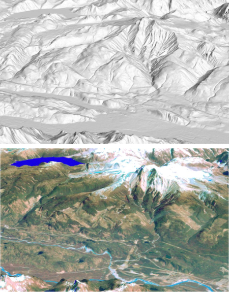
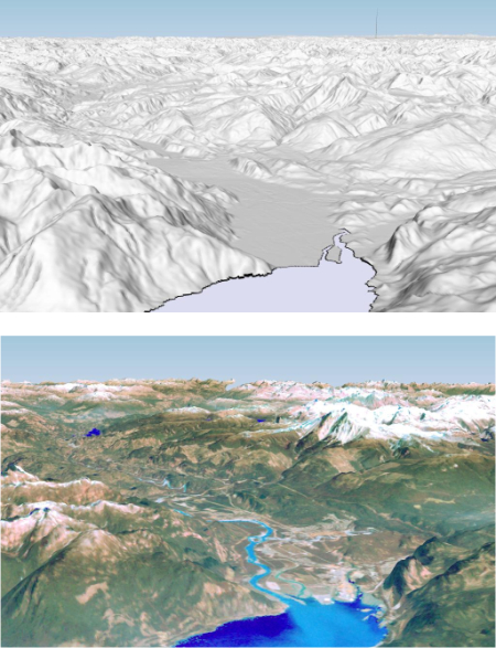
Garibaldi VolcanoView looks east across Squamish River and Cheakamus River valleys to Mount Garibaldi volcano and Garibaldi Lake. Upper image shows shaded topographic surface without satellite imagery.
See also: Garibaldi Lake volcanic field
|
VancouverView looking north across the Vancouver metropolitan area and Lower Mainland in the Fraser Valley (foreground) and Coast Mountains (background).
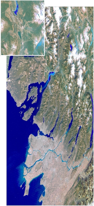
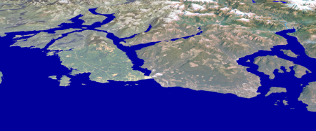
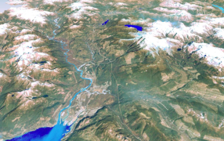
Sea to Sky corridor 2View looks south along the Sea to Sky corridor and Highway 99 with Pemberton, Lillooet Lake, and Lillooet River Valley (foreground), Whistler and Squamish (middle ground) and the Fraser Valley, Vancouver metropolitan area, and Howe sound (background).
Sunshine CoastView looks north across the Sunshine Coast and Howe Sound (right) into Coast Range (background).
|
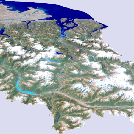
Lower MainlandView looks east across the delta of the Fraser River and Vancouver metropolitan area (foreground), and Lower Mainland in the Fraser Valley, and flanked by the Coast Mountains (left) and Cascade Mountains (right background).
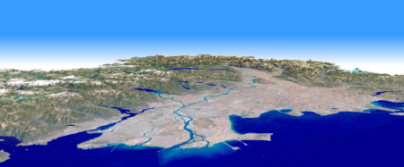
Eastern Fraser ValleyView looks east across the delta of the Fraser River and Vancouver metropolitan area (foreground), and Lower Mainland in the Fraser Valley, and flanked by the Coast Mountains (left) and Cascade Mountains (right background).

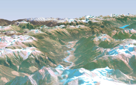
Mt. Meager VolcanoView looks southeast from the summit of Mount Meager volcano (foreground) downstream along the valley of the Lillooet River.
See also: Mt. Meager volcanic field
|
West VancouverView looks north across Burrard Inlet and West Vancouver (foreground) and eastern Howe Sound (left) and Coast Mountains. Upper image shows shaded topographic surface without satellite image.

SquamishView looks north along the Sea-to-sky corridor across the delta of the Squamish River, town of Squamish, Mt. Garibaldi volcano (middle, right) and the valley of the Cheakamus River. Upper image shows shaded topographic surface without satellite imagery.
Squamish-WhistlerView looks north along the Sea-to-Sky corridor from Squamish (foreground) to Whistler (background).
|