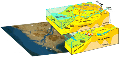
Over the last 10,000 years, a great pile of sediment has accumulated as a delta where the Fraser River flows into the Strait of Georgia. Before the construction of dykes in the 1900s, floods regularly deposited silt and clay on the flat Fraser delta plain. Sand that reaches the river mouth occasionally slumps into deep water along submarine canyons. Mud accumulates in tidal marshes and on the seafloor off the delta front. There are many competing pressures for the use of the delta land: it is an important agricultural area; it is experiencing dramatic urban and industrial growth centered in Richmond, Ladner, and Delta; and the tidal flats and marshes are vital habitats for salmon fry and migratory waterfowl.
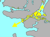
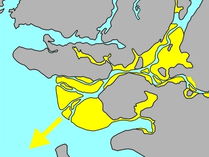
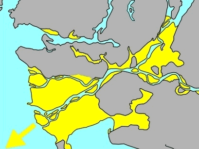
Growth of Fraser River delta and floodplain (shown in yellow) over the last 10,000 years.
10,000 years ago
5,000 years ago
NOW
Can't stop GROWING -- or can it?
The Fraser delta began to develop at what is now New Westminster about 10,000 years ago and has since advanced about 25 km seaward. However, today sand is dredged to maintain the shipping channels below New Westminster, dykes straitjacket the river, and little sediment is now deposited at the front of the delta. As a result of these changes, parts of the delta front are slowly being eroded.
The Unstable Front
There have been both historic and prehistoric landslides on the submarine slope of the Fraser River delta. The delta slope could fail again if an earthquake hit the area resulting in damage to the coal port, ferry terminal, or submarine electric cables that supply much of the power to Vancouver Island.
What Happens When It SHAKES?
Earthquakes pose special problems for the Fraser delta. Severe shaking turns loose, water-saturated sediment into a fluid (liquefaction). When sediments liquefy, the ground may subside irregularly, causing buildings that are not properly anchored to tilt or collapse. The thick delta sediments can locally dampen or intensify earthquake shaking; areas with intensified shaking experience greater damage.