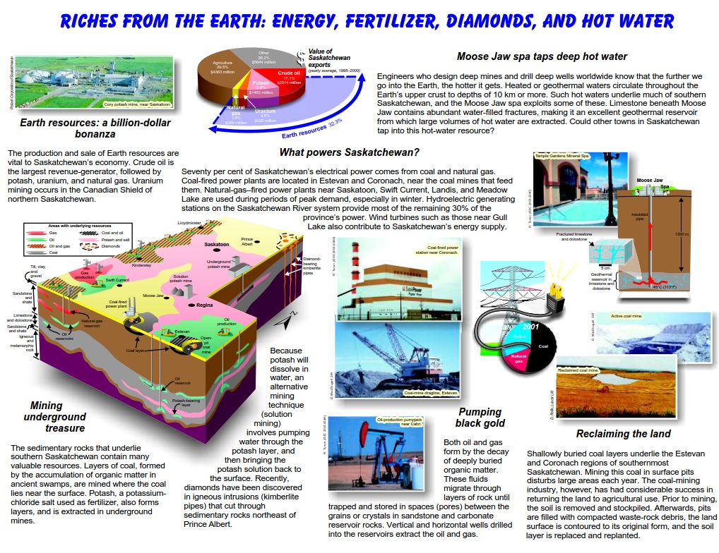
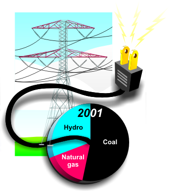
Seventy per cent of Saskatchewan's electrical power comes from coal and natural gas. Coal-fired power plants are located in Estevan and Coronach, near the coal mines that feed them. Natural gas-fired power plants near Saskatoon, Swift Current, Landis, and Meadow Lake are used during periods of peak demand, especially in winter. Hydroelectric generating stations on the Saskatchewan River system provide most of the remaining 30% of the province's power. Wind turbines such as those near Gull Lake also contribute to Saskatchewan's energy supply.
Most of Saskatchewan is powered by burning coal
Coal is mined and then burned to help power Saskatchewan
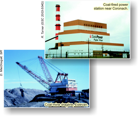
Earth resources: a billion-dollar bonanza
The production and sale of Earth resources are vital to Saskatchewan's economy. Crude oil is the largest revenue-generator, followed by potash, uranium, and natural gas. Uranium mining occurs in the Canadian Shield of northern Saskatchewan.
Earth Resources make up 32.3% of the total value of Saskatchewans exports
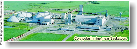
Cory potash mine near Saskatoon
Mining Underground Treasure
The sedimentary rocks that underlie southern Saskatchewan contain many valuable resources. Layers of coal, formed by the accumulation of organic matter in ancient swamps, are mined where the coal lies near the surface. Potash, a potassium-chloride salt used as fertilizer, also forms layers, and is extracted in underground mines. Because potash will dissolve in water, an alternative mining technique (solution mining) involves pumping water through the potash layer, and then bringing the potash solution back to the surface. Recently, diamonds have been discovered in igneous intrusions (kimberlite pipes) that cut through sedimentary rocks northeast of Prince Albert.
Many valuable resources can be found underground
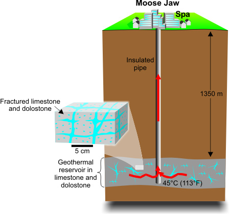
Moose Jaw Spa Taps Deep Hot Water
Engineers who design deep mines and drill deep wells worldwide know that the further we go into the Earth, the hotter it gets. Heated or geothermal waters circulate throughout the Earth's upper crust to depths of 10 km or more. Such hot waters underlie much of southern Saskatchewan, and the Moose Jaw spa exploits some of these. Limestone beneath Moose Jaw contains abundant water-filled fractures, making it an excellent geothermal reservoir from which large volumes of hot water are extracted. Could other towns in Saskatchewan tap into this hot-water resource?
Temple Gardens Mineral Spa
Deep hot water can be extracted to heat water in Spas such as the one in Moose Jaw
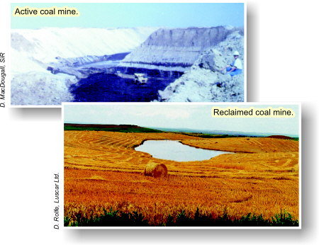
Reclaiming the Land
Shallowly buried coal layers underlie the Estevan and Coronach regions of southernmost Saskatchewan. Mining this coal in surface pits disturbs large areas each year. The coal-mining industry, however, has had considerable success in returning the land to agricultural use. Prior to mining, the soil is removed and stockpiled. Afterwards, pits are filled with compacted waste-rock debris, the land surface is contoured to its original form, and the soil layer is replaced and replanted.
Once an active coal mine becomes inactive, the land can be reclaimed to its original environment.
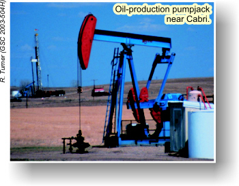
Oil production pumpjack near Cabri
Pumping Black Gold
Both oil and gas form by the decay of deeply buried organic matter. These fluids migrate through layers of rock until trapped and stored in spaces (pores) between the grains or crystals in sandstone and carbonate reservoir rocks. Vertical and horizontal wells drilled into the reservoirs extract the oil and gas.