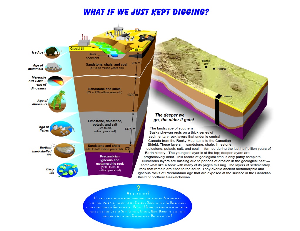
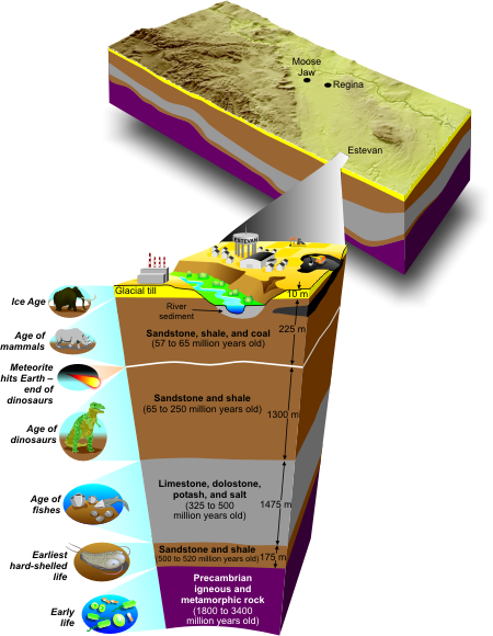
The landscape of southern Saskatchewan rests on a thick series of sedimentary rock layers that underlie central Canada from the Rocky Mountains to the Canadian Shield. These layers - sandstone, shale, limestone, dolostone, potash, salt, and coal - formed during the last half-billion years of Earth history. The youngest layer is at the top; deeper layers are progressively older.
This record of geological time is only partly complete. Numerous layers are missing due to periods of erosion in the geological past - somewhat like a book with many of its pages missing. The layers of sedimentary rock that remain are tilted to the south. They overlie ancient metamorphic and igneous rocks of Precambrian age that are exposed at the surface in the Canadian Shield of northern Saskatchewan.
The deeper we go the older it gets.
A big shortcut?
It's a drive of several hundred kilometres from southern Saskatchewan to the forest-and-lake country of the Canadian Shield north of La Ronge, home of the oldest rocks in Saskatchewan. But wait! Geologists know that these ancient rocks are within 5 km of Swift Current, Yorkton, North Battleford, and every other place in southern Saskatchewan. How can this be?