CGEN Archive

Geoscape - N. Saskatchewan

CGEN's Home Page
  • Home
  • CGEN Minutes
  • EarthLinks
  • EdGEO
    • Bringing Earth Science to Life
    • Putting the Earth into Science
  • FBY
    • FBY-Chapter Previews
    • FBY-Sample Lesson
    • QMA-Apercus des chapitres
  • Geoscape
    • Geoscape Canada >
      • Calgary
      • Fort Fraser
      • Montreal
      • Nanaimo
      • Northwest Territories
      • Ottawa-Gatineau
      • Québec
      • Saskatchewan-North
      • Saskatchewan-South
      • Toronto
      • Vancouver
      • Victoria
      • Whitehorse
    • Géopanorama du Canada
    • Geoscape Posters
    • Geotours
    • Waterscapes >
      • Bowen Island
      • Bow River Basin
      • Gulf Islands
      • Okanagan Basin
  • Geovistas
  • Key Publications
    • Wat On Earth
  • OGGP
  • Contact Us
Geoscape - Northern Saskatchewan
  • Home
  • If rocks could talk...
  • Athabasca Sedimentary Basin
  • The Ice Age
  • Meteorite Impact
  • Jobs in Mining
  • Hidden Treasures
  • How We Use Our Land
  • Waterways of the Canadian Shield
  • How long is time?
  • Credits & Citation
  • Poster Downloads

Geoscape - N. Saskatchewan

Waterways of the Canadian Shield

Picture
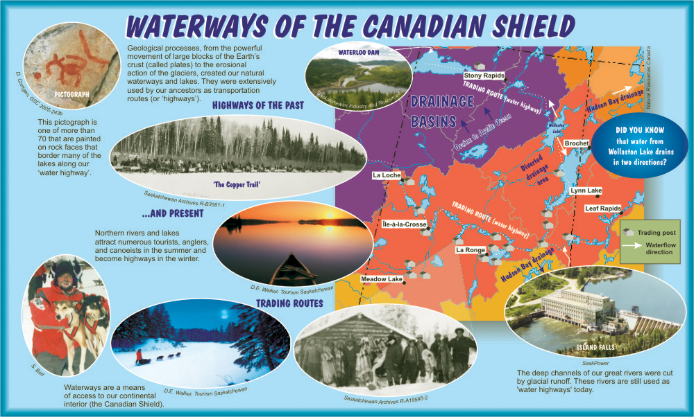
Geological processes, from the powerful movement of large blocks of the Earth's crust (called plates) to the erosional action of the glaciers, created our natural waterways and lakes. They were extensively used by our ancestors as transportation routes (or 'highways').

Pictographs
Picture
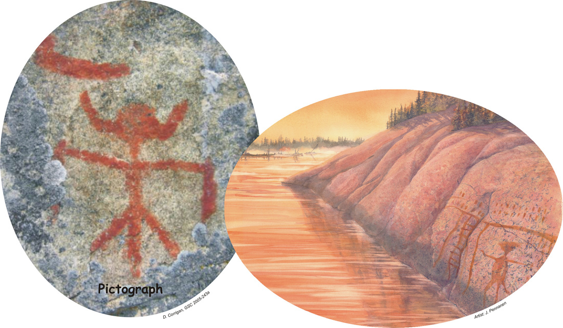
At least 23 reported sites from Uranium City to The Pas contain pictographs, drawn by our ancestors up to a thousand years ago.  (Courtesy of D. Corrigan, GSC 2005-243a (image-left); Artist: J. Pennanen (image-right))
Picture
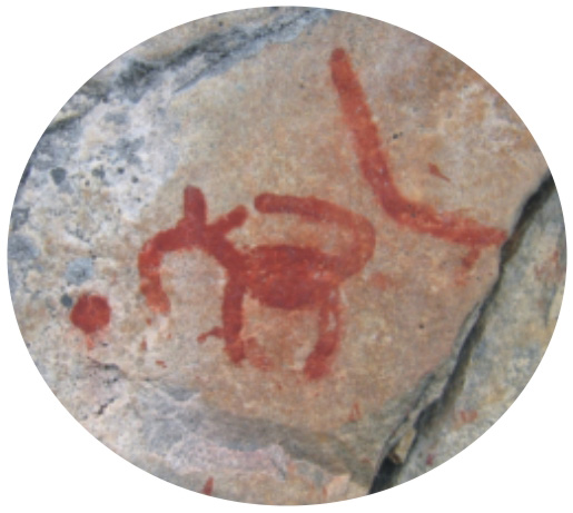
This pictograph is one of more than 70 that are painted on rock faces that border many of the lakes along our 'water highway'
(Courtesy of D. Corrigan, GSC 2005-243b)

Natural Highways

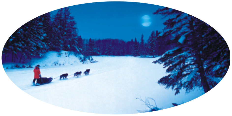
Northern rivers and lakes attract numerous tourists, anglers, and canoeists in the summer and become highways in the winter. The deep channels of our great rivers were cut by glacial runoff. These rivers are still used as 'water highways' today.
Picture
Waterways are a means of access to our continental interior (the Canadian Shield).  (Courtesy of Natural Resources Canada)
Picture
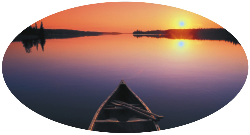
Canoeing.
(Courtesy of D.E. Walker, Tourism Saskatchewan)
Picture
Trading routes.
(Courtesy of D.E. Walker, Tourism Saskatchewan)
Picture
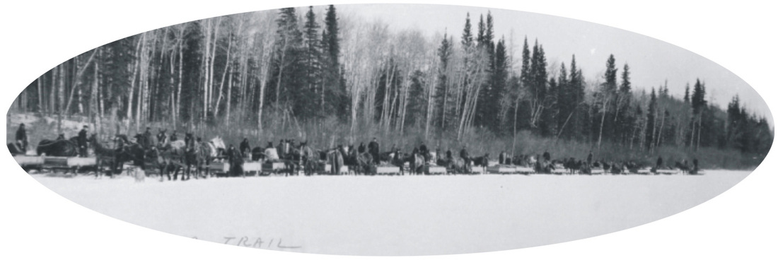
Highways of the past - "The Copper Trail"
(Courtesy of Saskatchewan Archives R-B3561-1)
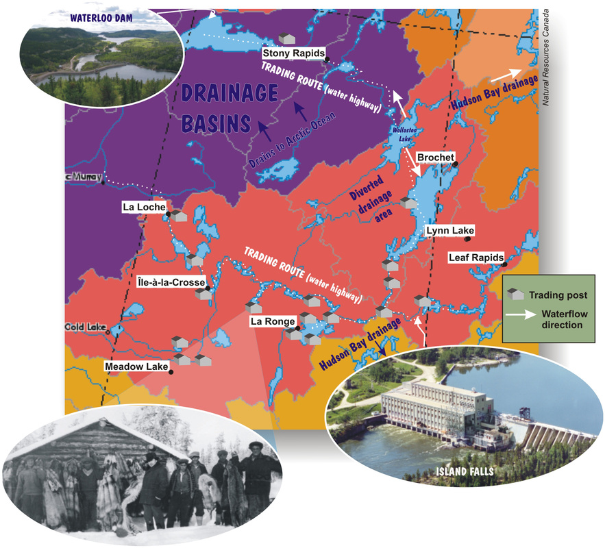
Did You Know?
  • water from Wollaston Lake drains in two directions?
Géopanorama du Canada
Geoscapes:
  • Canada
  • Calgary
  • Fort Fraser
  • Montreal
  • Nanaimo
  • Northwest Territories
  • Ottawa-Gatineau
  • Québec
  • Saskatchewan - North
  • Saskatchewan - South
  • Toronto
  • Vancouver
  • Victoria
  • Whitehorse
Copyright CGEN 2014-2021
​ Quick Links to Earth Sciences Canada sites
​Earthlinks | WHERE Challenge | Careers in Earth Science |  Four Billion Years and Counting | IYPE | CFES | CGEN | IUGS | GeoVistas | OGGP