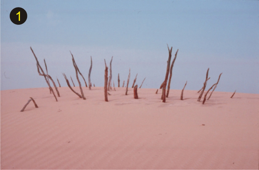
The Athabasca sand dunes formed from the reworking of sand initially deposited in deltas where glacial rivers entered glacial Lake Athabasca. As the lake levels dropped, the exposed dry sand was reworked into dunes by wind. These dunes are still 'active', visibly moving today. (Courtesy of R. Wright, Saskatchewan Environment)
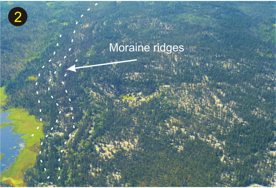
End moraines mark the position(s) of the glacier margin during a pause in its retreat. They comprise a mixture of boulder- and cobble- to silt-sized glacially derived sediments. (Courtesy of Saskatchewan Industry and Resources)
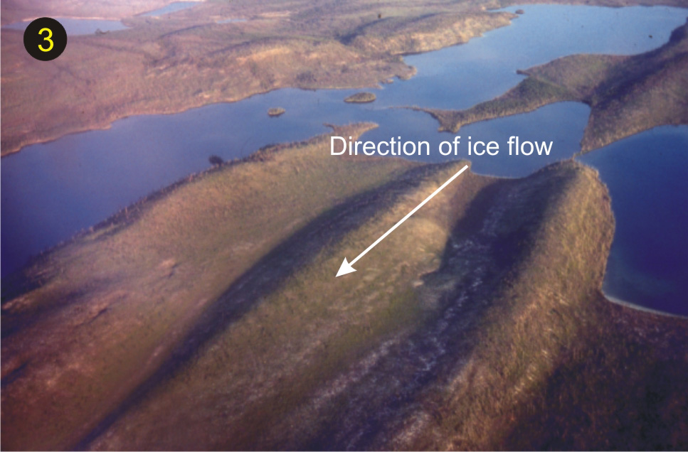
Elongated, teardrop-shaped hills of rock, sand, and gravel formed under the moving ice. Called drumlins, these structures are up to two kilometres in length. Drumlins indicate ice-flow direction with the gentle-sloped side pointing in the direction of ice flow. (Courtesy of L. Dredge, GSC 204034-G)
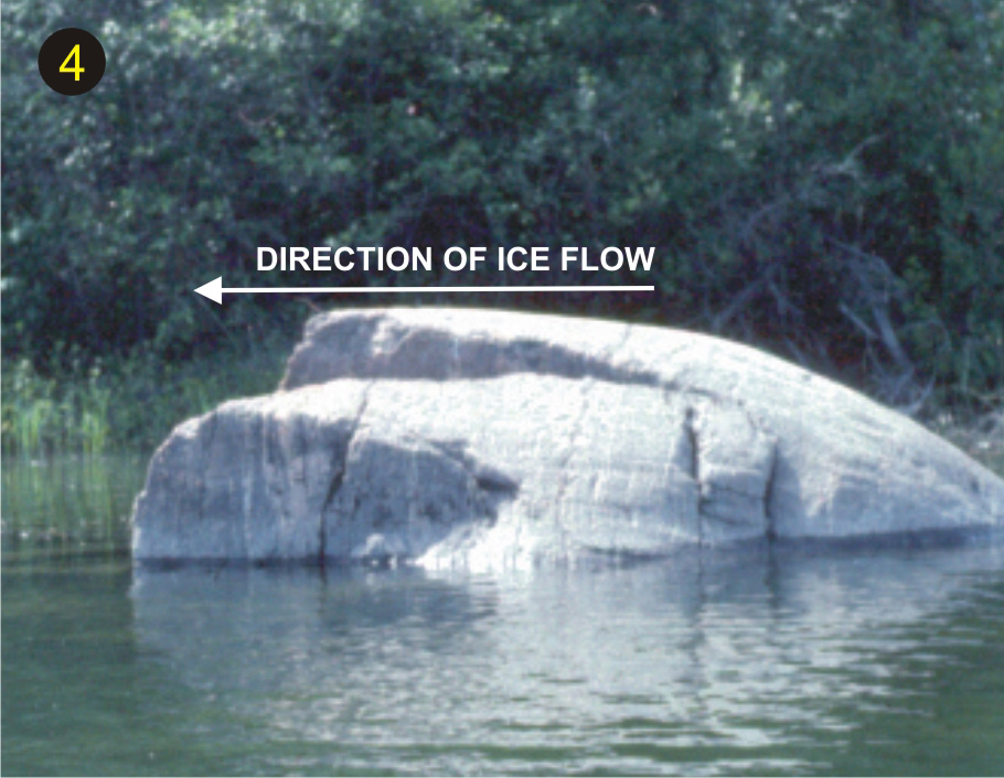
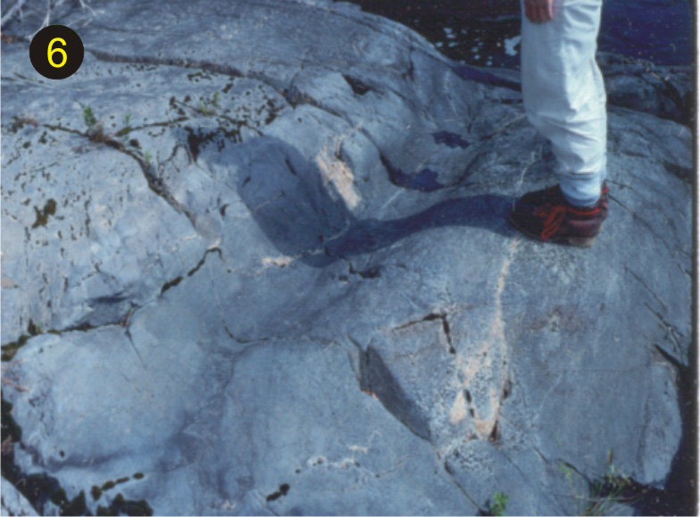
Roche moutonée (which means 'sheep rock' because it looks like a sleeping sheep) are bedrock features sculpted by glaciers. (Courtesy of J. Dale)
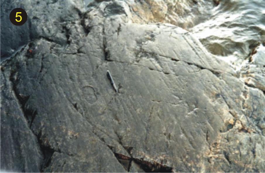
Scratches on the rocks (called striae) were gouged when rock fragments frozen to the base of the moving glacier scratched the underlying bedrock surfaces much like sandpaper does to wood. (Courtesy of J. Campbell)
Small channels were carved into the bedrock by fast-flowing, sediment-laden meltwater beneath the glacier. (Courtesy of J. Dale)
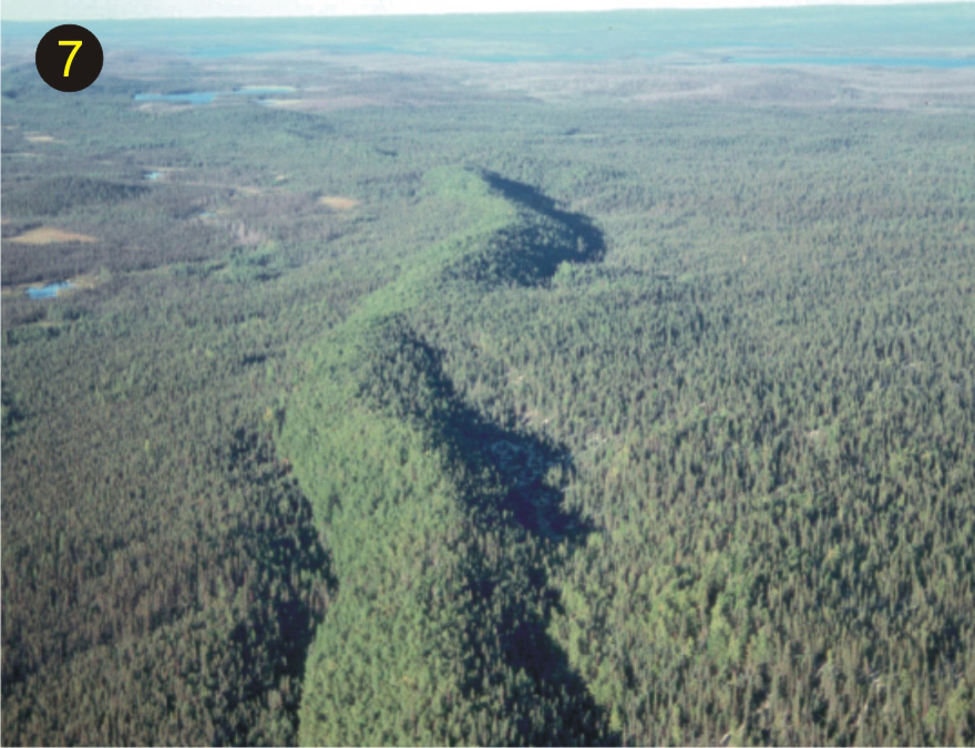
Eskers are long, winding ridges of sand and gravel typically oriented parallel to ice flow. They were deposited by glacial meltwater streams flowing in channels or tunnels in, on, or beneath the ice. (Courtesy of R. Wright, Saskatchewan Environment)
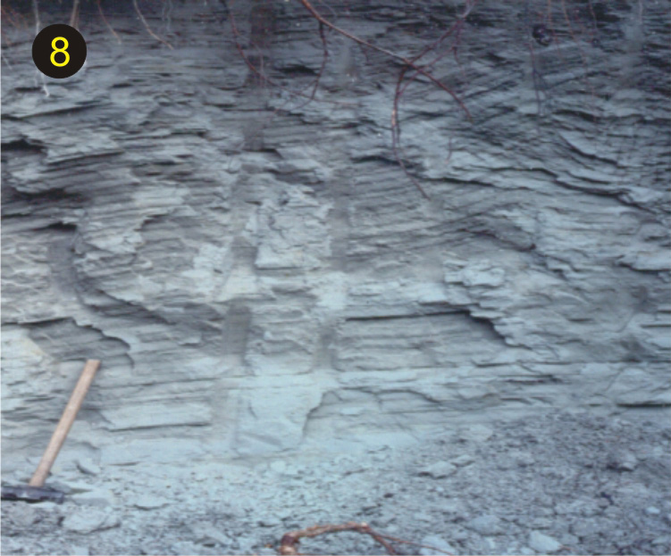
Varves - Extensive alternating layers of fine sand, silt, and clay (dark bands) were deposited in the deep quiet waters of glacial lakes. Each group of one fine and one coarse layer represents one year's deposition in the glacial lake. (Courtesy of Saskatchewan Geological Society)
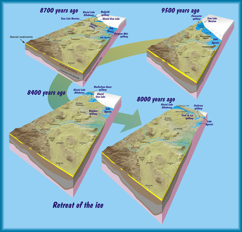
Retreat of the Ice
At least four times during the last 2.56 million years (the Quaternary Period), continent-sized glaciers, called ice sheets, covered much of Canada and northern United States.
The last ice sheet, which covered almost all of Saskatchewan some 23 000 years ago, began to retreat northeastward about 17 000 years ago, and disappeared from northern Saskatchewan between 10 000 and 8000 years ago. Our ancestors moved north following the retreating ice formation. Much of the present-day topography is the result of action of this ice sheet.
Unlike southern Saskatchewan where thick glacial sediments bury bedrock, northern Saskatchewan is characterized by thin and patchy glacial deposits and an abundance of glacially eroded and sculpted bedrock outcrops. As well, melting ice released enormous volumes of water which was carried away by giant glacial rivers that carved deep valleys and deposited sand and gravel or was trapped in large glacial lakes.
Retreat of the Ice.
Did You Know ?
the Cree Lake Moraine can be traced from Alberta across northern Saskatchewan into Manitoba.
eskers make great natural highways and camp sites.