CGEN Archive
Geoscape - N. Saskatchewan
CGEN's Home Page
Home
CGEN Minutes
EarthLinks
EdGEO
Bringing Earth Science to Life
Putting the Earth into Science
FBY
FBY-Chapter Previews
FBY-Sample Lesson
QMA-Apercus des chapitres
Geoscape
Geoscape Canada
>
Calgary
Fort Fraser
Montreal
Nanaimo
Northwest Territories
Ottawa-Gatineau
Québec
Saskatchewan-North
Saskatchewan-South
Toronto
Vancouver
Victoria
Whitehorse
Géopanorama du Canada
Geoscape Posters
Geotours
Waterscapes
>
Bowen Island
Bow River Basin
Gulf Islands
Okanagan Basin
Geovistas
Key Publications
Wat On Earth
OGGP
Contact Us
Geoscape - Northern Saskatchewan
Home
If rocks could talk...
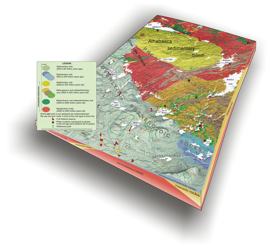
Athabasca Sedimentary Basin
The Ice Age
Meteorite Impact
Jobs in Mining
Hidden Treasures
How We Use Our Land
Waterways of the Canadian Shield
How long is time?
Credits & Citation
Poster Downloads
Geoscape - N. Saskatchewan
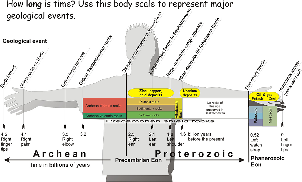
How long is time?
Map image created using Canadian Digital Elevation Data from Geomatics Canada
(Courtesy of B. Slimmon)
Géopanorama du Canada
Geoscapes:
Canada
Calgary
Fort Fraser
Montreal
Nanaimo
Northwest Territories
Ottawa-Gatineau
Québec
Saskatchewan - North
Saskatchewan - South
Toronto
Vancouver
Victoria
Whitehorse