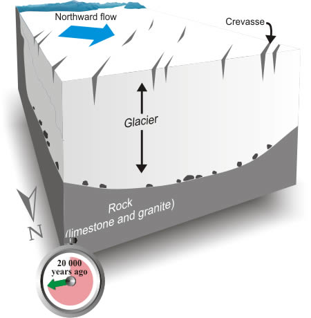
About 20 000 years ago, an ice sheet up to 2 km thick covered southern Yukon Territory. Glacier ice flowed northward along the Yukon River valley, overtopping Mount McIntyre, Canyon Mountain (locally known as Grey Mountain), and Golden Horn Mountain. Rock surfaces were scratched by stones frozen into the base of the glacier.
Buried Ice Cubes
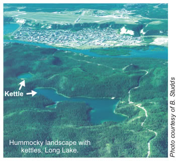
Large blocks of stagnant ice that become isolated from the snout of a melting glacier may be partly or completely buried by silt, sand, or gravel. When the ice blocks melt, they leave depressions on the landscape, called kettles. Kettles deep enough to extend below the water table form kettle lakes.
2. Thawing Out
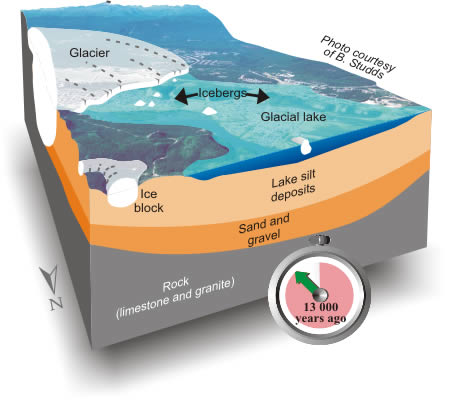
As the climate warmed, about 15 000 years ago, the glaciers covering southern Yukon Territory thinned and retreated to the south. Less than 2000 years later, glacier ice began to disappear from the Yukon River valley at Whitehorse. North-flowing meltwater, however, was dammed by a remnant mass of glacier ice near present-day Lake Laberge, and a large glacial lake developed in the Takhini and Yukon river valleys.
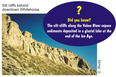
Streams flowing from melting ice transported large amounts of silt and sand into the lake. The silt deposits accumulated on the lake floor, in some places to a thickness of more than 90 m. These deposits are exposed in bluffs which border the Yukon River and surround downtown Whitehorse. They form the flat surface on which the Whitehorse airport is located. Next time you are at the airport, imagine yourself on a muddy lake bottom with icebergs floating overhead!
3. The River Rules
About 12 000 years ago, the glacial lake drained and the Yukon River reclaimed the valley. The river eroded into the soft lake silt, creating the cliffs that border the downtown area. Downtown Whitehorse is built over sand and gravel that were deposited by the shifting channels and periodic floods of the Yukon River over thousands of years.
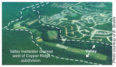
Mysterious Valleys
Long, narrow valleys on the sides of the Whitehorse valley are mysterious - they seem too large to have been carved by the small streams that now occupy them. Geologists believe that these valleys were carved by streams flowing from a melting glacier at the end of the Ice Age. The flat floors of these meltwater valleys contain wetlands that are an important plant and animal habitat.