CGEN Archive

Waterscape Canada

CGEN's Home Page
  • Home
  • CGEN Minutes
  • EarthLinks
  • EdGEO
    • Bringing Earth Science to Life
    • Putting the Earth into Science
  • FBY
    • FBY-Chapter Previews
    • FBY-Sample Lesson
    • QMA-Apercus des chapitres
  • Geoscape
    • Geoscape Canada >
      • Calgary
      • Fort Fraser
      • Montreal
      • Nanaimo
      • Northwest Territories
      • Ottawa-Gatineau
      • Québec
      • Saskatchewan-North
      • Saskatchewan-South
      • Toronto
      • Vancouver
      • Victoria
      • Whitehorse
    • Géopanorama du Canada
    • Geoscape Posters
    • Geotours
    • Waterscapes >
      • Bowen Island
      • Bow River Basin
      • Gulf Islands
      • Okanagan Basin
  • Geovistas
  • Key Publications
    • Wat On Earth
  • OGGP
  • Contact Us

Waterscape - Okanagan Basin

Hydropanoramas
  • Home
  • From Highlands
  • Our Water Cycle
  • Our Lakes
  • Groundwater
  • Our Changing Climate
  • Protecting Water Needs
  • We Need Healthy Streams
  • Irrigation
  • Wise Water Use Indoors
  • Wise Water Use Outdoors
  • Sharing Our Waters
  • Credits & Citation
  • Poster Downloads

Our Water Cycle

Dry to really, really dry
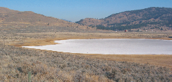
The Okanagan Basin is dry because it lies in the rain shadow of the Coast Mountains. This high mountain chain strips moisture from Pacific storms, leaving little for the basin. The farther south you go, the drier it gets. Cacti grow in the Okanagan Basin!

Picture
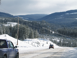
Our upland snow catchers
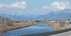
Most water enters the Okanagan Basin as winter snow on the highlands. During the spring, snowmelt infiltrates into the ground or flows in streams to highland reservoirs and valley lakes.
Picture
White Lake, west of Okanagan Falls, completely evaporates in summer, leaving behind a dry lake floor of white mineral salts.  
(R.J.W. Turner, GSC 2006-150)
Picture

The Okanagan River at Penticton. This is the main river of the Okanagan Valley. Not very big!  
(R.J.W. Turner, GSC 2006-151)
Picture


Highland snowpack along road to Big White ski area east of Kelowna

(R.J.W. Turner, GSC 2006-149)
We lose most of what we get
Only 15% of the rain and snow that falls in the basin flows to our lakes and remains there. The rest leaves the basin through transpiration from forests and crops, and evaporation from lakes.
Waterscapes:
  • Bowen Island 
  • Bow River Basin
  • Gulf Islands
  • Okanagan Basin ​
Copyright CGEN 2014-2021
​ Quick Links to Earth Sciences Canada sites
​Earthlinks | WHERE Challenge | Careers in Earth Science |  Four Billion Years and Counting | IYPE | CFES | CGEN | IUGS | GeoVistas | OGGP