CGEN Archive

Waterscape Canada

CGEN's Home Page
  • Home
  • CGEN Minutes
  • EarthLinks
  • EdGEO
    • Bringing Earth Science to Life
    • Putting the Earth into Science
  • FBY
    • FBY-Chapter Previews
    • FBY-Sample Lesson
    • QMA-Apercus des chapitres
  • Geoscape
    • Geoscape Canada >
      • Calgary
      • Fort Fraser
      • Montreal
      • Nanaimo
      • Northwest Territories
      • Ottawa-Gatineau
      • Québec
      • Saskatchewan-North
      • Saskatchewan-South
      • Toronto
      • Vancouver
      • Victoria
      • Whitehorse
    • Géopanorama du Canada
    • Geoscape Posters
    • Geotours
    • Waterscapes >
      • Bowen Island
      • Bow River Basin
      • Gulf Islands
      • Okanagan Basin
  • Geovistas
  • Key Publications
    • Wat On Earth
  • OGGP
  • Contact Us

Waterscape - Okanagan Basin

Hydropanoramas
  • Home
  • From Highlands
  • Our Water Cycle
  • Our Lakes
  • Groundwater
  • Our Changing Climate
  • Protecting Water Needs
  • We Need Healthy Streams
  • Irrigation
  • Wise Water Use Indoors
  • Wise Water Use Outdoors
  • Sharing Our Waters
  • Credits & Citation
  • Poster Downloads

From Highlands to Valley Floor

The Highlands
The Okanagan Valley is a great trough that cuts across the highlands of southern British Columbia. These forested highlands are the largest part of the basin and are the source of most of our water. In addition to outdoor recreation, forestry and cattle grazing are important in the highlands.
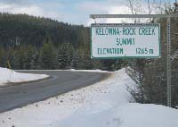
The valley is a busy place! 
The Okanagan Valley consists of the main lakes, valley bottom, benchlands, and surrounding slopes. Most of us live down on the valley bottom or on the surrounding benchlands in Kelowna, Vernon, Penticton, and other major centres. The valley contains our lakes, agriculture and wineries, tourist facilities and golf courses, and industry, as well as wetland ecosystems, species at risk, and endangered habitat. With all these competing uses, we need to plan our growth carefully.
Picture
The highlands
larger image
[JPEG, 247.2 kb, 927 X 955]
Picture

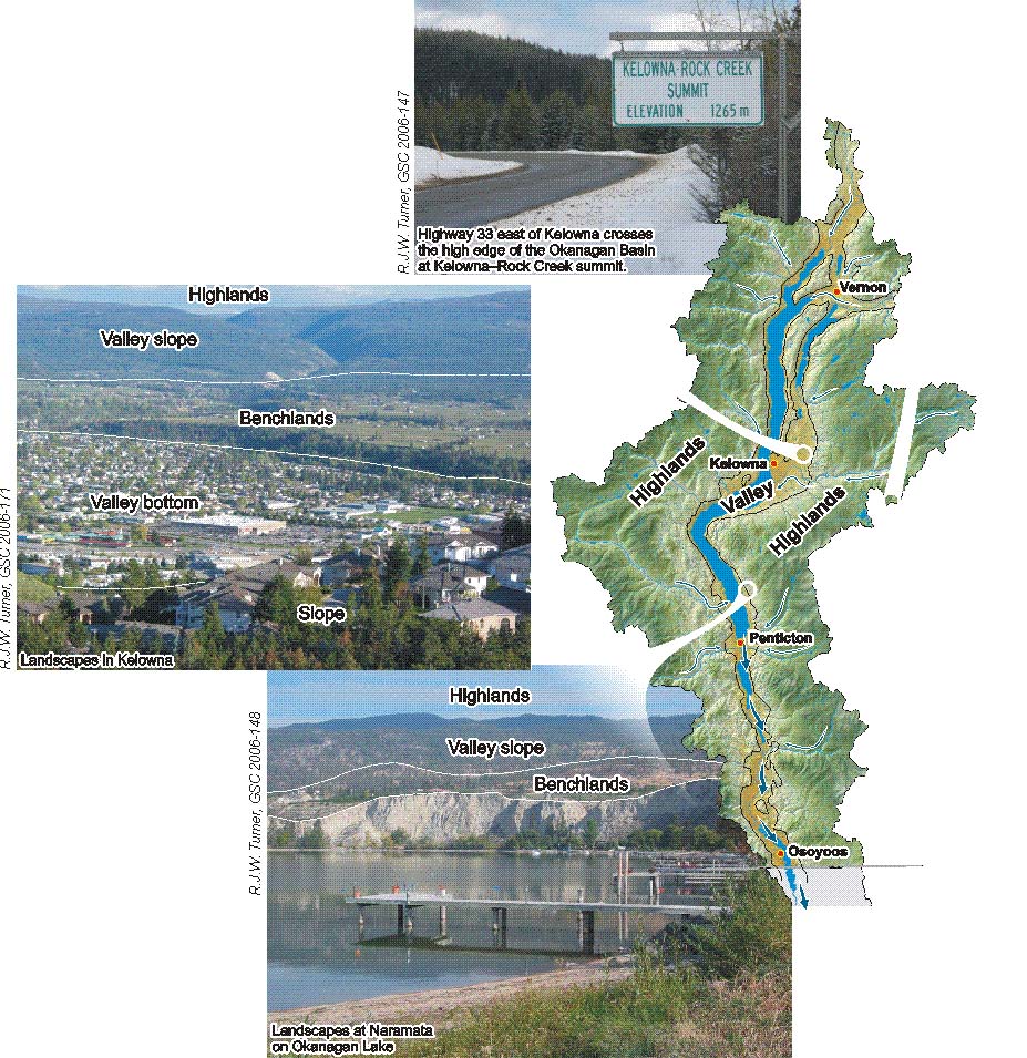
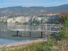
Highway 33 east of Kelowna crosses the high edge of the Okanagan Basin at Kelowna-Rock Creek summit. 
(R.J.W. Turner, GSC 2006-147)

Picture


Landscapes in Kelowna  

(R.J.W. Turner, GSC 2006-171)
Picture


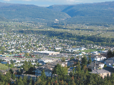
Landscapes at Naramata on Okanagan Lake 

(R.J.W. Turner, GSC 2006-148)
Waterscapes:
  • Bowen Island 
  • Bow River Basin
  • Gulf Islands
  • Okanagan Basin ​
Copyright CGEN 2014-2021
​ Quick Links to Earth Sciences Canada sites
​Earthlinks | WHERE Challenge | Careers in Earth Science |  Four Billion Years and Counting | IYPE | CFES | CGEN | IUGS | GeoVistas | OGGP