Geoscience for Central Vancouver Island Communities
Our Rock Foundation
Topics on this page:
Different Rocks, Different Landscapes
Under Nanaimo: A Record of Ancient History
Rock Types
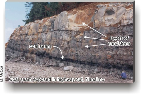
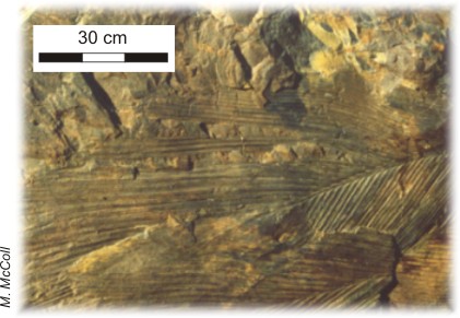
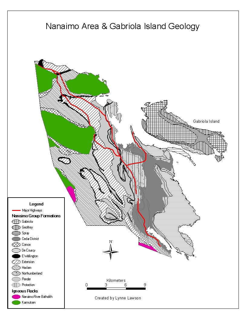
Nanaimo Group
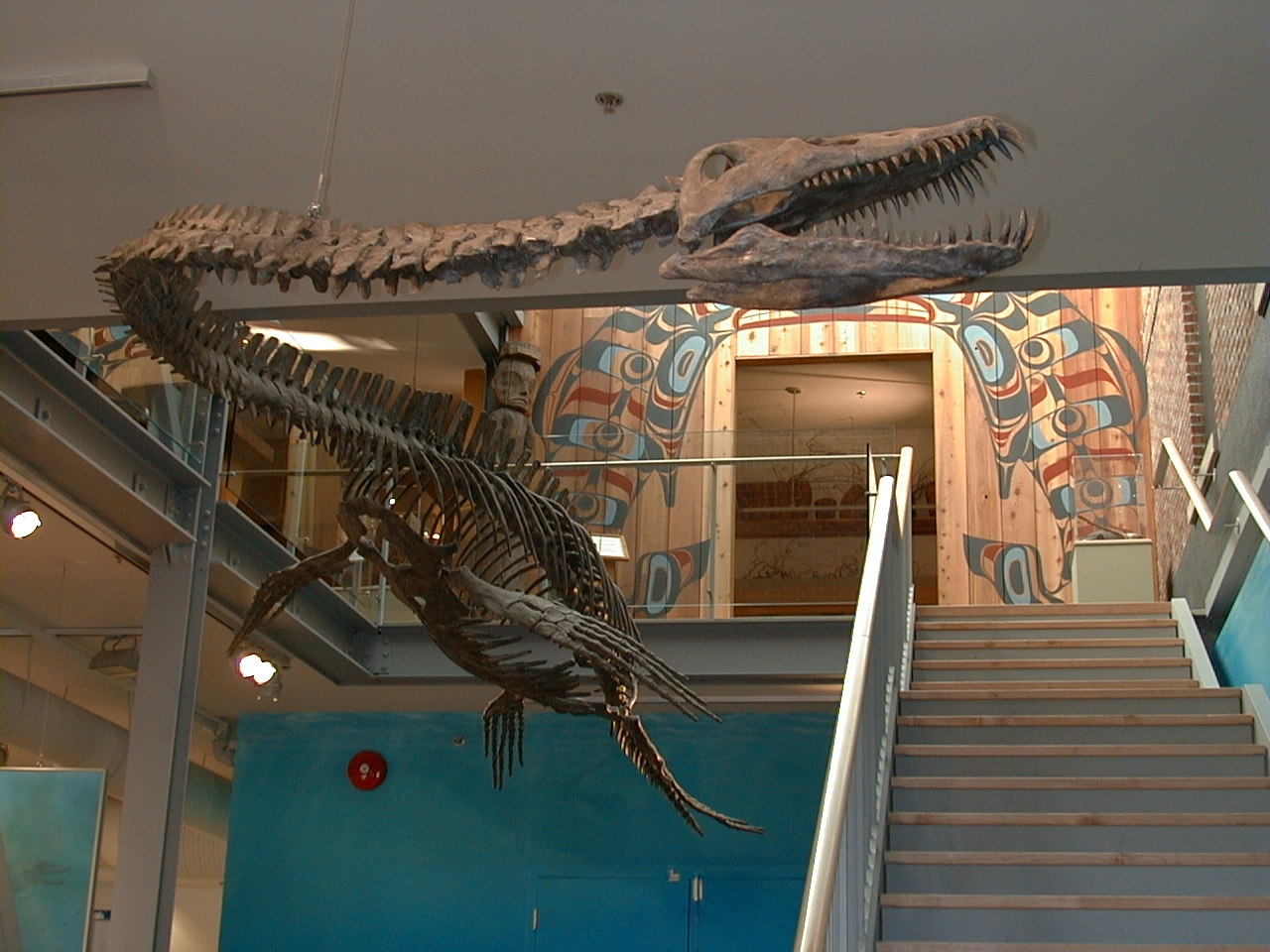
Fossils
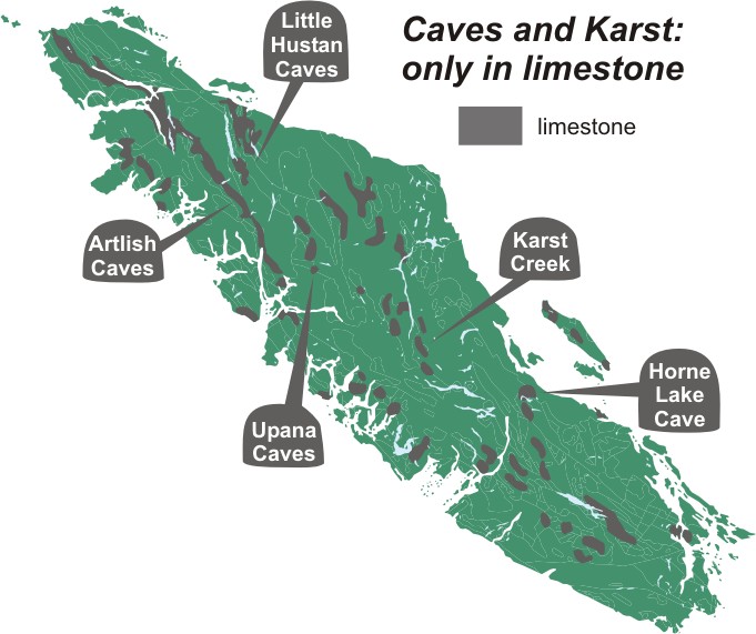
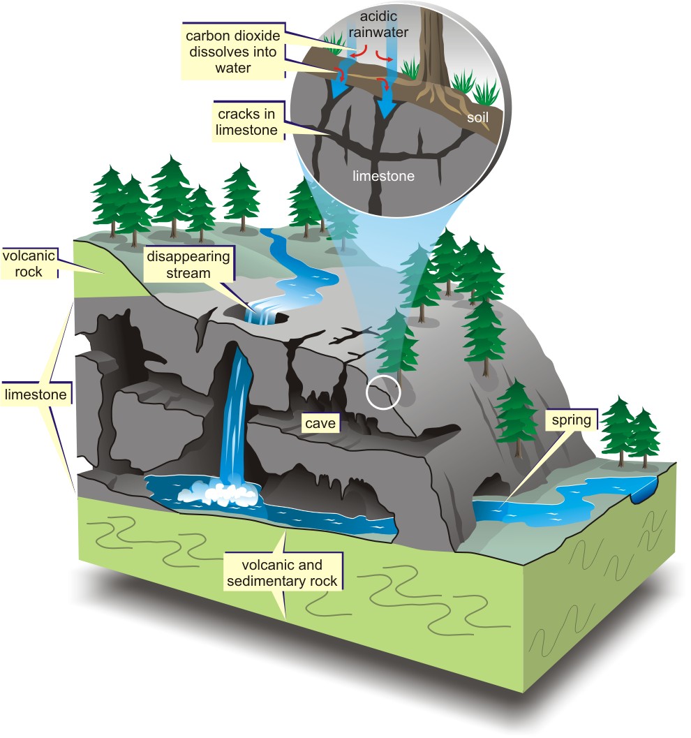
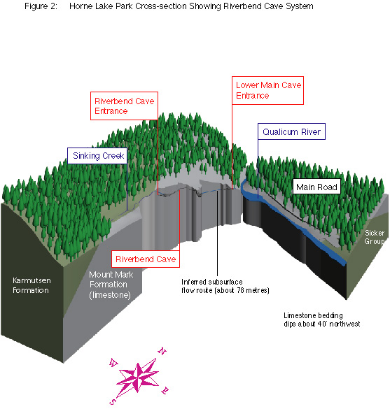
Karst
Caves
Different Rocks, Different Landscapes
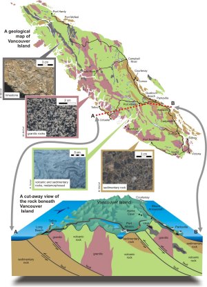
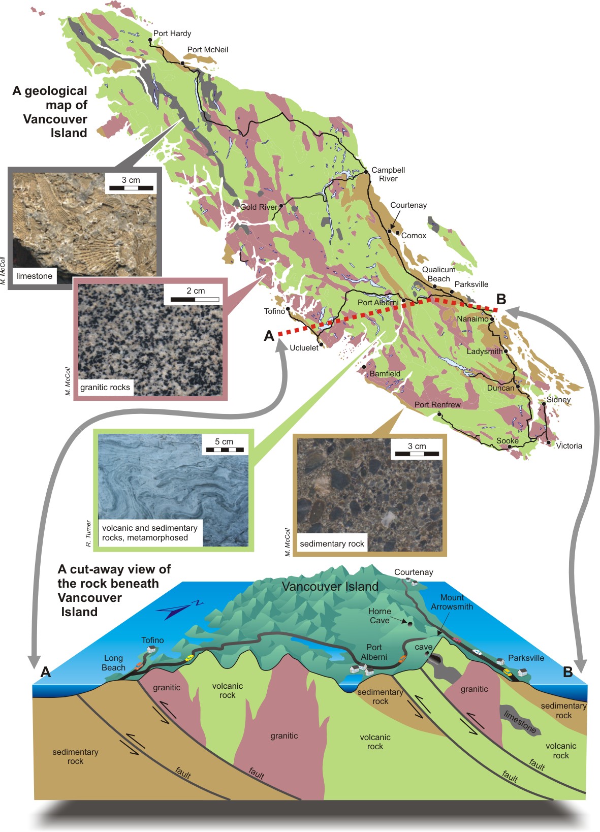
Rocks dictate our landscape and the location of resources, water, and people. Hard granitic and metamorphosed volcanic and sedimentary rocks form the central, mountainous spine of Vancouver Island, whereas sedimentary rocks underlie the more habitable coastal lowlands. Belts of limestone contain caves. The mountains of central Vancouver Island strongly affect the region's climate by producing a rain shadow to the east and torrential rains in the coastal rainforest to the west.
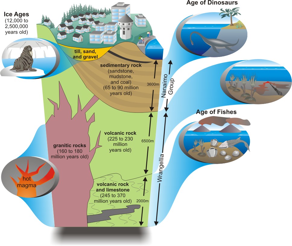
The rocks beneath our feet record nearly 400 million years of Earth history. The oldest rocks, referred to as 'Wrangellia' by geologists, include limestone and volcanic rocks that formed below a deep ocean. These rocks are cut by granite that was injected in a molten state and later cooled and solidified.
During the 'age of dinosaurs', the rocks of Wrangellia were buried by sediments that transformed into sedimentary rocks of the 'Nanaimo Group', now the foundation of Nanaimo. Finally, a partial blanket of glacial till, sand, and gravel was left behind by glaciers during the ice age.
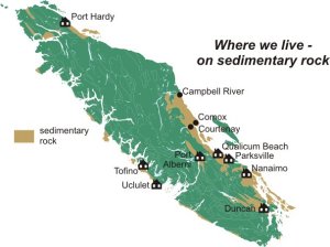
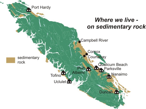
Eighty-five per cent of the population of central Vancouver Island live on coastal lowlands underlain by sedimentary rocks. These lowlands have formed over geological time by the relatively rapid stream and glacier erosion of the weak sedimentary rocks. In contrast, more resistant volcanic and granitic rocks form rugged mountain landscapes that are generally unfavourable for settlements.
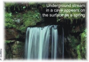
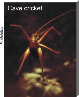
Karst is unique landscape formed by the underground erosion of rocks such as limestone and marble that dissolve in water. Rainwater, made acidic by carbon dioxide from the atmosphere and soil, slowly infiltrates cracks in limestone and marble, dissolving the rock and enlarging the openings. If these openings become large enough for humans to enter, they are termed caves. Caves, however, form only a tiny part of most karst areas. Karst openings support unique ecosystems that include plants, bacteria, crickets, spiders, fish, and small mammals adapted to this dark, but little changing environment.
Caves and karst develop slowly over tens of thousands of years or longer. Areas of karst landscape require careful management, as sensitive underground features can be damaged by surface activities such as road building or logging that alter the underground flow of water and air.
Vancouver Island: Queen of Caves
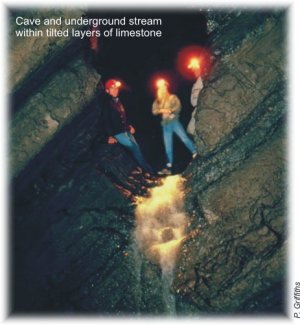
Vancouver Island has the highest density of caves in Canada and some of the longest and deepest caves in the country. All of the caves occur in limestone or marble. The caves are decorated with delicate stalactites and stalagmites formed over countless centuries by dripping water.

