Geoscience for Central Vancouver Island Communities
Climate
Topics on this page:
Legacy of the Ice Ages
The Big Freeze
The Great Flood
Glacial Landscape
Sand & Gravel Deposits
Tropical Nanaimo
Legacy of the Ice Ages
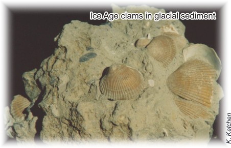
About 16 000 years ago, climate warmed and glaciers began to retreat. As the glaciers melted, the sea covered low-lying areas pushed down by the weight of the ice. Clam shells in ancient seafloor clay layers found far above present sea level prove that much of Nanaimo was covered by the ocean 15 000 years ago. Shortly thereafter, the land, relieved of its ice load, rebounded and carried these marine deposits up above sea level.
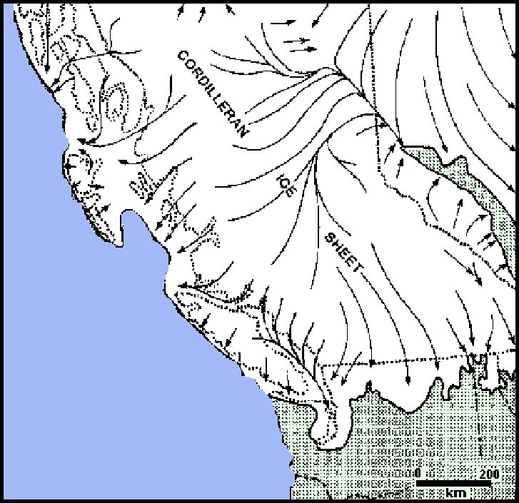
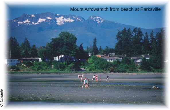
The most recent glaciation began about 35 000 years ago when climate turned much colder and wetter and glaciers began to grow in the nearby mountains. Glaciers flowing from Vancouver Island and the Coast Mountains filled the Strait of Georgia with 2 km of ice and buried nearly all of Vancouver Island. Craggy Mount Arrowsmith protruded above the ice as a 'nunatak', whereas lower peaks, such as Mount Benson near Nanaimo, were completely overrun, rounding their summits.
Our landscape carries the legacy of ice age glaciers. Glaciers carved sharp mountain peaks, steep U-shaped valleys, and fiords. Glaciers also left thick blankets of sediment in our lowlands and valleys that include gravel used for construction and sand that forms our beaches. Soils developed on these sediment blankets support our forests and farms.
Some mountain peaks, such as Mt. Arrowsmith, protruded above the ice as Nunataks, but most of the bedrock, even Mount Benson, was completely covered and smoothed as ice moved over it. Smoothed rock is extensive on the lower slopes of valleys.
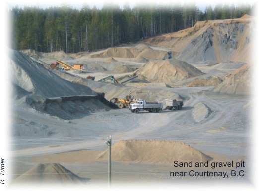
Sand & Gravel (Aggregate): A Legacy of the Ice Age
Rivers flowing into the Strait of Georgia at the end of the ice age left thick sand and gravel deltas where they met the sea. These deltas now lie high above modern sea level because the land rose after the weight of the glacier ice was removed. Ice age sands and gravels are mined in pits and used to produce concrete and asphalt, and as fill for road construction.
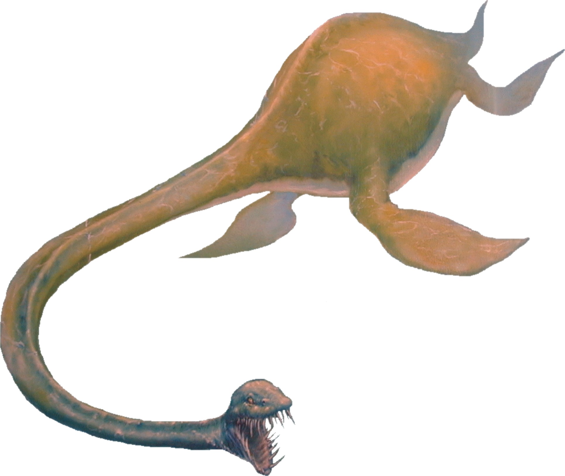
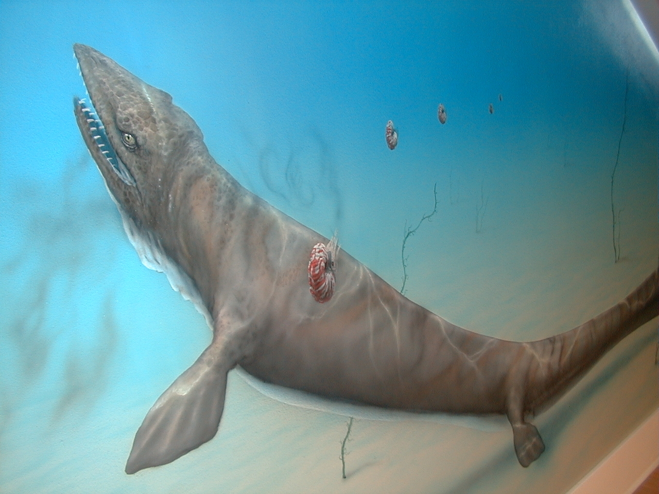
The sedimentary rocks beneath Nanaimo record an environment very different from that of today. Sand, gravel, and mud eroded from coastal mountains accumulated along shorelines and on the seafloor. Decaying vegetation in swamps accumulated as layers of peat that later transformed into coal, oil, and gas. Eighty million-year-old fossil leaves, flowers, nuts, turtles, clams, snails, lobsters, crabs, and sharks can all be found in the sedimentary rocks. Some of the animals, including ammonites, mosasaurs, and elasmosaurs, are long extinct.