Geoscience for Central Vancouver Island Communities
Hazards
Topics on this page:
Earthquake Country
Terranes
1946
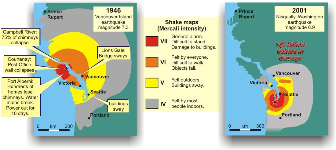
1946 vs. 2001
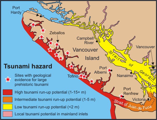
Tsunami
Landslide
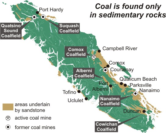
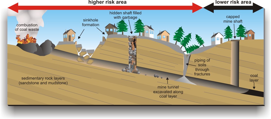
When Coal Was King
This is Earthquake Country
Why is this earthquake country?
The lithosphere, Earth's brittle outer skin, is divided into large 'plates' that continuously move towards, away from, or past each other. Stresses occur in the Earth where plates push together or past each other. Occasionally, rocks rupture along a fault, causing energy to be released as an earthquake.
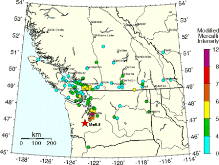
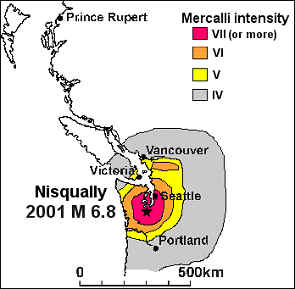
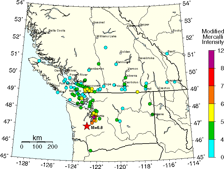
Mercalli Intensities for the Feb 28, 2001, Nisqually Earthquake.
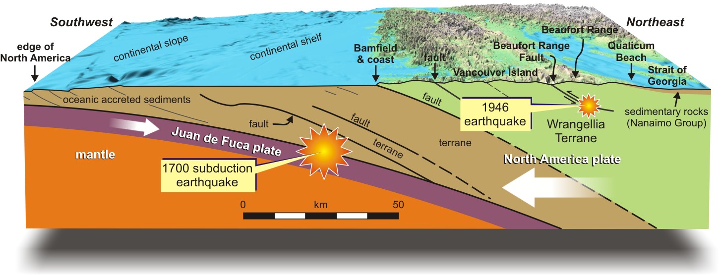
Great subduction zone earthquakes release 30 to 100 times more energy than the 1946 earthquake, but fortunately occur only once every 500–600 years, on average. The most recent of the great earthquakes, in January 1700, triggered a tsunami that destroyed First Nation villages on the west coast of Vancouver Island.
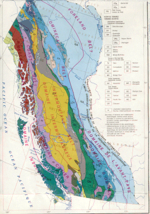
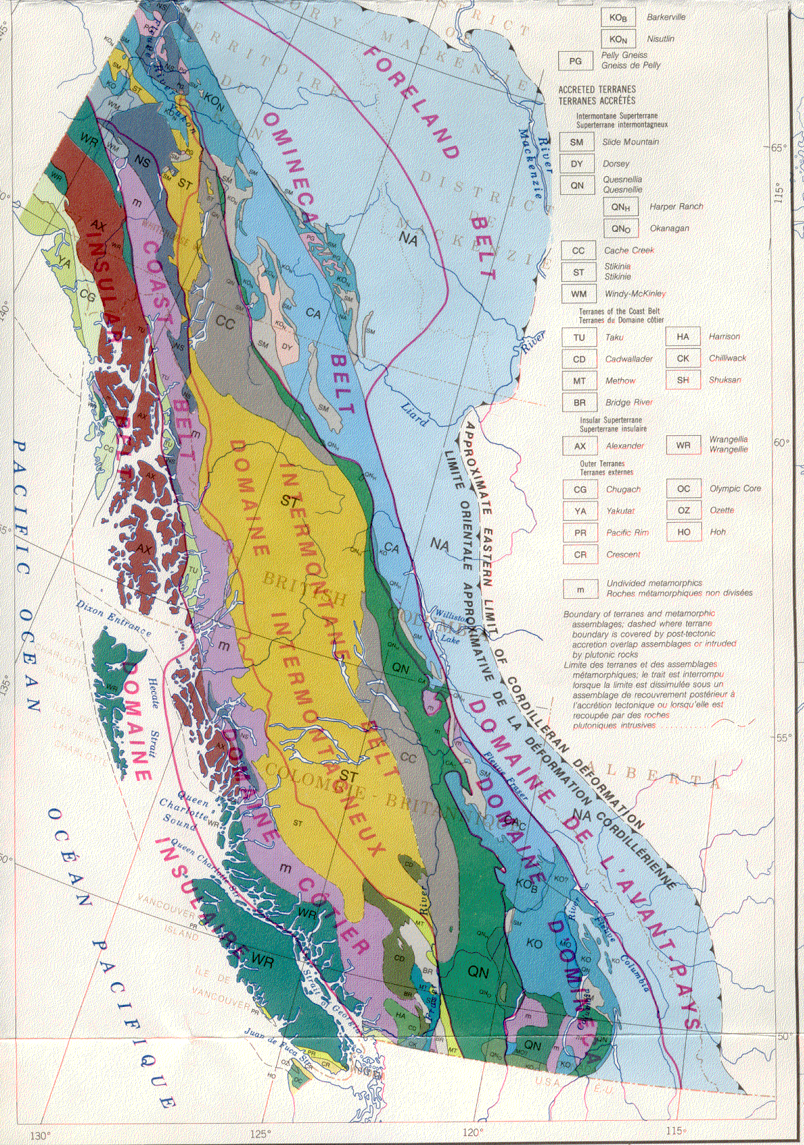
Much of the rocks that underlie British Columbia formed elsewhere and were transported here in the distant geological past. The margin of the North American continent has grown westward from the Alberta border by the addition of exotic fragments of the Earth's crust, which geologists call 'terranes'. Wrangellia Terrane, which forms most of Vancouver Island, originated within what is now the Pacific Ocean and was transported northeasterly to collide with North America about 100 million years ago. The force of this collision crumpled North American rocks as far to the east as the Rocky Mountains.
Vancouver Island experiences frequent earthquakes because it is close to the western margin of the North America Plate. The oceanic Juan de Fuca Plate dives down into the Earth's mantle beneath Vancouver Island, creating the stresses that are responsible for earthquakes. Damaging earthquakes on Vancouver Island can occur within the North America Plate, much deeper within the Juan de Fuca Plate, or at the boundary between these two plates.
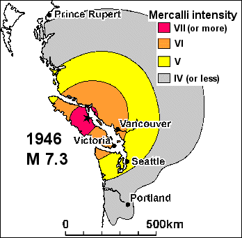
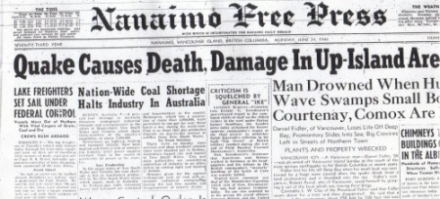
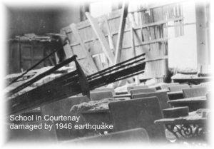
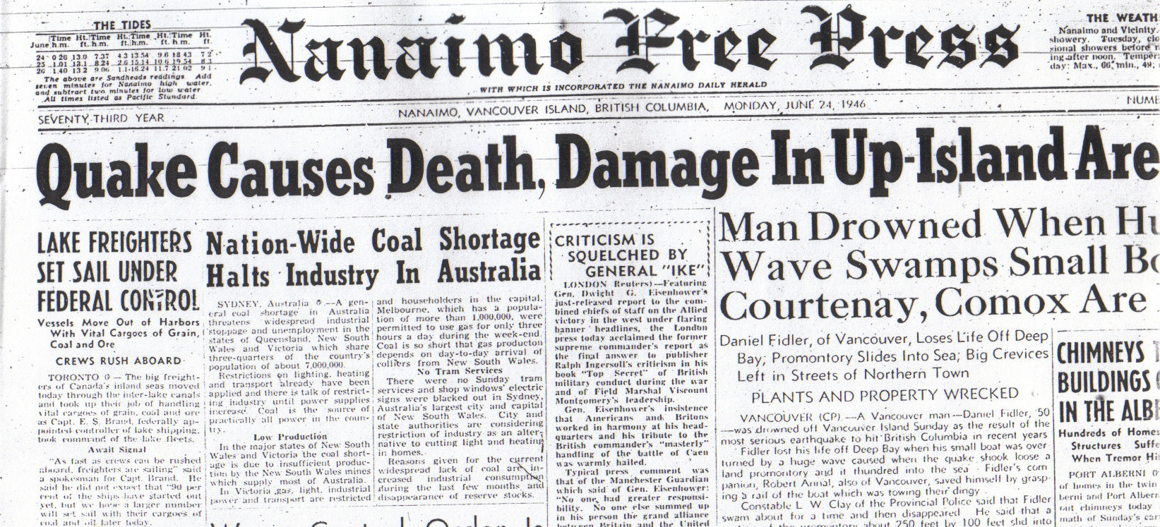
Canada's largest recorded earthquake on land, measuring 7.3 in magnitude, occurred west of Courtenay on Sunday morning, June 23, 1946. Damage was light because few people lived in the area, children were not in school, most buildings were small and made of wood, and there were few dams or bridges. When the next major earthquake strikes Vancouver Island, damage and loss of life is expected to be much greater.
Today, few residents of Vancouver Island remember the 1946 central Vancouver Island earthquake, although most of us felt the Nisqually earthquake of February 28, 2001.
The 2001 earthquake produced less shaking than the 1946 earthquake, partly because it was a smaller magnitude, and partly because its source was deeper in the Earth's crust. Nonetheless, damage from the 2001 earthquake exceeded $2 billion dollars.
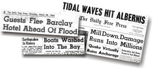
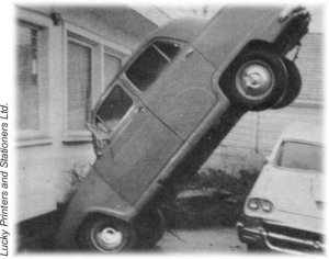
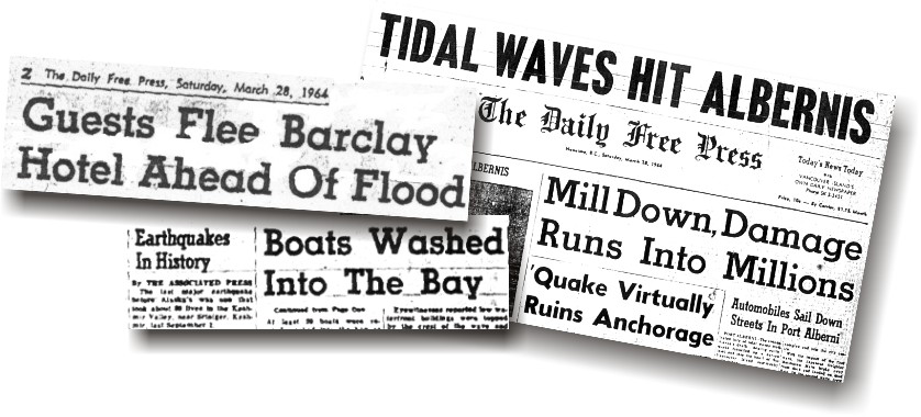
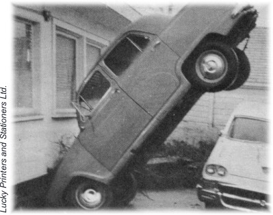
A destructive tsunami, triggered by the huge Alaska earthquake of March 1964, struck the west coast of Vancouver Island. The first wave arrived in Port Alberni about six hours after the earthquake, and four more major waves arrived over the next seven hours. Some homes were inundated, whereas others floated off of their foundations into Alberni Inlet!
Tsunami Hazard larger image [JPEG, 98.3 kb, 609 X 463]
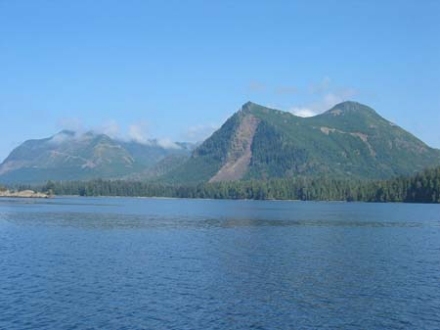
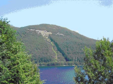
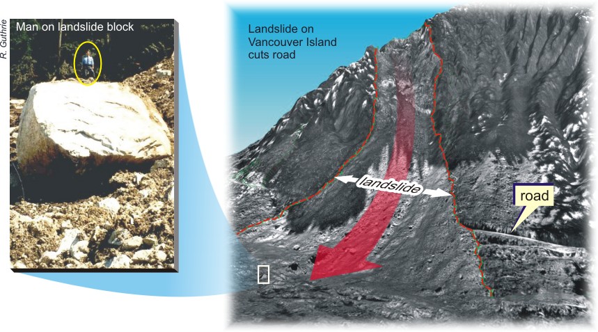
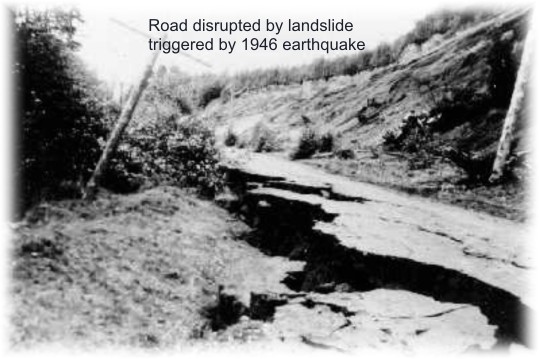
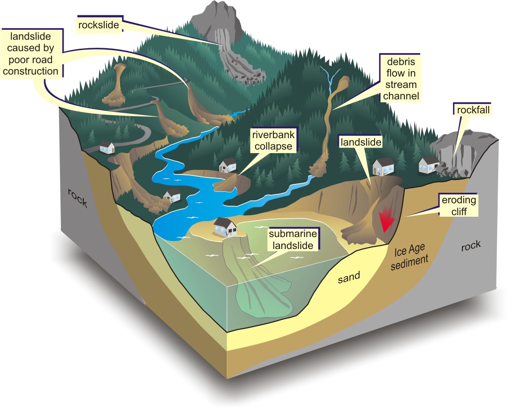
Landslides are common on the steep wet slopes of Vancouver Island. They may be large or small, rapid or slow, natural or human-induced, but they generally require steep slopes and a trigger such as rain or an earthquake. Planning for development on or near unstable slopes requires careful assessment of the risk. Where the risk is too high, development should be avoided.
Man on landslide block from landslide on Vancouver Island that cuts road.
When Coal Was King
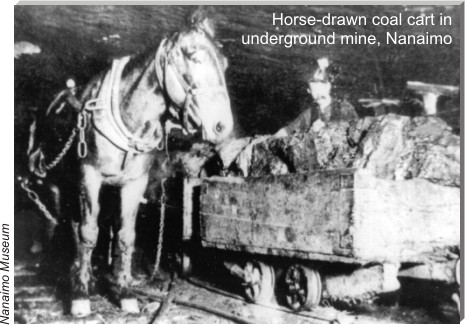
Che-wech-kan peoples of Nanymo Bay first brought coal to the Hudson's Bay Company Fort Victoria in 1849. Soon thereafter, Hudson's Bay Company opened mines at Nanaimo to provide fuel for coal-burning steamships. Other companies and owners, including Robert Dunsmuir, opened mines from Ladysmith to Port Hardy. Working conditions underground were harsh; about 700 men died mining coal on Vancouver Island. The coal industry declined during the 1950s as coal was replaced by fuel oil. Only the Quinsam coal mine near Campbell River operates today.
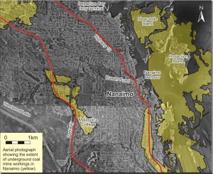
The ground above abandoned coal mines, can subside, damaging buildings, roads, and other structures; however, subsidence can be minimized by reinforcing building foundations or by filling the underground mines. Concrete caps have been placed on old mine shafts in Nanaimo, including one shaft beneath a house! Coal waste can spontaneously ignite, as happened once under the centre of Nanaimo. Most of Nanaimo's abandoned mine workings are now flooded by groundwater.
Horse-drawn coal cart in underground mine, Nanaimo


