Geoscape - CanadaFrom Coast to Coast

This series of photos showcases the geological diversity of the Canadian landscape - from coast to coast.
|
Mountains of Western Canada
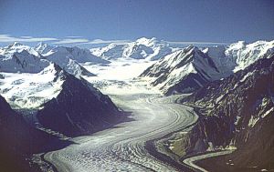
Figure 46. St. Elias Mountains with ice field and valley glaciers (J.J. Clague).
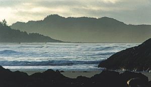
Figure 49. Rocky shore (metamorphosed clastic sedimentary rock) and sandy beach, Pacific Rim National Park, British Columbia (R.G. Anderson).
|
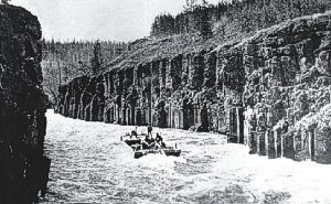
Figure 47. Miles Canyon, near Whitehorse, where Yukon River cuts through a lava flow (Emile Forrest Collection, Yukon Archives 80/60 PHO 131 #6).
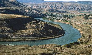
Figure 50. Terraces of gravel and glacial-lake sand and silt (Ice Age sediment) incised by Thompson River, Ashcroft, British Columbia (J.J. Clague).
|

Figure 48. Folded limestone and dolostone (carbonate rock), Kananaskis valley, Alberta (J.J. Clague).
|
Prairies
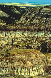
Figure 29. Eroded sandstone and shale (clastic sedimentary rock), Horseshoe Canyon, Alberta (S.E.B. Irwin).
|
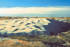
Figure 30. Active sand dune (modern sediment), Great Sand Hills, southwestern Saskatchewan (S.A. Wolfe).
|
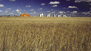
Figure 31. Grain growing on rich soil formed on silt-clay glacial lake sediments, Davidson, Saskatchewan (Agriculture and Agri-Food Canada).
|
Canadian Shield
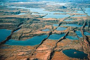
Figure 32. Erosion-resistant diabase dykes (volcanic rock) form ridges rising above soft, more easily eroded carbonate rock, Kugluktuk, Nunavut (R. Rainbird).
|
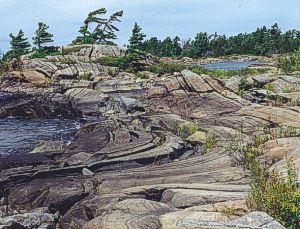
Figure 33. Folded gneiss, Gaspar Island, eastern Georgian Bay, Ontario (M.A. Rutka).
|
Great Lakes / St. Lawrence Lowlands
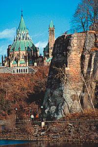
Figure 34. Limestone cliffs along the Ottawa River at Parliament Hill, Ottawa, Ontario (R.J.W. Turner).
|
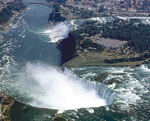
Figure 35. Niagara Falls cascades over a resistant layer of dolostone (carbonate rock) that caps the cliffs of the Niagara River gorge in Ontario (A.V. Morgan).
|
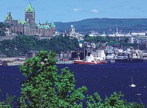
Figure 36. Vegetated cliffs of shale, sandstone, and carbonate rock separate the upper and lower parts of Québec, Quebec (A.V. Morgan).
|
Atlantic Canada
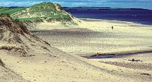
Figure 37. Partly vegetated sand dunes and sand beach, north shore, Prince Edward Island (A.V. Morgan).

Figure 40. Bog on coastal plain backed by gneissic rock of the Long Range Mountains, Gros Morne National Park, Newfoundland (D. Grant).
|
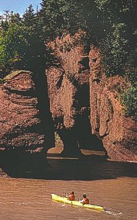
Figure 38. Red iron-stained conglomerate carved by ocean waves into cliffs and 'flower pots', Hopewell Rocks, New Brunswick (B. Atkinson, © Images of New Brunswick).
|
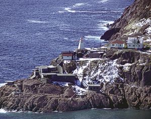
Figure 39. Shoreline formed in metamorphosed sandstone and conglomerate at the entrance to St. John's Harbour, Newfoundland (A.V. Morgan).
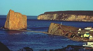
Figure 41. Coastal cliffs of dolostone (carbonate rock) and gravelly shoreline deposits, Percé Rock, Gaspé, Québec (A.V. Morgan).
|
Arctic Canada
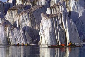
Figure 42. Tidewater terminus of Pallisade glacier, Ellesmere Island, Nunavut (© P. vanPeenen).
|
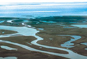
Figure 43. Channels and islands of the Mackenzie River delta, Northwest Territories (P. Hill).
|
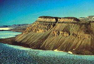
Figure 44. Dark intrusions of diabase (volcanic rock) in layered carbonate rock, Wynniatt Bay, Victoria Island, Northwest Territories (R. Rainbird).
|
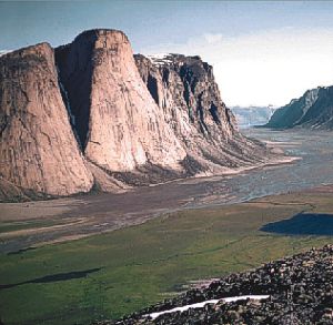
Figure 45. Glacially carved valley containing river gravel and sand in a mountainous granitic terrane, North Pangnirtung Fiord, Cumberland Peninsula, Baffin Island, Nunavut (W.J. Crawford).
|