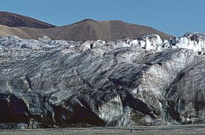
Geoscape - CanadaEARTH MATERIALSICEIce occurs as glaciers in mountainous areas of British Columbia, Yukon Territory, Alberta, and the Arctic Islands. Glaciers form where the accumulation of snow, principally during winter, exceeds summer snowmelt. Most Canadian glaciers have retreated since the late 1800s. Meltwater from glaciers is important in maintaining the flow of many rivers in western Canada during the dry summer months.
|

|
MODERN SEDIMENT
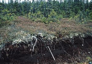
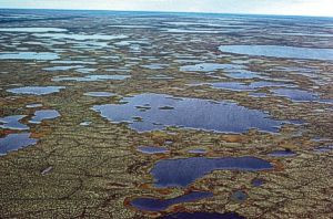
Modern, or postglacial, sediment has been deposited by rivers, wind, waves, landslides, plants, and glaciers since the end of the ice ages. Where present, it forms a blanket over more extensive Ice Age sediment or bedrock. Peat Peat is partly decomposed plant material. It occurs in wetlands and large tracts of poorly drained land known as 'muskeg'. Peatlands are important ecosystems and store vast quantities of carbon and water. Peat bogs are mined for sphagnum moss, which is used as a soil conditioner. Farms on peatlands provide important cranberry and blueberry production.
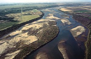
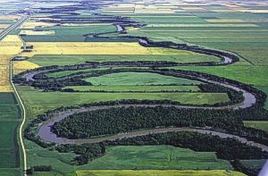
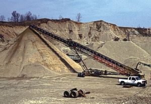
Mud, Sand, and Gravel Mud, sand, and gravel are mainly river, stream, and beach sediments. They occur on floodplains, deltas (bodies of sediment deposited where rivers enter a lake or the sea), and shorelines. Deltas and floodplains support important wetland ecosystems and, in southern Canada, are important agricultural areas. Sand and gravel are common along Canada's lake and ocean shores. Floodplains, deltas, and beaches are prone to flooding and to liquefaction during earthquakes.
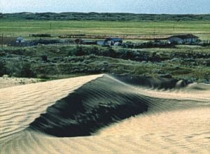
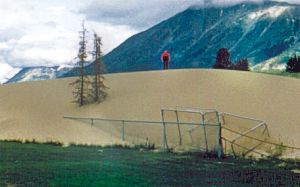
Sand
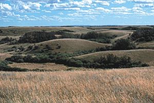
Sand underlies active and vegetated dunes. Wind-blown sand is extensive around Lake Athabasca, and in parts of southern Saskatchewan. Sand dunes also occur in coastal areas in association with sand beaches. Dunes retain little moisture, have limited nutrients, and thus support unique drought-tolerant plant communities.
|
|
|
ROCK
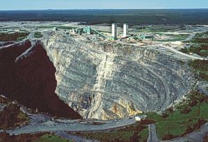
Rock is the dominant surface material in mountains, on the Canadian Shield, along escarpments (e.g. the Niagara Escarpment), and along some shorelines. In many parts of Canada, rock is buried beneath thick modern or Ice Age sediments. Areas mapped as rock include sites where rock is covered by thin, locally derived modern sediment or thin, patchy Ice Age sediment. Carbonate Rock Carbonate rock includes limestone, dolostone, marble, and calcareous shale. It can form rugged mountains and steep escarpments. Rain and groundwater slowly dissolve carbonate rock, forming caves and surface depressions. Waters in carbonate terranes are 'hard' due to high concentrations of dissolved bicarbonate. Carbonate rock contains important oil, gas, and metal (zinc, lead, silver) resources. Limestone is used in making cement.
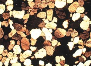
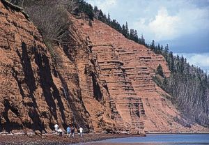
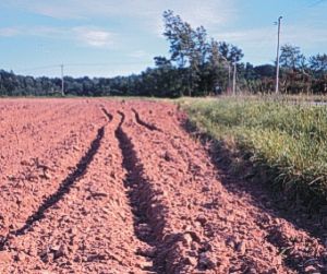
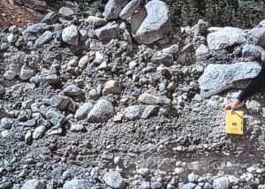
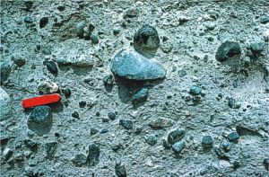
Clastic Sedimentary Rock Clastic sedimentary rock was deposited as loose sediment, similar to modern sediment (e.g. sand, mud, and gravel), and later transformed into solid rock. It includes sandstone, mudstone, shale, and conglomerate. Mudstone and shale are easily eroded and commonly underlie valleys. Sandstone is more resistant and can form ridges and cliffs. Clastic sedimentary rock is commonly porous and can contain abundant oil and gas in western Canada, the Mackenzie River delta, and offshore Atlantic Canada. It also hosts important tar sand, heavy oil, coal, uranium, and groundwater resources.
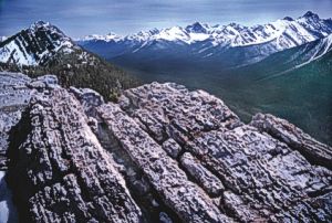
Metamorphosed Clastic Sedimentary Rock Clastic sedimentary rock transforms, or 'metamorphoses' into quartzite, slate, and schist when subjected to high temperature and pressure deep within the Earth. Metamorphism reduces rock pore space, thus these rocks are rarely important hydrocarbon reservoirs or groundwater aquifers; however, they do host important metal and uranium deposits. Metamorphosed clastic sedimentary rock is resistant to erosion; it is an important element of mountain ranges in western Canada and southern Quebec.
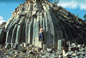
Volcanic Rock Volcanic rock is most common in the Cordillera and forms lava flows, intrusions (dykes, sills), volcanoes, and cinder cones. It ranges from fine-grained, dark coloured rock to paler, variably coloured, fragmental rock. Some volcanic rock contains abundant fractures and pores and can host important aquifers. Steep volcanic slopes are prone to landslides. Some volcanoes in British Columbia and southwestern Yukon Territory are dormant and will erupt in the future. Some volcanic intrusions (kimberlite pipes) in the Canadian Shield are important sources of diamonds.
Metamorphosed Volcanic Rock
Metamorphosed volcanic rock has lost its original surface volcanic form through erosion, burial, deformation, and metamorphism. It has less pore space and is more resistant to erosion than unmetamorphosed volcanic rock. It typically is dark in colour, occurs widely in the Appalachians and Cordillera, and is a major component of extensive 'greenstone belts' on the Canadian Shield. Metamorphosed volcanic rock contains important deposits of copper, zinc, lead, nickel, silver, and gold.
Granitic Rock
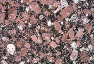
Granitic rock is coarse grained and varies from light to dark in colour. It forms deep within the Earth by crystallization of molten rock. Granitic rock is extensive on the Canadian Shield, eastern Baffin Island, and in the British Columbia Coast Mountains. It is commonly massive, resistant to erosion, and forms uplands with thin unproductive soils. Granitic rock hosts important copper, nickel, tin, gold, and building stone resources.
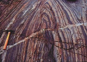
Gneissic Rock
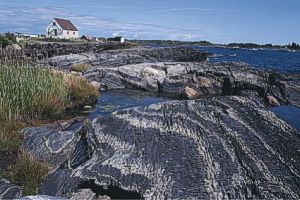
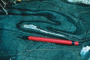
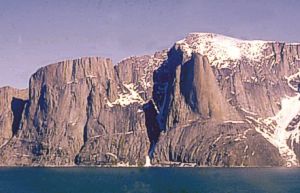
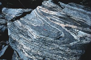
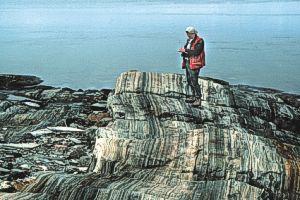
Gneissic rock is a coarse-grained, banded metamorphic rock that has formed at high temperature and pressure deep in the Earth's crust. It has physical properties similar to those of granitic rock, forms extensive areas of the Canadian Shield, and commonly is associated with thin poor soils, 'soft' water, and lakes vulnerable to acidification from acid precipitation. Gneiss plateaus cut by steep-walled valleys and fiords occur in the eastern Arctic Islands and western Newfoundland.
|