Geoscape - CanadaWhat do the map patterns mean?The answer lies underground
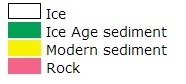
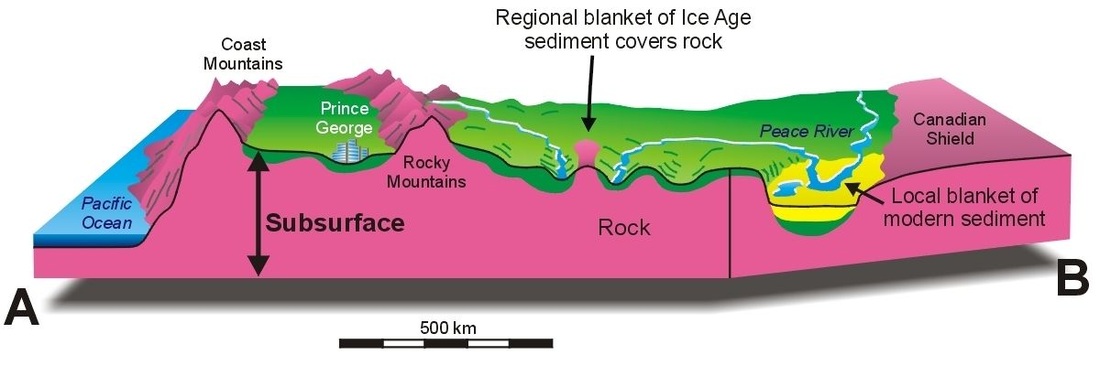
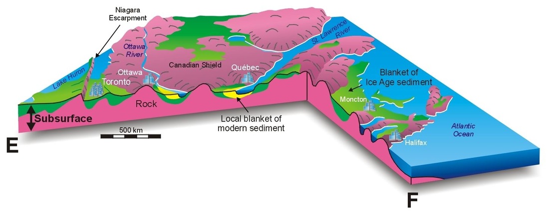
The simplified map below shows the three main types of earth materials that form Canada's surface -- modern sediments, Ice Age sediments, and rock. These materials, however, also extend into the subsurface, always in the same order. Modern sediments (yellow on inset map) are associated with rivers, sand dunes, coastal areas, and wetlands. They lie on top of Ice Age sediments and rock. Extensive blankets of Ice Age sediments (green) left by now-vanished glaciers overlie rock in flatter areas such as the Prairies and the lowlands bordering Hudson Bay. Rock (pink) underlies all parts of Canada but is widespread at the surface only in rugged mountain areas, on the Canadian Shield, and in the northern Arctic Islands. |
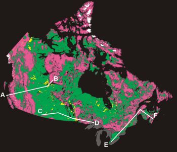
Simplified Map
|
|