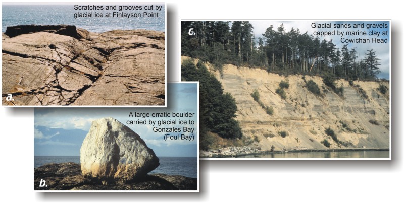
The effects of glaciation on southern Vancouver Island are conspicuous. Bedrock exposures commonly are striated and grooved, dramatically showing the erosive effects of ice-entrained debris during the last glaciation, between 30,000 and 10,000 years ago. Boulders, or erratics, of various sizes, which were carried by the ice and left behind when it melted, can be seen in most areas of the island. Glacial deposits of sand and gravel form James and Sidney islands, Cowichan Head and many other areas. The large gravel pit along Metchosin Road formed as the delta of a river draining from ice in Saanich Inlet and the Goldstream watershed about 14,500 years ago.
a) Scratches and grooves cut by glacial ice at Finlayson Point. b) A large erratic carried by glacial ice to Gonzales Bay (Foul Bay). c) Glacial sands and gravels capped by marine clay at Cowichan Head.
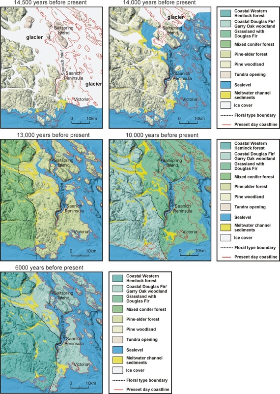
The History of Deglaciation
These five maps (below) show the history of deglaciation, sea-level changes and flora variation during the past 14,500 years in the area surrounding Saanich Inlet. During glaciation the crust was depressed beneath the weight of the ice and sea level was lowered because water was removed from the oceans to form glaciers. As the ice melted the depressed crust and lowered sea levels regained their former elevations, resulting in marked changes to shorelines in the area as well as the distribution and types of forest cover. Modern sea level was reached about 5,000 years ago and since then has changed very little.