CGEN Archive
Geoscapes - NWT
CGEN's Home Page
Home
CGEN Minutes
EarthLinks
EdGEO
Bringing Earth Science to Life
Putting the Earth into Science
FBY
FBY-Chapter Previews
FBY-Sample Lesson
QMA-Apercus des chapitres
Geoscape
Geoscape Canada
>
Calgary
Fort Fraser
Montreal
Nanaimo
Northwest Territories
Ottawa-Gatineau
Québec
Saskatchewan-North
Saskatchewan-South
Toronto
Vancouver
Victoria
Whitehorse
Géopanorama du Canada
Geoscape Posters
Geotours
Waterscapes
>
Bowen Island
Bow River Basin
Gulf Islands
Okanagan Basin
Geovistas
Key Publications
Wat On Earth
OGGP
Contact Us
Geoscape - Northwest Territories
Home
Why Mountains?
The Big Freeze
Timeline
Yellowknife... Built on Gold
Diamonds
Fossils, Falls & Fluids
Gas & Oil
Credits & Citation
Poster Downloads
Geoscape - Northwest Territories
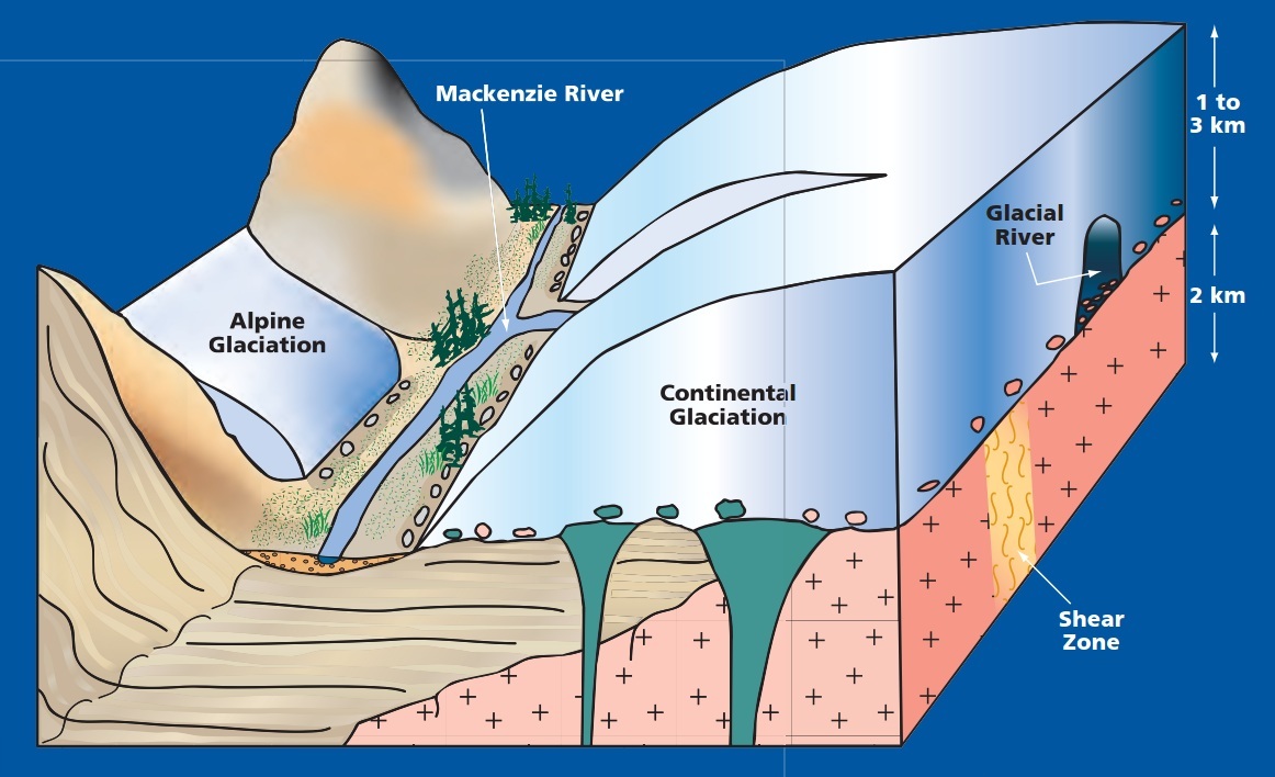
The Big Freeze
Click for larger image.
The Ice Age, about 16,000 Years Ago
Ice sheets over a kilometre thick covered most of the NWT except for parts of the mountains. Glacial ice advanced and retreated four times.
The present landscape was scoured and shaped by the ice movements.
Click for larger image.
The End of The Ice Age about 10,000 Years Ago
The weight and movement of the ice ground the rocks into gravel and sand. This material was transported and deposited, reshaping the landscape.
Glacial material provides us with industrial resources like gravel and sand.
Boulders and till deposited by glaciers can be used to trace back to the source of mineral deposits.
Géopanorama du Canada
Geoscapes:
Canada
Calgary
Fort Fraser
Montreal
Nanaimo
Northwest Territories
Ottawa-Gatineau
Québec
Saskatchewan - North
Saskatchewan - South
Toronto
Vancouver
Victoria
Whitehorse