CGEN Archive

Waterscape Canada

CGEN's Home Page
  • Home
  • CGEN Minutes
  • EarthLinks
  • EdGEO
    • Bringing Earth Science to Life
    • Putting the Earth into Science
  • FBY
    • FBY-Chapter Previews
    • FBY-Sample Lesson
    • QMA-Apercus des chapitres
  • Geoscape
    • Geoscape Canada >
      • Calgary
      • Fort Fraser
      • Montreal
      • Nanaimo
      • Northwest Territories
      • Ottawa-Gatineau
      • Québec
      • Saskatchewan-North
      • Saskatchewan-South
      • Toronto
      • Vancouver
      • Victoria
      • Whitehorse
    • Géopanorama du Canada
    • Geoscape Posters
    • Geotours
    • Waterscapes >
      • Bowen Island
      • Bow River Basin
      • Gulf Islands
      • Okanagan Basin
  • Geovistas
  • Key Publications
    • Wat On Earth
  • OGGP
  • Contact Us

Waterscape - Bow River Basin

Hydropanoramas
  • Home
  • The River
  • River Basin
  • Water Cycle
  • Groundwater
  • Climate Change
  • Sharing Our Waters
  • Urban Water
  • Irrigation
  • Keeping the River Clean
  • Credits & Citation
  • Poster Downloads
Irrigation: Watering the Prairie for Food

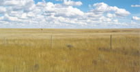
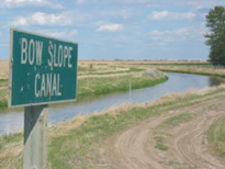
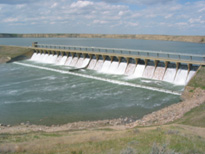
Transforming the Prairie: 
Dry Grasslands to Watered Prairie

When European settlers first came to the prairie country of the Bow River basin, they found First Nations peoples living in a vast grassland with few lakes and streams. Early in the last century, irrigation districts were established to move Bow River water out onto the prairie. Through a system of canals and storage reservoirs, water was supplied to farmers. Over time, communities and industries also grew on the prairie, and the irrigation system supplied water for their needs.
Picture
(R.J.W. Turner, GSC 2005-192)
Native prairie grassland 
east of Brooks
Picture
(R.J.W. Turner, GSC 2005-208)
Irrigation canal south of Brooks
Picture
(R.J.W. Turner, GSC 2005-205)
Irrigation spray near Vauxhall
Picture
(R.J.W. Turner, GSC 2005-207)
Bassano dam on the Bow River

Picture
(Courtesy of Ducks Unlimited Canada)
Water storage in wetland 
near Brooks
Picture
(R.J.W. Turner, GSC 2005-206)
A hay harvest north of Brooks
How Irrigation Works
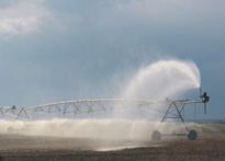
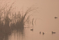
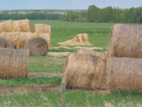
Irrigation starts in May and continues until October. Irrigation water is diverted from the river into a system of canals and reservoirs. These provide important wetland habitat for waterfowl and fish. Improved irrigation techniques have greatly reduced the water required to grow crops, allowing more crop production while using the same amount of water.
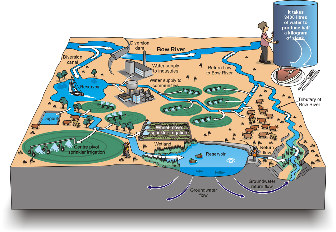
Picture
Waterscapes:
  • Bowen Island 
  • Bow River Basin
  • Gulf Islands
  • Okanagan Basin ​
Copyright CGEN 2014-2021
​ Quick Links to Earth Sciences Canada sites
​Earthlinks | WHERE Challenge | Careers in Earth Science |  Four Billion Years and Counting | IYPE | CFES | CGEN | IUGS | GeoVistas | OGGP