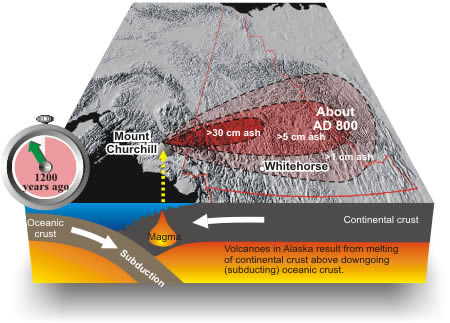
About 1200 years ago, in approximately 800 AD, an enormous eruption at Mount Churchill near the Alaska-Yukon border blanketed central and southern Yukon Territory with volcanic ash. The ash, referred to as the 'White River Ash', is visible in the soil layer throughout central Yukon, including Whitehorse. Volcanic eruptions are common in Alaska, and a large eruption at a time when winds are blowing from the west could bring more ash to Whitehorse.
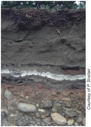
Roadcut exposes White River Ash layer (white) in soil. The ash layer is about 10 cm thick.
White River Ash layer
Where did the people go?
Did people leave central Yukon Territory because the AD 800 volcanic eruption reduced their food supply? Some anthropologists have speculated that people displaced by that eruption were ancestors of Athapaskan-speaking peoples such as the Navajo in the southwestern United States, Tsuu T'ina in Alberta, and Dene in the MacKenzie River valley.
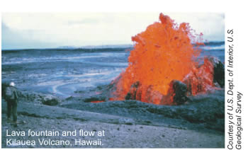
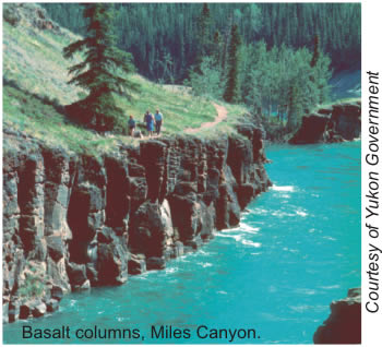
Nine Million Years ago, lavas oozed into the valley
Several times between fifteen and nine million years ago, lava erupted quietly, as from a Hawaiian volcano, from a vent near the Mount Sima ski area. The lava flowed like a slow-moving river into the Yukon River valley, where it cooled to form basalt layers up to 15 m thick. Since then, the Yukon River has eroded a canyon through the basalt, exposing it to view at Miles Canyon and Whitehorse Rapids.
lava fountain
The Chilling Tale of Shrinking Basalt
Lava shrinks as it cools, forming near-vertical fractures perpendicular to the surface of the flow. Columns formed from five or six intersecting cooling fractures are a distinctive feature of many basaltic flows.